Property Record
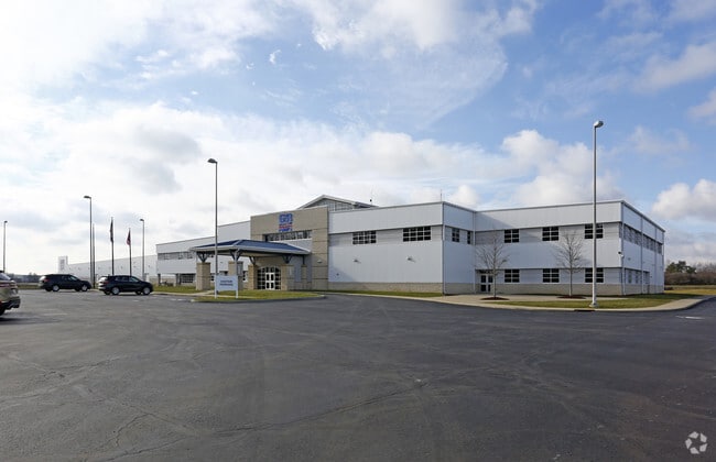
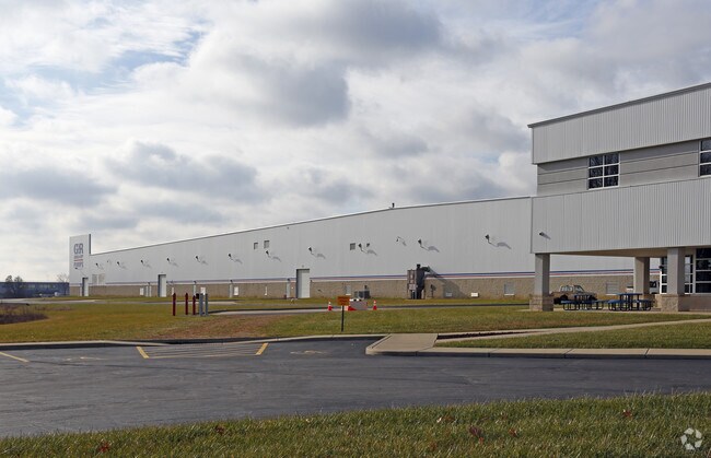
350 Ruby Ave, Mansfield, OH 44907
Property Detail
350 Ruby Ave
Mansfield, OH
NW A 14.765 LT 4 PT & 30 FT VAC RUPP AVE TO NORTH
028-90-101-18-001
RICHLAND
Warehouse
Ohio
B and X Area of moderate flood hazard, usually the area between the limits of the 100-year and 500-year floods.
4
2024
14.77 AC
2025
Richland County
001100
Cleveland
404,200 SF
NEARBY LISTINGS FOR SALE OR LEASE
DEMOGRAPHICS near 350 Ruby Ave
1 mile
3 mile
5 mile
2025 Total Population
97
18,973
56,678
2030 Population
98
18,941
56,606
Pop Growth 2025-2030
+ 1.03%
(0.17%)
(0.13%)
Average Age
42
41
41
2025 Total Households
34
5,801
21,982
HH Growth 2025-2030
0.00%
(0.26%)
(0.19%)
Median Household Inc
$74,999
$47,849
$47,699
Avg Household Size
2.40
2.30
2.20
2025 Avg HH Vehicles
3.00
2.00
2.00
Median Home Value
$190,908
$98,538
$126,883
Median Year Built
1969
1957
1957
Nearby Places
Map Layers
Map Styles
 Street
 Aerial
Layers
 Traffic
 Biking
Places
Listings with unknown addresses are not visible on the map
- Restaurants
- Banks
- Shops
- Fitness
- Groceries
Nearby Properties
Address
Land Use
TOTAL SIZE
Lot Size
Zoning
Address
Land Use
TOTAL SIZE
Lot Size
Zoning
456.50 AC
Address
Land Use
TOTAL SIZE
Lot Size
Zoning
27,360 SF
63.77 AC
Address
Land Use
TOTAL SIZE
Lot Size
Zoning
221,864 SF
20 AC
Address
Land Use
TOTAL SIZE
Lot Size
Zoning
318,366 SF
26.16 AC
Address
Land Use
TOTAL SIZE
Lot Size
Zoning
458,316 SF
27.90 AC
Address
Land Use
TOTAL SIZE
Lot Size
Zoning
15,490 SF
89.80 AC
Address
Land Use
TOTAL SIZE
Lot Size
Zoning
4,950 SF
158.55 AC
Address
Land Use
TOTAL SIZE
Lot Size
Zoning
161,800 SF
15.87 AC
Address
Land Use
TOTAL SIZE
Lot Size
Zoning
47.90 AC
Address
Land Use
TOTAL SIZE
Lot Size
Zoning
30,306 SF
5.63 AC
Address
Land Use
TOTAL SIZE
Lot Size
Zoning
106,361 SF
5.06 AC
Address
Land Use
TOTAL SIZE
Lot Size
Zoning
31,064 SF
9 AC
Address
Land Use
TOTAL SIZE
Lot Size
Zoning
103,000 SF
17.38 AC
Address
Land Use
TOTAL SIZE
Lot Size
Zoning
34,320 SF
20.54 AC
Address
Land Use
TOTAL SIZE
Lot Size
Zoning
43,356 SF
5.30 AC
Address
Land Use
TOTAL SIZE
Lot Size
Zoning
163,292 SF
16.76 AC
Address
Land Use
TOTAL SIZE
Lot Size
Zoning
70,665 SF
10.56 AC
Address
Land Use
TOTAL SIZE
Lot Size
Zoning
80,000 SF
12.10 AC
Address
Land Use
TOTAL SIZE
Lot Size
Zoning
46,040 SF
8.57 AC
Address
Land Use
TOTAL SIZE
Lot Size
Zoning
138,116 SF
21.57 AC
Address
Land Use
TOTAL SIZE
Lot Size
Zoning
78,014 SF
3.50 AC
Address
Land Use
TOTAL SIZE
Lot Size
Zoning
28,157 SF
5.31 AC
Address
Land Use
TOTAL SIZE
Lot Size
Zoning
101,000 SF
5.81 AC
Address
Land Use
TOTAL SIZE
Lot Size
Zoning
84,336 SF
6.42 AC
Address
Land Use
TOTAL SIZE
Lot Size
Zoning
16.38 AC
Address
Land Use
TOTAL SIZE
Lot Size
Zoning
98,120 SF
5.31 AC
Address
Land Use
TOTAL SIZE
Lot Size
Zoning
2,525 SF
0.61 AC
Address
Land Use
TOTAL SIZE
Lot Size
Zoning
4,361 SF
2 AC
Address
Land Use
TOTAL SIZE
Lot Size
Zoning
152,800 SF
7.66 AC
The World's #1 Commercial Real Estate Marketplace
Connect with us
© 2026 CoStar Group
The information above has been obtained from sources believed reliable. While we do not doubt its accuracy we have not verified it and make no guarantee, warranty or representation about it. It is your responsibility to independently confirm its accuracy and completeness. Any projections, opinions, assumptions, or estimates used are for example only and do not represent the current or future performance of the property. The value of this transaction to you depends on tax and other factors which should be evaluated by your tax, financial, and legal advisors. You and your advisors should conduct a careful, independent investigation of the property to determine to your satisfaction the suitability of the property for your needs.