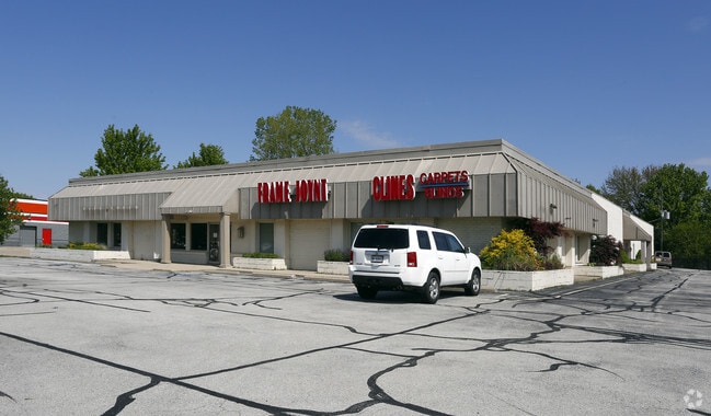
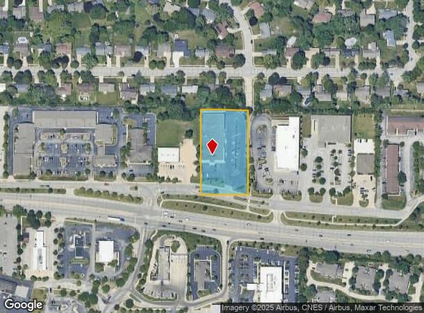
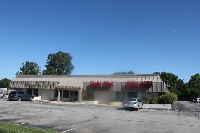
Property Record
350 Sagamore Pky W, West Lafayette, IN 47906
NEARBY LISTINGS FOR SALE OR LEASE
Property Detail
350 Sagamore Pky W
79-07-07-283-002.000-026
PT NE SEC 7 TWP 23 R4 1.653 A
Storebuilding
Tippecanoe
X
Indiana
18157C0133D
1
2024
1.65 AC
2024
Lafayette/Kokomo
005102
Other Market Areas
20,000 SF
Lafayette-West Lafayette, IN
DEMOGRAPHICS near 350 Sagamore Pky W
1 Mile
3 Mile
5 Mile
2024 Total Population
9,209
75,249
121,921
2029 Population
9,357
77,994
126,102
Pop Growth 2024-2029
+ 1.61%
+ 3.65%
+ 3.43%
Average Age
39
32
34
2024 Total Households
3,829
29,624
48,798
HH Growth 2024-2029
+ 1.54%
+ 4.14%
+ 3.77%
Median Household Inc
$71,738
$36,790
$45,959
Avg Household Size
2.30
2.10
2.20
2024 Avg HH Vehicles
2.00
2.00
2.00
Median Home Value
$268,944
$223,992
$195,722
Median Year Built
1978
1988
1982
Nearby Places
- Restaurants
- Banks
- Shops
- Fitness
- Groceries
PUBLIC TRANSPORTATION
COMMUTER RAIL
Lafayette Amtrak Station (Cardinal - Amtrak)
DRIVE
WALK
Distance
Lafayette Amtrak Station (Cardinal - Amtrak)
8 min
4.1 mi
Freight Ports
Port Milwaukee
DRIVE
WALK
Distance
Port Milwaukee
249 min
207.5 mi
SALE & LEASE HISTORY
LISTING DATE
SALE/LEASE

Sep 24, 2016
For Sale
Jan 22, 2020
For Lease
Nearby Properties
Address
Land Use
TOTAL SIZE
Lot Size
Zoning
Address
Land Use
TOTAL SIZE
Lot Size
Zoning
469,872 SF
0.85 AC
Address
Land Use
TOTAL SIZE
Lot Size
Zoning
377,937 SF
4.80 AC
Address
Land Use
TOTAL SIZE
Lot Size
Zoning
385,162 SF
1 AC
Address
Land Use
TOTAL SIZE
Lot Size
Zoning
401,345 SF
1.64 AC
Address
Land Use
TOTAL SIZE
Lot Size
Zoning
498,665 SF
1.94 AC
Address
Land Use
TOTAL SIZE
Lot Size
Zoning
Address
Land Use
TOTAL SIZE
Lot Size
Zoning
417,720 SF
3.09 AC
Address
Land Use
TOTAL SIZE
Lot Size
Zoning
13,773 SF
87 SF
Address
Land Use
TOTAL SIZE
Lot Size
Zoning
191,872 SF
87 SF
Address
Land Use
TOTAL SIZE
Lot Size
Zoning
249,214 SF
1.93 AC
Address
Land Use
TOTAL SIZE
Lot Size
Zoning
265,805 SF
10.67 AC
Address
Land Use
TOTAL SIZE
Lot Size
Zoning
159,946 SF
87 SF
Address
Land Use
TOTAL SIZE
Lot Size
Zoning
267,566 SF
18.99 AC
Address
Land Use
TOTAL SIZE
Lot Size
Zoning
402,757 SF
23.10 AC
Address
Land Use
TOTAL SIZE
Lot Size
Zoning
159,723 SF
44 SF
Address
Land Use
TOTAL SIZE
Lot Size
Zoning
148,860 SF
1.25 AC
Address
Land Use
TOTAL SIZE
Lot Size
Zoning
335,332 SF
87 SF
Address
Land Use
TOTAL SIZE
Lot Size
Zoning
0.01 AC
Address
Land Use
TOTAL SIZE
Lot Size
Zoning
336,185 SF
87 SF
Address
Land Use
TOTAL SIZE
Lot Size
Zoning
257,996 SF
19.30 AC
Address
Land Use
TOTAL SIZE
Lot Size
Zoning
232,565 SF
1.15 AC
Address
Land Use
TOTAL SIZE
Lot Size
Zoning
Address
Land Use
TOTAL SIZE
Lot Size
Zoning
205,701 SF
1.27 AC
Address
Land Use
TOTAL SIZE
Lot Size
Zoning
27,300 SF
22.52 AC
Address
Land Use
TOTAL SIZE
Lot Size
Zoning
164,234 SF
0.88 AC
Address
Land Use
TOTAL SIZE
Lot Size
Zoning
184,441 SF
44 SF
Address
Land Use
TOTAL SIZE
Lot Size
Zoning
222,276 SF
0.31 AC
Address
Land Use
TOTAL SIZE
Lot Size
Zoning
42,800 SF
131 SF
Address
Land Use
TOTAL SIZE
Lot Size
Zoning
141,960 SF
2.27 AC
The World's #1 Commercial Real Estate Marketplace
Connect with us
© 2025 CoStar Group
The information above has been obtained from sources believed reliable. While we do not doubt its accuracy we have not verified it and make no guarantee, warranty or representation about it. It is your responsibility to independently confirm its accuracy and completeness. Any projections, opinions, assumptions, or estimates used are for example only and do not represent the current or future performance of the property. The value of this transaction to you depends on tax and other factors which should be evaluated by your tax, financial, and legal advisors. You and your advisors should conduct a careful, independent investigation of the property to determine to your satisfaction the suitability of the property for your needs.