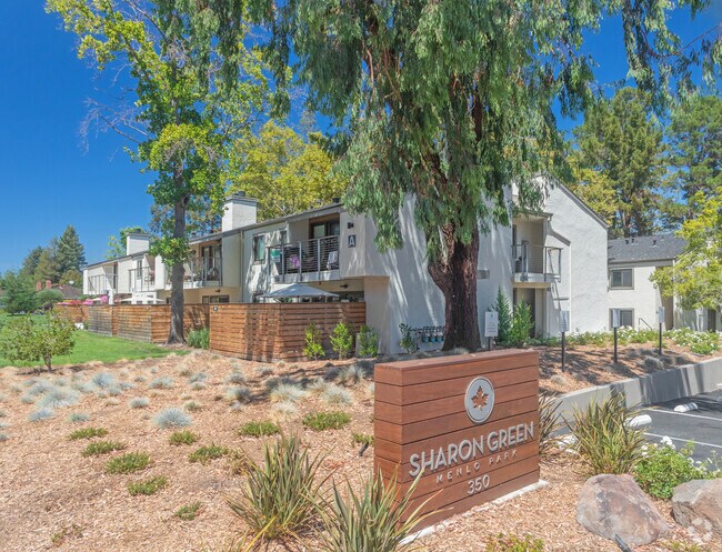
Property Record
350 Sharon Park Dr, Menlo Park, CA 94025


NEARBY LISTINGS FOR SALE OR LEASE
Property Detail
350 Sharon Park Dr
San Francisco-Redwood City-South San Francisco, CA
Sharon Heights No 10
074-281-110
4.81 AC MOL BEING NWLY PTN OF LOT 5 SHARON HEIGHTS NO 10 RSM 63/8 11
Multifamilydwelling
San Mateo
X
California
06081C0312E
5
2024
4.96 AC
2025
Sharon Height
613000
San Francisco
200 SF
DEMOGRAPHICS near 350 Sharon Park Dr
1 Mile
3 Mile
5 Mile
2024 Total Population
13,736
80,420
265,933
2029 Population
13,352
77,946
256,002
Pop Growth 2024-2029
(2.80%)
(3.08%)
(3.73%)
Average Age
39
39
40
2024 Total Households
4,254
28,563
91,780
HH Growth 2024-2029
(3.31%)
(3.04%)
(3.69%)
Median Household Inc
$207,515
$163,825
$154,267
Avg Household Size
2.50
2.30
2.60
2024 Avg HH Vehicles
2.00
2.00
2.00
Median Home Value
$1,144,389
$1,143,833
$1,133,858
Median Year Built
1970
1969
1965
Nearby Places
Map Layers
Map Styles
 Street
 Aerial
- Restaurants
- Banks
- Shops
- Fitness
- Groceries
PUBLIC TRANSPORTATION
COMMUTER RAIL
Menlo Park (Caltrain - Caltrain (Caltrain), Limited - Caltrain (Caltrain), Local Weekday - Caltrain (Caltrain), Local Weekend - Caltrain (Caltrain))
DRIVE
WALK
Distance
Menlo Park (Caltrain - Caltrain (Caltrain), Limited - Caltrain (Caltrain), Local Weekday - Caltrain (Caltrain), Local Weekend - Caltrain (Caltrain))
8 min
3.0 mi
Palo Alto (Caltrain - Caltrain (Caltrain), Express - Caltrain (Caltrain), Limited - Caltrain (Caltrain), Local Weekday - Caltrain (Caltrain), Local Weekend - Caltrain (Caltrain))
DRIVE
WALK
Distance
Palo Alto (Caltrain - Caltrain (Caltrain), Express - Caltrain (Caltrain), Limited - Caltrain (Caltrain), Local Weekday - Caltrain (Caltrain), Local Weekend - Caltrain (Caltrain))
9 min
3.2 mi
AIRPORT
Norman Y Mineta San Jose International
DRIVE
WALK
Distance
Norman Y Mineta San Jose International
32 min
18.1 mi
San Francisco International
DRIVE
WALK
Distance
San Francisco International
33 min
20.2 mi
Metro Oakland International
DRIVE
WALK
Distance
Metro Oakland International
49 min
32.7 mi
Freight Ports
Port of Redwood City
DRIVE
WALK
Distance
Port of Redwood City
17 min
7.0 mi
Nearby Properties
Address
Land Use
TOTAL SIZE
Lot Size
Zoning
Address
Land Use
TOTAL SIZE
Lot Size
Zoning
1,395,540 SF
51.72 AC
C3
Address
Land Use
TOTAL SIZE
Lot Size
Zoning
Address
Land Use
TOTAL SIZE
Lot Size
Zoning
265,341 SF
13.53 AC
RP
Address
Land Use
TOTAL SIZE
Lot Size
Zoning
918,926 SF
17.54 AC
PC442
Address
Land Use
TOTAL SIZE
Lot Size
Zoning
182,606 SF
16.48 AC
EAC01C
Address
Land Use
TOTAL SIZE
Lot Size
Zoning
Address
Land Use
TOTAL SIZE
Lot Size
Zoning
118,168 SF
10.92 AC
EA0C1C
Address
Land Use
TOTAL SIZE
Lot Size
Zoning
521,754 SF
46.72 AC
RP
Address
Land Use
TOTAL SIZE
Lot Size
Zoning
169,391 SF
13.30 AC
EAC01C
Address
Land Use
TOTAL SIZE
Lot Size
Zoning
145,617 SF
8.24 AC
EA00C1
Address
Land Use
TOTAL SIZE
Lot Size
Zoning
328,024 SF
10.64 AC
Address
Land Use
TOTAL SIZE
Lot Size
Zoning
61.20 AC
R10000
Address
Land Use
TOTAL SIZE
Lot Size
Zoning
113,964 SF
6.28 AC
RP
Address
Land Use
TOTAL SIZE
Lot Size
Zoning
16.43 AC
Address
Land Use
TOTAL SIZE
Lot Size
Zoning
140,948 SF
7.79 AC
EAC01C
Address
Land Use
TOTAL SIZE
Lot Size
Zoning
52,504 SF
1.16 AC
PC
Address
Land Use
TOTAL SIZE
Lot Size
Zoning
98,626 SF
4.44 AC
RP
Address
Land Use
TOTAL SIZE
Lot Size
Zoning
77,814 SF
3.42 AC
RP
Address
Land Use
TOTAL SIZE
Lot Size
Zoning
96,025 SF
4.67 AC
RP
Address
Land Use
TOTAL SIZE
Lot Size
Zoning
0.15 AC
A1
Address
Land Use
TOTAL SIZE
Lot Size
Zoning
0.41 AC
A
Address
Land Use
TOTAL SIZE
Lot Size
Zoning
0.40 AC
A
Address
Land Use
TOTAL SIZE
Lot Size
Zoning
0.41 AC
A
Address
Land Use
TOTAL SIZE
Lot Size
Zoning
0.05 AC
ZN PF
Address
Land Use
TOTAL SIZE
Lot Size
Zoning
442,796 SF
18.45 AC
C10000
Address
Land Use
TOTAL SIZE
Lot Size
Zoning
0.19 AC
A1
Address
Land Use
TOTAL SIZE
Lot Size
Zoning
48,469 SF
6.70 AC
C10000
Address
Land Use
TOTAL SIZE
Lot Size
Zoning
180,943 SF
10.40 AC
RP
Address
Land Use
TOTAL SIZE
Lot Size
Zoning
1.45 AC
A1
Address
Land Use
TOTAL SIZE
Lot Size
Zoning
0.41 AC
A
The World's #1 Commercial Real Estate Marketplace
Connect with us
© 2025 CoStar Group
The information above has been obtained from sources believed reliable. While we do not doubt its accuracy we have not verified it and make no guarantee, warranty or representation about it. It is your responsibility to independently confirm its accuracy and completeness. Any projections, opinions, assumptions, or estimates used are for example only and do not represent the current or future performance of the property. The value of this transaction to you depends on tax and other factors which should be evaluated by your tax, financial, and legal advisors. You and your advisors should conduct a careful, independent investigation of the property to determine to your satisfaction the suitability of the property for your needs.