Property Record
350 Simpson Cir Ne, Cartersville, GA 30121
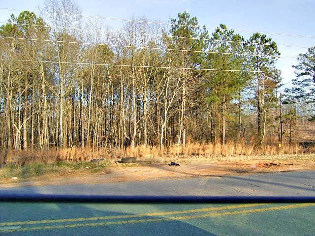

Property Detail
350 Simpson Cir Ne
Atlanta-Sandy Springs-Roswell, GA
LL307/308 LD5
0091-0308-030
BARTOW
Commercialacreage
Georgia
B and X Area of moderate flood hazard, usually the area between the limits of the 100-year and 500-year floods.
3 AC
2025
Bartow County
2025
Atlanta
960403
NEARBY LISTINGS FOR SALE OR LEASE
DEMOGRAPHICS near 350 Simpson Cir Ne
1 mile
3 mile
5 mile
2025 Total Population
1,846
9,967
34,254
2030 Population
1,967
10,716
36,688
Pop Growth 2025-2030
+ 6.55%
+ 7.51%
+ 7.11%
Average Age
41
40
39
2025 Total Households
692
3,633
13,097
HH Growth 2025-2030
+ 6.50%
+ 7.57%
+ 7.17%
Median Household Inc
$108,654
$92,025
$78,235
Avg Household Size
2.70
2.60
2.50
2025 Avg HH Vehicles
2.00
2.00
2.00
Median Home Value
$327,809
$323,499
$304,055
Median Year Built
1995
1998
1995
Nearby Places
Map Layers
Map Styles
 Street
 Aerial
Layers
 Traffic
 Biking
Places
Listings with unknown addresses are not visible on the map
- Restaurants
- Banks
- Shops
- Fitness
- Groceries
Nearby Properties
Address
Land Use
TOTAL SIZE
Lot Size
Zoning
Address
Land Use
TOTAL SIZE
Lot Size
Zoning
141,651 SF
181.89 AC
I1
Address
Land Use
TOTAL SIZE
Lot Size
Zoning
107,992 SF
46 AC
IN
Address
Land Use
TOTAL SIZE
Lot Size
Zoning
7,488 SF
38.49 AC
IN
Address
Land Use
TOTAL SIZE
Lot Size
Zoning
90,497 SF
24.36 AC
Address
Land Use
TOTAL SIZE
Lot Size
Zoning
33,096 SF
15.80 AC
Address
Land Use
TOTAL SIZE
Lot Size
Zoning
683.23 AC
Address
Land Use
TOTAL SIZE
Lot Size
Zoning
51,681 SF
16 AC
Address
Land Use
TOTAL SIZE
Lot Size
Zoning
24,256 SF
11.87 AC
R3WC
Address
Land Use
TOTAL SIZE
Lot Size
Zoning
211,821 SF
20.32 AC
Address
Land Use
TOTAL SIZE
Lot Size
Zoning
8,064 SF
36.63 AC
IN
Address
Land Use
TOTAL SIZE
Lot Size
Zoning
60,361 SF
13.66 AC
A1
Address
Land Use
TOTAL SIZE
Lot Size
Zoning
20.79 AC
RESIDENTIA
Address
Land Use
TOTAL SIZE
Lot Size
Zoning
196,426 SF
37.60 AC
IN
Address
Land Use
TOTAL SIZE
Lot Size
Zoning
28,736 SF
8.53 AC
C1
Address
Land Use
TOTAL SIZE
Lot Size
Zoning
64,691 SF
6.95 AC
Address
Land Use
TOTAL SIZE
Lot Size
Zoning
103,600 SF
30.12 AC
Address
Land Use
TOTAL SIZE
Lot Size
Zoning
32,952 SF
6.57 AC
Address
Land Use
TOTAL SIZE
Lot Size
Zoning
73,808 SF
2.53 AC
Address
Land Use
TOTAL SIZE
Lot Size
Zoning
5,187 SF
7.73 AC
Address
Land Use
TOTAL SIZE
Lot Size
Zoning
3,208 SF
5 AC
IN
Address
Land Use
TOTAL SIZE
Lot Size
Zoning
30,516 SF
5.21 AC
Address
Land Use
TOTAL SIZE
Lot Size
Zoning
77,586 SF
4.57 AC
IN
Address
Land Use
TOTAL SIZE
Lot Size
Zoning
16,848 SF
Address
Land Use
TOTAL SIZE
Lot Size
Zoning
54,592 SF
2.16 AC
C1
Address
Land Use
TOTAL SIZE
Lot Size
Zoning
35,546 SF
5.32 AC
C1
Address
Land Use
TOTAL SIZE
Lot Size
Zoning
40,367 SF
5.13 AC
Address
Land Use
TOTAL SIZE
Lot Size
Zoning
34,000 SF
5.39 AC
IN
Address
Land Use
TOTAL SIZE
Lot Size
Zoning
37,131 SF
2.80 AC
IN
Address
Land Use
TOTAL SIZE
Lot Size
Zoning
19,180 SF
2.28 AC
IN
Address
Land Use
TOTAL SIZE
Lot Size
Zoning
92,426 SF
16.19 AC
IN
The World's #1 Commercial Real Estate Marketplace
Connect with us
© 2026 CoStar Group
The information above has been obtained from sources believed reliable. While we do not doubt its accuracy we have not verified it and make no guarantee, warranty or representation about it. It is your responsibility to independently confirm its accuracy and completeness. Any projections, opinions, assumptions, or estimates used are for example only and do not represent the current or future performance of the property. The value of this transaction to you depends on tax and other factors which should be evaluated by your tax, financial, and legal advisors. You and your advisors should conduct a careful, independent investigation of the property to determine to your satisfaction the suitability of the property for your needs.