Property Record
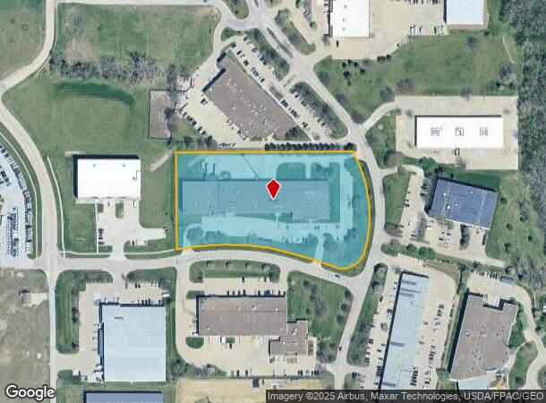
3500 109Th St, Urbandale, IA 50322


This Property Is For Sale
NEARBY LISTINGS FOR SALE OR LEASE
Property Detail
3500 109Th St
Des Moines-West Des Moines, IA
Walnut Ridge Business Park
312-03240415000
LOT 15 WALNUT RIDGE BUSINESS PARK
Officebuilding
Polk
X
Iowa
19153C0169F
15
2024
4.74 AC
2025
Western Suburbs
010406
Des Moines
50,640 SF
DEMOGRAPHICS near 3500 109Th St
1 Mile
3 Mile
5 Mile
2024 Total Population
1,508
55,982
194,207
2029 Population
1,546
58,503
210,467
Pop Growth 2024-2029
+ 2.52%
+ 4.50%
+ 8.37%
Average Age
43
40
39
2024 Total Households
657
23,004
79,843
HH Growth 2024-2029
+ 2.74%
+ 4.59%
+ 8.46%
Median Household Inc
$97,849
$86,514
$85,783
Avg Household Size
2.30
2.40
2.40
2024 Avg HH Vehicles
2.00
2.00
2.00
Median Home Value
$255,639
$265,744
$263,267
Median Year Built
1981
1986
1991
Nearby Places
- Restaurants
- Banks
- Shops
- Fitness
- Groceries
PUBLIC TRANSPORTATION
AIRPORT
Des Moines International
DRIVE
WALK
Distance
Des Moines International
24 min
13.9 mi
Freight Ports
Port of Shreveport
DRIVE
WALK
Distance
Port of Shreveport
1 min
640.6 mi
Nearby Properties
Address
Land Use
TOTAL SIZE
Lot Size
Zoning
Address
Land Use
TOTAL SIZE
Lot Size
Zoning
472,476 SF
12.48 AC
PUD OFFICE
Address
Land Use
TOTAL SIZE
Lot Size
Zoning
18,093 SF
38.92 AC
Address
Land Use
TOTAL SIZE
Lot Size
Zoning
422,683 SF
46.57 AC
PCP
Address
Land Use
TOTAL SIZE
Lot Size
Zoning
457,056 SF
26.01 AC
Address
Land Use
TOTAL SIZE
Lot Size
Zoning
407,183 SF
17.02 AC
PUD
Address
Land Use
TOTAL SIZE
Lot Size
Zoning
415,320 SF
51.16 AC
PUD
Address
Land Use
TOTAL SIZE
Lot Size
Zoning
241,324 SF
21.67 AC
PUD B&C
Address
Land Use
TOTAL SIZE
Lot Size
Zoning
322,220 SF
7.61 AC
Address
Land Use
TOTAL SIZE
Lot Size
Zoning
275,227 SF
18.31 AC
PCP
Address
Land Use
TOTAL SIZE
Lot Size
Zoning
59,496 SF
9.34 AC
Address
Land Use
TOTAL SIZE
Lot Size
Zoning
196,904 SF
26.10 AC
PUD
Address
Land Use
TOTAL SIZE
Lot Size
Zoning
182,866 SF
10.21 AC
Address
Land Use
TOTAL SIZE
Lot Size
Zoning
189,691 SF
27.03 AC
PCP
Address
Land Use
TOTAL SIZE
Lot Size
Zoning
300,000 SF
17.51 AC
Address
Land Use
TOTAL SIZE
Lot Size
Zoning
572,809 SF
42.13 AC
M-2
Address
Land Use
TOTAL SIZE
Lot Size
Zoning
367,386 SF
24.31 AC
PUD
Address
Land Use
TOTAL SIZE
Lot Size
Zoning
341,024 SF
12.15 AC
RH
Address
Land Use
TOTAL SIZE
Lot Size
Zoning
133,256 SF
15.93 AC
Address
Land Use
TOTAL SIZE
Lot Size
Zoning
67,691 SF
7.30 AC
Address
Land Use
TOTAL SIZE
Lot Size
Zoning
151,344 SF
10.43 AC
C-3
Address
Land Use
TOTAL SIZE
Lot Size
Zoning
260,000 SF
14.32 AC
Address
Land Use
TOTAL SIZE
Lot Size
Zoning
195,931 SF
13.66 AC
Address
Land Use
TOTAL SIZE
Lot Size
Zoning
83,370 SF
0.98 AC
C-3
Address
Land Use
TOTAL SIZE
Lot Size
Zoning
79,916 SF
7.82 AC
PUD OFFICE
Address
Land Use
TOTAL SIZE
Lot Size
Zoning
260,000 SF
18.45 AC
Address
Land Use
TOTAL SIZE
Lot Size
Zoning
235,422 SF
13.39 AC
Address
Land Use
TOTAL SIZE
Lot Size
Zoning
308,117 SF
18.33 AC
RH
Address
Land Use
TOTAL SIZE
Lot Size
Zoning
250,000 SF
13.93 AC
Address
Land Use
TOTAL SIZE
Lot Size
Zoning
80,045 SF
5.07 AC
C-3
Address
Land Use
TOTAL SIZE
Lot Size
Zoning
168,898 SF
17.54 AC
PUD
The World's #1 Commercial Real Estate Marketplace
Connect with us
© 2025 CoStar Group
The information above has been obtained from sources believed reliable. While we do not doubt its accuracy we have not verified it and make no guarantee, warranty or representation about it. It is your responsibility to independently confirm its accuracy and completeness. Any projections, opinions, assumptions, or estimates used are for example only and do not represent the current or future performance of the property. The value of this transaction to you depends on tax and other factors which should be evaluated by your tax, financial, and legal advisors. You and your advisors should conduct a careful, independent investigation of the property to determine to your satisfaction the suitability of the property for your needs.