Property Record
3500 Beachwood Ct, Jacksonville, FL 32224


Current Lease Availabilities
NEARBY LISTINGS FOR SALE OR LEASE
Property Detail
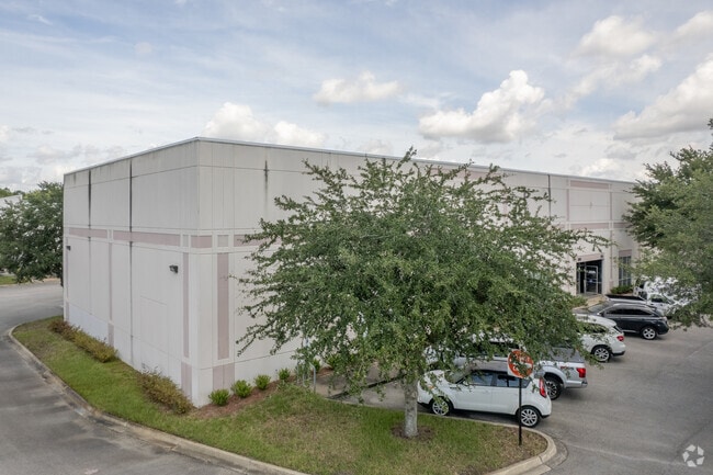
3500 Beachwood Ct
Jacksonville, FL
Beachwood Court
165768-1300
56-92 32-2S-28E 4.30 BEACHWOOD COURT LOT 4
Warehouse
Duval
X
Florida
12031C0392H
4
2025
4.30 AC
2026
Butler Corridor
014415
Jacksonville (Florida)
62,040 SF
DEMOGRAPHICS near 3500 Beachwood Ct
1 Mile
3 Mile
5 Mile
2024 Total Population
5,854
75,551
217,999
2029 Population
6,048
78,924
228,162
Pop Growth 2024-2029
+ 3.31%
+ 4.46%
+ 4.66%
Average Age
33
37
38
2024 Total Households
2,034
29,582
89,876
HH Growth 2024-2029
+ 3.15%
+ 4.51%
+ 4.82%
Median Household Inc
$45,028
$70,769
$69,023
Avg Household Size
2.30
2.40
2.30
2024 Avg HH Vehicles
1.00
2.00
2.00
Median Home Value
$195,018
$252,849
$272,920
Median Year Built
1989
1997
1995
Nearby Places
Map Layers
Map Styles
 Street
 Aerial
- Restaurants
- Banks
- Shops
- Fitness
- Groceries
PUBLIC TRANSPORTATION
AIRPORT
Jacksonville International
DRIVE
WALK
Distance
Jacksonville International
31 min
20.9 mi
Freight Ports
Jacksonville Port
DRIVE
WALK
Distance
Jacksonville Port
21 min
11.5 mi
Nearby Properties
Address
Land Use
TOTAL SIZE
Lot Size
Zoning
Address
Land Use
TOTAL SIZE
Lot Size
Zoning
387,908 SF
32.59 AC
PUD
Address
Land Use
TOTAL SIZE
Lot Size
Zoning
297,275 SF
38.30 AC
PUD
Address
Land Use
TOTAL SIZE
Lot Size
Zoning
1,037,304 SF
103.91 AC
PUD
Address
Land Use
TOTAL SIZE
Lot Size
Zoning
461,453 SF
46.69 AC
PUD
Address
Land Use
TOTAL SIZE
Lot Size
Zoning
283,724 SF
28.50 AC
PUD
Address
Land Use
TOTAL SIZE
Lot Size
Zoning
444,532 SF
27.22 AC
PUD
Address
Land Use
TOTAL SIZE
Lot Size
Zoning
186,482 SF
33.57 AC
PUD
Address
Land Use
TOTAL SIZE
Lot Size
Zoning
375,307 SF
29.13 AC
PUD
Address
Land Use
TOTAL SIZE
Lot Size
Zoning
242,868 SF
13.45 AC
PUD
Address
Land Use
TOTAL SIZE
Lot Size
Zoning
216,370 SF
10.02 AC
PUD
Address
Land Use
TOTAL SIZE
Lot Size
Zoning
279,038 SF
28.39 AC
PUD
Address
Land Use
TOTAL SIZE
Lot Size
Zoning
364,605 SF
33.94 AC
PUD
Address
Land Use
TOTAL SIZE
Lot Size
Zoning
361,268 SF
15.27 AC
PUD
Address
Land Use
TOTAL SIZE
Lot Size
Zoning
262,453 SF
17.09 AC
PUD
Address
Land Use
TOTAL SIZE
Lot Size
Zoning
475,463 SF
37.20 AC
PUD
Address
Land Use
TOTAL SIZE
Lot Size
Zoning
255,951 SF
5.58 AC
PUD
Address
Land Use
TOTAL SIZE
Lot Size
Zoning
306,416 SF
12.27 AC
PUD
Address
Land Use
TOTAL SIZE
Lot Size
Zoning
329,810 SF
33.39 AC
PUD
Address
Land Use
TOTAL SIZE
Lot Size
Zoning
258,174 SF
10.55 AC
PUD
Address
Land Use
TOTAL SIZE
Lot Size
Zoning
276,424 SF
5.06 AC
PUD
Address
Land Use
TOTAL SIZE
Lot Size
Zoning
171,972 SF
9 AC
PUD
Address
Land Use
TOTAL SIZE
Lot Size
Zoning
288,252 SF
4.60 AC
PUD
Address
Land Use
TOTAL SIZE
Lot Size
Zoning
304,922 SF
26.28 AC
PUD
Address
Land Use
TOTAL SIZE
Lot Size
Zoning
426,575 SF
32.98 AC
PUD
Address
Land Use
TOTAL SIZE
Lot Size
Zoning
408,283 SF
25.16 AC
RMD-D
Address
Land Use
TOTAL SIZE
Lot Size
Zoning
282,233 SF
13.70 AC
PUD
Address
Land Use
TOTAL SIZE
Lot Size
Zoning
380,690 SF
6.68 AC
PUD
Address
Land Use
TOTAL SIZE
Lot Size
Zoning
176,465 SF
10.33 AC
PUD
Address
Land Use
TOTAL SIZE
Lot Size
Zoning
282,193 SF
18.68 AC
RMD-D
Address
Land Use
TOTAL SIZE
Lot Size
Zoning
345,122 SF
19.85 AC
RMD-D
The World's #1 Commercial Real Estate Marketplace
Connect with us
© 2026 CoStar Group
The information above has been obtained from sources believed reliable. While we do not doubt its accuracy we have not verified it and make no guarantee, warranty or representation about it. It is your responsibility to independently confirm its accuracy and completeness. Any projections, opinions, assumptions, or estimates used are for example only and do not represent the current or future performance of the property. The value of this transaction to you depends on tax and other factors which should be evaluated by your tax, financial, and legal advisors. You and your advisors should conduct a careful, independent investigation of the property to determine to your satisfaction the suitability of the property for your needs.