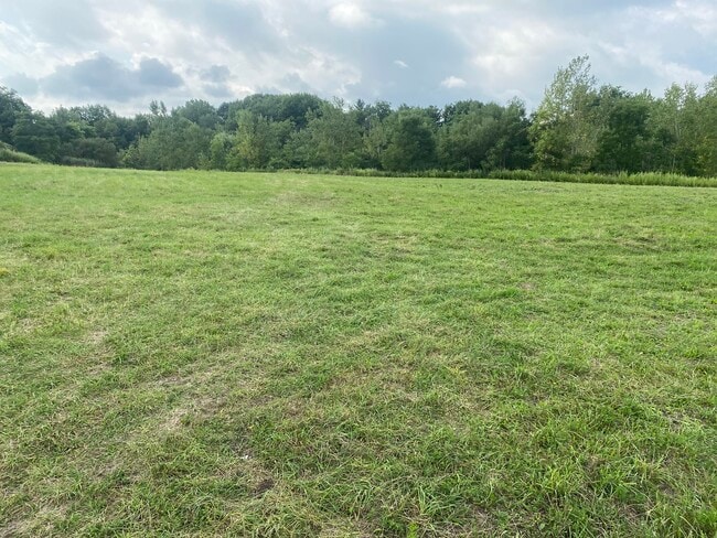
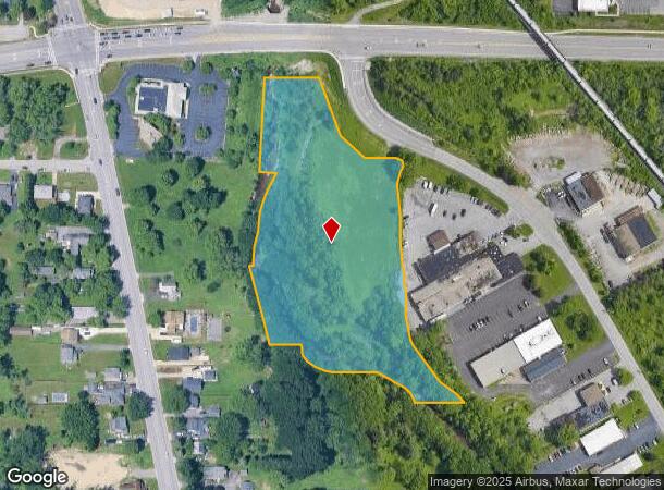
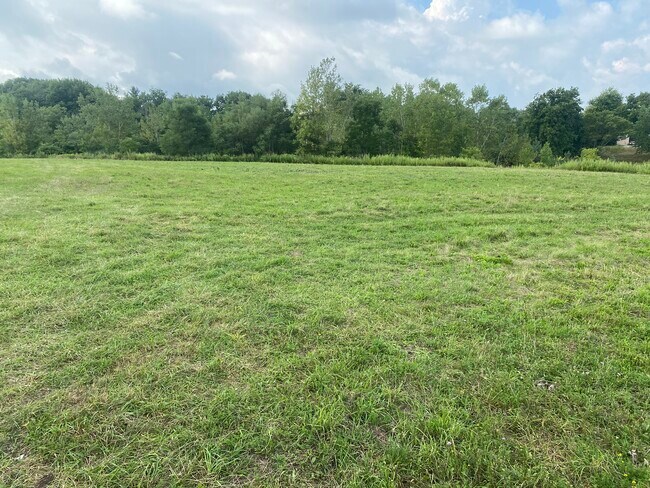
Property Record
3500 California Rd, Orchard Park, NY 14127
NEARBY LISTINGS FOR SALE OR LEASE
Property Detail
3500 California Rd
146089-161-050-0001-003-100
141.61 X 6.3 AC
Gasolinefuelbulkstorage
Erie
AE
New York
36029C0341H
3.100
2025
5.94 AC
2024
South
013600
Buffalo/Niagara Falls
3,462 SF
Buffalo-Cheektowaga-Niagara Falls, NY
DEMOGRAPHICS near 3500 California Rd
1 Mile
3 Mile
5 Mile
2024 Total Population
3,984
50,673
144,004
2029 Population
3,935
50,437
142,771
Pop Growth 2024-2029
(1.23%)
(0.47%)
(0.86%)
Average Age
42
44
43
2024 Total Households
1,751
22,529
62,134
HH Growth 2024-2029
(1.26%)
(0.53%)
(0.94%)
Median Household Inc
$63,701
$66,814
$67,559
Avg Household Size
2.20
2.20
2.20
2024 Avg HH Vehicles
2.00
2.00
2.00
Median Home Value
$173,746
$192,280
$191,991
Median Year Built
1969
1966
1961
Nearby Places
- Restaurants
- Banks
- Shops
- Fitness
- Groceries
PUBLIC TRANSPORTATION
AIRPORT
Buffalo Niagara International
DRIVE
WALK
Distance
Buffalo Niagara International
25 min
16.0 mi
Niagara Falls International
DRIVE
WALK
Distance
Niagara Falls International
45 min
30.0 mi
Freight Ports
Port of Toledo
DRIVE
WALK
Distance
Port of Toledo
349 min
297.3 mi
SALE & LEASE HISTORY
LISTING DATE
SALE/LEASE

Sep 10, 2020
For Lease
Sep 10, 2020
For Sale
Nearby Properties
Address
Land Use
TOTAL SIZE
Lot Size
Zoning
Address
Land Use
TOTAL SIZE
Lot Size
Zoning
49,500 SF
108.40 AC
R1
Address
Land Use
TOTAL SIZE
Lot Size
Zoning
22,754 SF
41.80 AC
Address
Land Use
TOTAL SIZE
Lot Size
Zoning
183,334 SF
50.90 AC
B2
Address
Land Use
TOTAL SIZE
Lot Size
Zoning
184,188 SF
110.75 AC
Address
Land Use
TOTAL SIZE
Lot Size
Zoning
77,270 SF
46.15 AC
C3
Address
Land Use
TOTAL SIZE
Lot Size
Zoning
337,198 SF
51.05 AC
M1
Address
Land Use
TOTAL SIZE
Lot Size
Zoning
197,584 SF
32.50 AC
B2
Address
Land Use
TOTAL SIZE
Lot Size
Zoning
48.14 AC
OP
Address
Land Use
TOTAL SIZE
Lot Size
Zoning
18,840 SF
114.12 AC
M3
Address
Land Use
TOTAL SIZE
Lot Size
Zoning
118,358 SF
59.67 AC
Address
Land Use
TOTAL SIZE
Lot Size
Zoning
115,317 SF
17.87 AC
DR
Address
Land Use
TOTAL SIZE
Lot Size
Zoning
124,112 SF
53.10 AC
05 - COMME
Address
Land Use
TOTAL SIZE
Lot Size
Zoning
149,065 SF
21.53 AC
B2
Address
Land Use
TOTAL SIZE
Lot Size
Zoning
59,421 SF
75.40 AC
B1
Address
Land Use
TOTAL SIZE
Lot Size
Zoning
202,597 SF
24.22 AC
Address
Land Use
TOTAL SIZE
Lot Size
Zoning
0.07 AC
Address
Land Use
TOTAL SIZE
Lot Size
Zoning
97,709 SF
14.13 AC
R2
Address
Land Use
TOTAL SIZE
Lot Size
Zoning
3,268 SF
1.68 AC
Address
Land Use
TOTAL SIZE
Lot Size
Zoning
Address
Land Use
TOTAL SIZE
Lot Size
Zoning
91,618 SF
11.30 AC
Address
Land Use
TOTAL SIZE
Lot Size
Zoning
165,478 SF
9.79 AC
Address
Land Use
TOTAL SIZE
Lot Size
Zoning
72.11 AC
Address
Land Use
TOTAL SIZE
Lot Size
Zoning
10,486 SF
25.30 AC
R3
Address
Land Use
TOTAL SIZE
Lot Size
Zoning
28,578 SF
10.46 AC
C1
Address
Land Use
TOTAL SIZE
Lot Size
Zoning
221,896 SF
21.50 AC
Address
Land Use
TOTAL SIZE
Lot Size
Zoning
8,320 SF
22.10 AC
Address
Land Use
TOTAL SIZE
Lot Size
Zoning
149,858 SF
24.18 AC
Address
Land Use
TOTAL SIZE
Lot Size
Zoning
103,215 SF
6.14 AC
C1
Address
Land Use
TOTAL SIZE
Lot Size
Zoning
102,037 SF
9.95 AC
C2
Address
Land Use
TOTAL SIZE
Lot Size
Zoning
13,062 SF
26.07 AC
R4
The World's #1 Commercial Real Estate Marketplace
Connect with us
© 2025 CoStar Group
The information above has been obtained from sources believed reliable. While we do not doubt its accuracy we have not verified it and make no guarantee, warranty or representation about it. It is your responsibility to independently confirm its accuracy and completeness. Any projections, opinions, assumptions, or estimates used are for example only and do not represent the current or future performance of the property. The value of this transaction to you depends on tax and other factors which should be evaluated by your tax, financial, and legal advisors. You and your advisors should conduct a careful, independent investigation of the property to determine to your satisfaction the suitability of the property for your needs.