Property Record
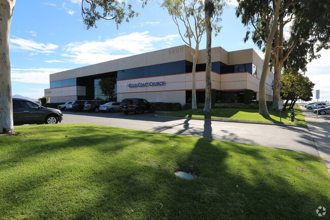
3500 Camino Ave, Oxnard, CA 93030


Property Detail
3500 Camino Ave
216-0-030-110
LOT: B REF: 22 PM 28
Commercialnec
Ventura
BRP
California
C and X Area of minimal flood hazard, usually depicted on FIRMs as above the 500-year flood level.
b
2024
2.79 AC
2025
Oxnard/Port Hueneme
004902
Los Angeles
62,915 SF
Oxnard-Thousand Oaks-Ventura, CA
NEARBY LISTINGS FOR SALE OR LEASE
DEMOGRAPHICS near 3500 Camino Ave
1 mile
3 mile
5 mile
2025 Total Population
2,731
44,406
211,349
2030 Population
2,642
43,803
208,828
Pop Growth 2025-2030
(3.26%)
(1.36%)
(1.19%)
Average Age
34
37
38
2025 Total Households
716
11,998
60,039
HH Growth 2025-2030
(3.21%)
(1.41%)
(1.30%)
Median Household Inc
$65,675
$109,371
$101,245
Avg Household Size
3.60
3.50
3.40
2025 Avg HH Vehicles
2.00
2.00
2.00
Median Home Value
$724,537
$738,435
$724,879
Median Year Built
1967
1991
1975
Nearby Places
Map Layers
Map Styles
 Street
 Aerial
Transit
 Traffic
 Biking
Places
Listings with unknown addresses are not visible on the map
- Restaurants
- Banks
- Shops
- Fitness
- Groceries
PUBLIC TRANSPORTATION
COMMUTER RAIL
Drive
Walk
Distance
10 min
5.7 mi
Camarillo (Ventura County Line - Southern California Regional Rail Authority (Metrolink))
Drive
Walk
Distance
Camarillo (Ventura County Line - Southern California Regional Rail Authority (Metrolink))
9 min
5.7 mi
Freight Ports
The Port of Hueneme
Drive
Walk
Distance
The Port of Hueneme
18 min
9.2 mi
SALE & LEASE HISTORY
LISTING DATE
SALE/LEASE

Dec 05, 2016
For Lease
Nearby Properties
Address
Land Use
TOTAL SIZE
Lot Size
Zoning
Address
Land Use
TOTAL SIZE
Lot Size
Zoning
135,631 SF
74.32 AC
Address
Land Use
TOTAL SIZE
Lot Size
Zoning
25.09 AC
Address
Land Use
TOTAL SIZE
Lot Size
Zoning
35.90 AC
BRP
Address
Land Use
TOTAL SIZE
Lot Size
Zoning
31.75 AC
Address
Land Use
TOTAL SIZE
Lot Size
Zoning
505,728 SF
20.81 AC
Address
Land Use
TOTAL SIZE
Lot Size
Zoning
10.59 AC
Address
Land Use
TOTAL SIZE
Lot Size
Zoning
15.09 AC
Address
Land Use
TOTAL SIZE
Lot Size
Zoning
352,898 SF
16.57 AC
ML
Address
Land Use
TOTAL SIZE
Lot Size
Zoning
Address
Land Use
TOTAL SIZE
Lot Size
Zoning
30,800 SF
32.79 AC
M-1-
Address
Land Use
TOTAL SIZE
Lot Size
Zoning
15.59 AC
Address
Land Use
TOTAL SIZE
Lot Size
Zoning
8,398 SF
45.88 AC
M1PD
Address
Land Use
TOTAL SIZE
Lot Size
Zoning
70,392 SF
19.97 AC
4
Address
Land Use
TOTAL SIZE
Lot Size
Zoning
41,327 SF
7.04 AC
Address
Land Use
TOTAL SIZE
Lot Size
Zoning
770 SF
9.80 AC
M1
Address
Land Use
TOTAL SIZE
Lot Size
Zoning
13,833 SF
13.91 AC
Address
Land Use
TOTAL SIZE
Lot Size
Zoning
72,335 SF
10.67 AC
Address
Land Use
TOTAL SIZE
Lot Size
Zoning
2,440 SF
7.49 AC
C2
Address
Land Use
TOTAL SIZE
Lot Size
Zoning
84,518 SF
4.71 AC
RPD
Address
Land Use
TOTAL SIZE
Lot Size
Zoning
16,237 SF
4.23 AC
Address
Land Use
TOTAL SIZE
Lot Size
Zoning
390 SF
39.49 AC
Address
Land Use
TOTAL SIZE
Lot Size
Zoning
0.75 AC
BRP
Address
Land Use
TOTAL SIZE
Lot Size
Zoning
88,224 SF
7.40 AC
Address
Land Use
TOTAL SIZE
Lot Size
Zoning
17.60 AC
Address
Land Use
TOTAL SIZE
Lot Size
Zoning
60,496 SF
4.17 AC
R4PD
Address
Land Use
TOTAL SIZE
Lot Size
Zoning
11,794 SF
11.57 AC
C2PD
Address
Land Use
TOTAL SIZE
Lot Size
Zoning
106,404 SF
5.95 AC
ML
Address
Land Use
TOTAL SIZE
Lot Size
Zoning
17,185 SF
13.96 AC
RE1A
Address
Land Use
TOTAL SIZE
Lot Size
Zoning
66,715 SF
4.07 AC
Address
Land Use
TOTAL SIZE
Lot Size
Zoning
13,802 SF
6.03 AC
The World's #1 Commercial Real Estate Marketplace
Connect with us
© 2026 CoStar Group
The information above has been obtained from sources believed reliable. While we do not doubt its accuracy we have not verified it and make no guarantee, warranty or representation about it. It is your responsibility to independently confirm its accuracy and completeness. Any projections, opinions, assumptions, or estimates used are for example only and do not represent the current or future performance of the property. The value of this transaction to you depends on tax and other factors which should be evaluated by your tax, financial, and legal advisors. You and your advisors should conduct a careful, independent investigation of the property to determine to your satisfaction the suitability of the property for your needs.