Property Record
3500 Duckels Ct, Steamboat Springs, CO 80487

Property Detail
3500 Duckels Ct
R4818171
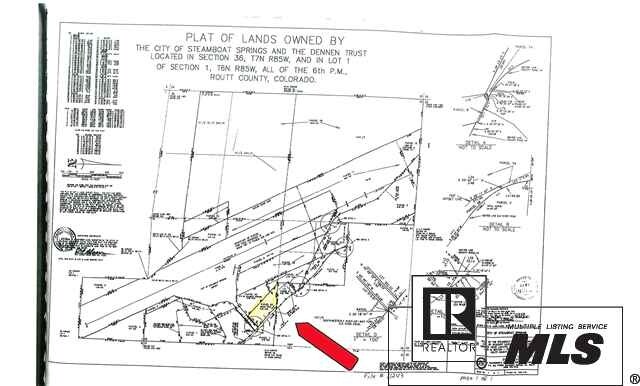
TR IN SW4SW4 SEC 31-7-84 TOTAL 12.19A
Commercialnec
ROUTT
I
Colorado
B and X Area of moderate flood hazard, usually the area between the limits of the 100-year and 500-year floods.
12.19 AC
2025
Colorado Ski Area
2025
Other Market Areas
000400
Steamboat Springs, CO
4,793 SF
NEARBY LISTINGS FOR SALE OR LEASE
DEMOGRAPHICS near 3500 Duckels Ct
1 mile
3 mile
5 mile
2025 Total Population
1,147
6,606
12,895
2030 Population
1,144
6,372
12,935
Pop Growth 2025-2030
(0.26%)
(3.54%)
+ 0.31%
Average Age
36
39
42
2025 Total Households
413
2,432
5,104
HH Growth 2025-2030
(0.24%)
(4.19%)
+ 0.39%
Median Household Inc
$57,752
$94,655
$100,799
Avg Household Size
2.60
2.50
2.40
2025 Avg HH Vehicles
2.00
2.00
2.00
Median Home Value
$612,745
$851,464
$1,017,985
Median Year Built
1988
1989
1992
Nearby Places
Map Layers
Map Styles
 Street
 Aerial
Transit
 Traffic
 Biking
Places
Listings with unknown addresses are not visible on the map
- Restaurants
- Banks
- Shops
- Fitness
- Groceries
PUBLIC TRANSPORTATION
AIRPORT
Yampa Valley
Drive
Walk
Distance
Yampa Valley
29 min
23.8 mi
Freight Ports
Tulsa Port Of Catoosa
Drive
Walk
Distance
Tulsa Port Of Catoosa
931 min
868.0 mi
Nearby Properties
Address
Land Use
TOTAL SIZE
Lot Size
Zoning
Address
Land Use
TOTAL SIZE
Lot Size
Zoning
Address
Land Use
TOTAL SIZE
Lot Size
Zoning
165,497 SF
61.09 AC
Address
Land Use
TOTAL SIZE
Lot Size
Zoning
164,090 SF
36.31 AC
AF
Address
Land Use
TOTAL SIZE
Lot Size
Zoning
50,497 SF
150 AC
Address
Land Use
TOTAL SIZE
Lot Size
Zoning
195,194 SF
18.50 AC
Address
Land Use
TOTAL SIZE
Lot Size
Zoning
81,317 SF
11.43 AC
Address
Land Use
TOTAL SIZE
Lot Size
Zoning
50,087 SF
150.54 AC
Address
Land Use
TOTAL SIZE
Lot Size
Zoning
28,732 SF
1.43 AC
Address
Land Use
TOTAL SIZE
Lot Size
Zoning
65,720 SF
10.76 AC
Address
Land Use
TOTAL SIZE
Lot Size
Zoning
52,850 SF
1.92 AC
Z14
Address
Land Use
TOTAL SIZE
Lot Size
Zoning
22,403 SF
2.56 AC
Address
Land Use
TOTAL SIZE
Lot Size
Zoning
21,282 SF
145.19 AC
Z16
Address
Land Use
TOTAL SIZE
Lot Size
Zoning
86,967 SF
4.20 AC
Address
Land Use
TOTAL SIZE
Lot Size
Zoning
51,717 SF
5.07 AC
Address
Land Use
TOTAL SIZE
Lot Size
Zoning
25,310 SF
1.27 AC
Address
Land Use
TOTAL SIZE
Lot Size
Zoning
34,665 SF
0.86 AC
Address
Land Use
TOTAL SIZE
Lot Size
Zoning
20,957 SF
0.64 AC
Address
Land Use
TOTAL SIZE
Lot Size
Zoning
22,796 SF
0.64 AC
Address
Land Use
TOTAL SIZE
Lot Size
Zoning
35,133 SF
0.64 AC
Address
Land Use
TOTAL SIZE
Lot Size
Zoning
53,405 SF
2.35 AC
RO
Address
Land Use
TOTAL SIZE
Lot Size
Zoning
Address
Land Use
TOTAL SIZE
Lot Size
Zoning
19,888 SF
0.88 AC
Address
Land Use
TOTAL SIZE
Lot Size
Zoning
15,920 SF
0.48 AC
Address
Land Use
TOTAL SIZE
Lot Size
Zoning
40,188 SF
26.79 AC
Address
Land Use
TOTAL SIZE
Lot Size
Zoning
11,076 SF
0.16 AC
Address
Land Use
TOTAL SIZE
Lot Size
Zoning
14,000 SF
15.83 AC
Address
Land Use
TOTAL SIZE
Lot Size
Zoning
Address
Land Use
TOTAL SIZE
Lot Size
Zoning
Address
Land Use
TOTAL SIZE
Lot Size
Zoning
13,694 SF
0.64 AC
Address
Land Use
TOTAL SIZE
Lot Size
Zoning
9,076 SF
17.85 AC
The World's #1 Commercial Real Estate Marketplace
Connect with us
© 2026 CoStar Group
The information above has been obtained from sources believed reliable. While we do not doubt its accuracy we have not verified it and make no guarantee, warranty or representation about it. It is your responsibility to independently confirm its accuracy and completeness. Any projections, opinions, assumptions, or estimates used are for example only and do not represent the current or future performance of the property. The value of this transaction to you depends on tax and other factors which should be evaluated by your tax, financial, and legal advisors. You and your advisors should conduct a careful, independent investigation of the property to determine to your satisfaction the suitability of the property for your needs.