Property Record
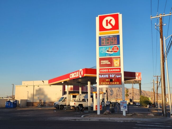
3500 E Charleston Blvd, Las Vegas, NV 89104


This Property Is For Sale
NEARBY LISTINGS FOR SALE OR LEASE
Property Detail
3500 E Charleston Blvd
140-31-401-035
PT GOV LOT 4 PT SW4 SW4 SEC 31-20-62
Storebuilding
Clark
X
Nevada
32003C2186F
4
2024
0.38 AC
2025
Central East Las Vegas
000518
Las Vegas
2,610 SF
Las Vegas-Henderson-Paradise, NV
DEMOGRAPHICS near 3500 E Charleston Blvd
1 Mile
3 Mile
5 Mile
2024 Total Population
25,489
237,452
530,632
2029 Population
27,365
253,865
567,801
Pop Growth 2024-2029
+ 7.36%
+ 6.91%
+ 7.00%
Average Age
38
37
37
2024 Total Households
9,291
82,826
189,482
HH Growth 2024-2029
+ 7.51%
+ 6.94%
+ 7.07%
Median Household Inc
$32,390
$38,373
$41,417
Avg Household Size
2.60
2.80
2.70
2024 Avg HH Vehicles
1.00
2.00
2.00
Median Home Value
$153,445
$233,004
$261,050
Median Year Built
1978
1980
1982
Nearby Places
Map Layers
Map Styles
 Street
 Aerial
- Restaurants
- Banks
- Shops
- Fitness
- Groceries
PUBLIC TRANSPORTATION
AIRPORT
Harry Reid International
DRIVE
WALK
Distance
Harry Reid International
16 min
9.6 mi
Boulder City Municipal
DRIVE
WALK
Distance
Boulder City Municipal
31 min
23.0 mi
Nearby Properties
Address
Land Use
TOTAL SIZE
Lot Size
Zoning
Address
Land Use
TOTAL SIZE
Lot Size
Zoning
79,707 SF
2.76 AC
Address
Land Use
TOTAL SIZE
Lot Size
Zoning
39,972 SF
3.04 AC
CV
Address
Land Use
TOTAL SIZE
Lot Size
Zoning
162,501 SF
5.77 AC
C2
Address
Land Use
TOTAL SIZE
Lot Size
Zoning
2.79 AC
CV
Address
Land Use
TOTAL SIZE
Lot Size
Zoning
281,120 SF
21.38 AC
Address
Land Use
TOTAL SIZE
Lot Size
Zoning
5.96 AC
C2
Address
Land Use
TOTAL SIZE
Lot Size
Zoning
345,133 SF
27.01 AC
H1
Address
Land Use
TOTAL SIZE
Lot Size
Zoning
123,990 SF
2.18 AC
C2
Address
Land Use
TOTAL SIZE
Lot Size
Zoning
324 SF
8.74 AC
R1
Address
Land Use
TOTAL SIZE
Lot Size
Zoning
53,435 SF
2.98 AC
C2
Address
Land Use
TOTAL SIZE
Lot Size
Zoning
6,396 SF
15.06 AC
Address
Land Use
TOTAL SIZE
Lot Size
Zoning
55,639 SF
6.13 AC
CV
Address
Land Use
TOTAL SIZE
Lot Size
Zoning
198,388 SF
1.88 AC
C2
Address
Land Use
TOTAL SIZE
Lot Size
Zoning
520,114 SF
2.03 AC
Address
Land Use
TOTAL SIZE
Lot Size
Zoning
103,573 SF
2.75 AC
Address
Land Use
TOTAL SIZE
Lot Size
Zoning
61,010 SF
1.88 AC
M
Address
Land Use
TOTAL SIZE
Lot Size
Zoning
67,649 SF
13.42 AC
CV
Address
Land Use
TOTAL SIZE
Lot Size
Zoning
274,676 SF
1.01 AC
Address
Land Use
TOTAL SIZE
Lot Size
Zoning
22.77 AC
CV
Address
Land Use
TOTAL SIZE
Lot Size
Zoning
29.35 AC
CV
Address
Land Use
TOTAL SIZE
Lot Size
Zoning
15.88 AC
Address
Land Use
TOTAL SIZE
Lot Size
Zoning
15.95 AC
PF
Address
Land Use
TOTAL SIZE
Lot Size
Zoning
20.91 AC
PF
Address
Land Use
TOTAL SIZE
Lot Size
Zoning
0.98 AC
Address
Land Use
TOTAL SIZE
Lot Size
Zoning
1,008 SF
31.47 AC
PF
Address
Land Use
TOTAL SIZE
Lot Size
Zoning
94,247 SF
0.33 AC
C2
Address
Land Use
TOTAL SIZE
Lot Size
Zoning
75,942 SF
1.75 AC
Address
Land Use
TOTAL SIZE
Lot Size
Zoning
58,188 SF
20.04 AC
L:C-V
Address
Land Use
TOTAL SIZE
Lot Size
Zoning
19,667 SF
0.48 AC
C2
Address
Land Use
TOTAL SIZE
Lot Size
Zoning
7,068 SF
47.05 AC
CV
The World's #1 Commercial Real Estate Marketplace
Connect with us
© 2025 CoStar Group
The information above has been obtained from sources believed reliable. While we do not doubt its accuracy we have not verified it and make no guarantee, warranty or representation about it. It is your responsibility to independently confirm its accuracy and completeness. Any projections, opinions, assumptions, or estimates used are for example only and do not represent the current or future performance of the property. The value of this transaction to you depends on tax and other factors which should be evaluated by your tax, financial, and legal advisors. You and your advisors should conduct a careful, independent investigation of the property to determine to your satisfaction the suitability of the property for your needs.