Property Record
3500 E Fairview Rd Sw, Stockbridge, GA 30281

Property Detail
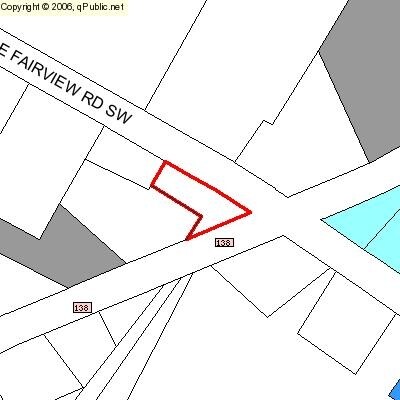
3500 E Fairview Rd Sw
007-0-01-0001
EAST FAIRVIEW RD & HWY 138
Officebuilding
ROCKDALE
OI
Georgia
B and X Area of moderate flood hazard, usually the area between the limits of the 100-year and 500-year floods.
170
0
0.65 AC
2025
I-20 East/Conyers
060403
Atlanta
9,600 SF
Atlanta-Sandy Springs-Roswell, GA
NEARBY LISTINGS FOR SALE OR LEASE
DEMOGRAPHICS near 3500 E Fairview Rd Sw
1 mile
3 mile
5 mile
2025 Total Population
1,256
10,050
47,213
2030 Population
1,303
10,351
49,077
Pop Growth 2025-2030
+ 3.74%
+ 3.00%
+ 3.95%
Average Age
44
42
41
2025 Total Households
444
3,502
16,391
HH Growth 2025-2030
+ 4.05%
+ 3.14%
+ 4.09%
Median Household Inc
$117,968
$93,909
$101,917
Avg Household Size
2.80
2.90
2.80
2025 Avg HH Vehicles
3.00
2.00
2.00
Median Home Value
$380,127
$343,702
$318,201
Median Year Built
1995
1997
1995
Nearby Places
Map Layers
Map Styles
 Street
 Aerial
Layers
 Traffic
 Biking
Places
Listings with unknown addresses are not visible on the map
- Restaurants
- Banks
- Shops
- Fitness
- Groceries
PUBLIC TRANSPORTATION
AIRPORT
Hartsfield - Jackson Atlanta International
Drive
Walk
Distance
Hartsfield - Jackson Atlanta International
39 min
25.4 mi
Nearby Properties
Address
Land Use
TOTAL SIZE
Lot Size
Zoning
Address
Land Use
TOTAL SIZE
Lot Size
Zoning
88,314 SF
107.40 AC
AR
Address
Land Use
TOTAL SIZE
Lot Size
Zoning
69,417 SF
13.85 AC
C1/C
Address
Land Use
TOTAL SIZE
Lot Size
Zoning
113,548 SF
15 AC
AR
Address
Land Use
TOTAL SIZE
Lot Size
Zoning
82,000 SF
23.58 AC
AR
Address
Land Use
TOTAL SIZE
Lot Size
Zoning
26,050 SF
37.18 AC
RA
Address
Land Use
TOTAL SIZE
Lot Size
Zoning
489.57 AC
AR
Address
Land Use
TOTAL SIZE
Lot Size
Zoning
560.20 AC
AR
Address
Land Use
TOTAL SIZE
Lot Size
Zoning
113.51 AC
AR/R1/C
Address
Land Use
TOTAL SIZE
Lot Size
Zoning
21,840 SF
15 AC
AR
Address
Land Use
TOTAL SIZE
Lot Size
Zoning
14,412 SF
36.40 AC
AR/R1
Address
Land Use
TOTAL SIZE
Lot Size
Zoning
3,621 SF
1.25 AC
C1
Address
Land Use
TOTAL SIZE
Lot Size
Zoning
2,978 SF
1.03 AC
C1
Address
Land Use
TOTAL SIZE
Lot Size
Zoning
15,400 SF
13.35 AC
AR
Address
Land Use
TOTAL SIZE
Lot Size
Zoning
9,421 SF
3.18 AC
AR/C1
Address
Land Use
TOTAL SIZE
Lot Size
Zoning
5,670 SF
1.25 AC
OI/COND
Address
Land Use
TOTAL SIZE
Lot Size
Zoning
4,140 SF
2.04 AC
C1
Address
Land Use
TOTAL SIZE
Lot Size
Zoning
13,960 SF
3.04 AC
OI/C
Address
Land Use
TOTAL SIZE
Lot Size
Zoning
175.80 AC
AR
Address
Land Use
TOTAL SIZE
Lot Size
Zoning
275 AC
AR
Address
Land Use
TOTAL SIZE
Lot Size
Zoning
392.41 AC
R85
Address
Land Use
TOTAL SIZE
Lot Size
Zoning
5,000 SF
1.65 AC
C1
Address
Land Use
TOTAL SIZE
Lot Size
Zoning
13,500 SF
2.03 AC
C1
Address
Land Use
TOTAL SIZE
Lot Size
Zoning
3,956 SF
0.91 AC
C1
Address
Land Use
TOTAL SIZE
Lot Size
Zoning
146.05 AC
AR
Address
Land Use
TOTAL SIZE
Lot Size
Zoning
49.97 AC
R1
Address
Land Use
TOTAL SIZE
Lot Size
Zoning
25,000 SF
98.40 AC
AR
Address
Land Use
TOTAL SIZE
Lot Size
Zoning
4,880 SF
12.01 AC
C1/OI/AR
Address
Land Use
TOTAL SIZE
Lot Size
Zoning
126.18 AC
AR
Address
Land Use
TOTAL SIZE
Lot Size
Zoning
2,400 SF
2.61 AC
C1/C
The World's #1 Commercial Real Estate Marketplace
Connect with us
© 2026 CoStar Group
The information above has been obtained from sources believed reliable. While we do not doubt its accuracy we have not verified it and make no guarantee, warranty or representation about it. It is your responsibility to independently confirm its accuracy and completeness. Any projections, opinions, assumptions, or estimates used are for example only and do not represent the current or future performance of the property. The value of this transaction to you depends on tax and other factors which should be evaluated by your tax, financial, and legal advisors. You and your advisors should conduct a careful, independent investigation of the property to determine to your satisfaction the suitability of the property for your needs.