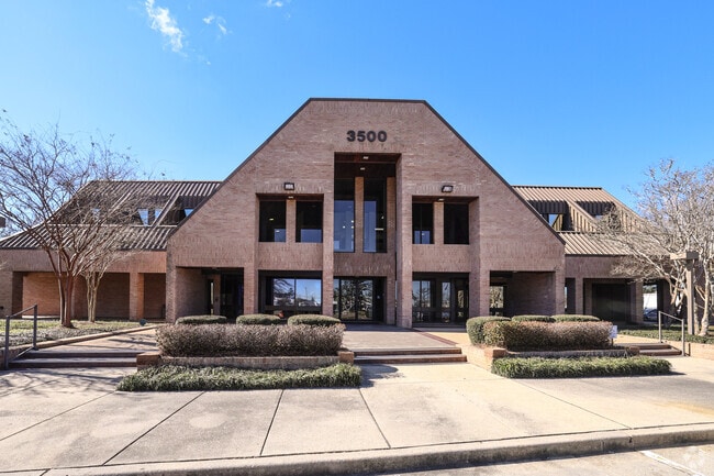
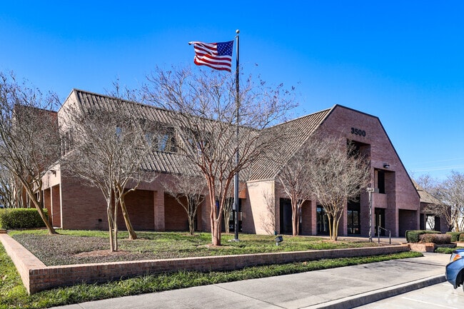
Property Record
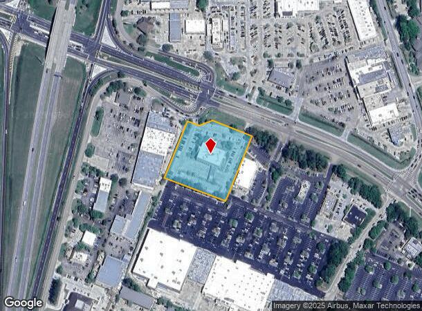
3500 Highway 190, Mandeville, LA 70471
Current Lease Availabilities
NEARBY LISTINGS FOR SALE OR LEASE
Property Detail
3500 Highway 190
57462
Commercial Hwy 190 Mandeville
Commercialnec
2.44 ACS SEC 38 7 11 MANDEVILLE CB 989 635 INST NO 941023 INST NO 1175362
X
St Tammany
2202020314D
Louisiana
2025
2.44 AC
2024
Mandeville/Covington
040306
New Orleans/Metairie/Kenner
20,544 SF
New Orleans-Metairie, LA
DEMOGRAPHICS near 3500 Highway 190
1 Mile
3 Mile
5 Mile
2024 Total Population
7,826
42,803
74,568
2029 Population
8,371
45,865
79,897
Pop Growth 2024-2029
+ 6.96%
+ 7.15%
+ 7.15%
Average Age
43
42
41
2024 Total Households
3,123
16,665
29,250
HH Growth 2024-2029
+ 7.04%
+ 7.16%
+ 7.16%
Median Household Inc
$81,040
$83,511
$80,184
Avg Household Size
2.40
2.50
2.50
2024 Avg HH Vehicles
2.00
2.00
2.00
Median Home Value
$389,455
$342,442
$315,472
Median Year Built
1993
1992
1995
Nearby Places
- Restaurants
- Banks
- Shops
- Fitness
- Groceries
PUBLIC TRANSPORTATION
AIRPORT
Louis Armstrong New Orleans International
DRIVE
WALK
Distance
Louis Armstrong New Orleans International
48 min
35.8 mi
Freight Ports
Port of New Orleans
DRIVE
WALK
Distance
Port of New Orleans
53 min
36.8 mi
Nearby Properties
Address
Land Use
TOTAL SIZE
Lot Size
Zoning
Address
Land Use
TOTAL SIZE
Lot Size
Zoning
178,608 SF
34.02 AC
Address
Land Use
TOTAL SIZE
Lot Size
Zoning
229,994 SF
30 AC
Address
Land Use
TOTAL SIZE
Lot Size
Zoning
220,860 SF
25.07 AC
Address
Land Use
TOTAL SIZE
Lot Size
Zoning
154,751 SF
14.96 AC
Address
Land Use
TOTAL SIZE
Lot Size
Zoning
165,168 SF
18.16 AC
Address
Land Use
TOTAL SIZE
Lot Size
Zoning
66,500 SF
4.35 AC
Address
Land Use
TOTAL SIZE
Lot Size
Zoning
156,183 SF
20 AC
Address
Land Use
TOTAL SIZE
Lot Size
Zoning
57,360 SF
2.77 AC
Address
Land Use
TOTAL SIZE
Lot Size
Zoning
147,457 SF
8.90 AC
Address
Land Use
TOTAL SIZE
Lot Size
Zoning
131,925 SF
2.02 AC
Address
Land Use
TOTAL SIZE
Lot Size
Zoning
113,686 SF
10.34 AC
Address
Land Use
TOTAL SIZE
Lot Size
Zoning
54,226 SF
5.10 AC
Address
Land Use
TOTAL SIZE
Lot Size
Zoning
93,800 SF
10.35 AC
Address
Land Use
TOTAL SIZE
Lot Size
Zoning
206,403 SF
9.06 AC
Address
Land Use
TOTAL SIZE
Lot Size
Zoning
50,560 SF
6.32 AC
Address
Land Use
TOTAL SIZE
Lot Size
Zoning
56,162 SF
5.30 AC
Address
Land Use
TOTAL SIZE
Lot Size
Zoning
48,866 SF
2.21 AC
Address
Land Use
TOTAL SIZE
Lot Size
Zoning
100,734 SF
23.66 AC
Address
Land Use
TOTAL SIZE
Lot Size
Zoning
77,388 SF
7.57 AC
Address
Land Use
TOTAL SIZE
Lot Size
Zoning
48,200 SF
1.95 AC
Address
Land Use
TOTAL SIZE
Lot Size
Zoning
40,064 SF
3.66 AC
Address
Land Use
TOTAL SIZE
Lot Size
Zoning
90,603 SF
6.50 AC
Address
Land Use
TOTAL SIZE
Lot Size
Zoning
41,311 SF
Address
Land Use
TOTAL SIZE
Lot Size
Zoning
43,301 SF
3.26 AC
Address
Land Use
TOTAL SIZE
Lot Size
Zoning
86,799 SF
28.55 AC
Address
Land Use
TOTAL SIZE
Lot Size
Zoning
72,091 SF
3.10 AC
Address
Land Use
TOTAL SIZE
Lot Size
Zoning
76,264 SF
8.26 AC
Address
Land Use
TOTAL SIZE
Lot Size
Zoning
39,945 SF
4.82 AC
Address
Land Use
TOTAL SIZE
Lot Size
Zoning
82,479 SF
5.95 AC
Address
Land Use
TOTAL SIZE
Lot Size
Zoning
82,035 SF
26.05 AC
The World's #1 Commercial Real Estate Marketplace
Connect with us
© 2025 CoStar Group
The information above has been obtained from sources believed reliable. While we do not doubt its accuracy we have not verified it and make no guarantee, warranty or representation about it. It is your responsibility to independently confirm its accuracy and completeness. Any projections, opinions, assumptions, or estimates used are for example only and do not represent the current or future performance of the property. The value of this transaction to you depends on tax and other factors which should be evaluated by your tax, financial, and legal advisors. You and your advisors should conduct a careful, independent investigation of the property to determine to your satisfaction the suitability of the property for your needs.