Property Record
3500 S La Cometa, Goodyear, AZ 85338


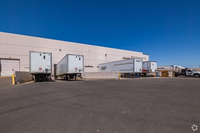
Property Detail
3500 S La Cometa
500-07-136
AIRPORT COMMERCENTER SUBDIVISION NO. 3 AMD MCR 287-01
Foodprocessing
Maricopa
PAD
Arizona
C and X Area of minimal flood hazard, usually depicted on FIRMs as above the 500-year flood level.
2a
2025
3.52 AC
2025
Goodyear
061058
Phoenix
59,891 SF
Phoenix-Mesa-Chandler, AZ
NEARBY LISTINGS FOR SALE OR LEASE
DEMOGRAPHICS near 3500 S La Cometa
1 mile
3 mile
5 mile
2025 Total Population
54
43,252
140,974
2030 Population
58
45,603
148,841
Pop Growth 2025-2030
+ 7.41%
+ 5.44%
+ 5.58%
Average Age
34
35
37
2025 Total Households
16
13,163
44,673
HH Growth 2025-2030
+ 6.25%
+ 5.43%
+ 5.64%
Median Household Inc
$95,833
$78,639
$91,334
Avg Household Size
3.40
3.20
3.10
2025 Avg HH Vehicles
2.00
2.00
2.00
Median Home Value
$433,333
$379,437
$439,361
Median Year Built
2011
2002
2005
Nearby Places
Map Layers
Map Styles
 Street
 Aerial
Transit
 Traffic
 Biking
Places
Listings with unknown addresses are not visible on the map
- Restaurants
- Banks
- Shops
- Fitness
- Groceries
PUBLIC TRANSPORTATION
AIRPORT
Phoenix Sky Harbor International
Drive
Walk
Distance
Phoenix Sky Harbor International
36 min
25.6 mi
Freight Ports
Port of San Diego
Drive
Walk
Distance
Port of San Diego
379 min
334.2 mi
Nearby Properties
Address
Land Use
TOTAL SIZE
Lot Size
Zoning
Address
Land Use
TOTAL SIZE
Lot Size
Zoning
15.76 AC
Address
Land Use
TOTAL SIZE
Lot Size
Zoning
16.70 AC
Address
Land Use
TOTAL SIZE
Lot Size
Zoning
15.76 AC
Address
Land Use
TOTAL SIZE
Lot Size
Zoning
12.80 AC
Address
Land Use
TOTAL SIZE
Lot Size
Zoning
370,726 SF
23.41 AC
PAD
Address
Land Use
TOTAL SIZE
Lot Size
Zoning
487,354 SF
188.22 AC
PAD
Address
Land Use
TOTAL SIZE
Lot Size
Zoning
90,008 SF
20.42 AC
M-H
Address
Land Use
TOTAL SIZE
Lot Size
Zoning
418,000 SF
23.58 AC
I-1
Address
Land Use
TOTAL SIZE
Lot Size
Zoning
1,310,258 SF
79.03 AC
PAD
Address
Land Use
TOTAL SIZE
Lot Size
Zoning
963,302 SF
48.33 AC
I-2
Address
Land Use
TOTAL SIZE
Lot Size
Zoning
563,328 SF
24.43 AC
C2
Address
Land Use
TOTAL SIZE
Lot Size
Zoning
901,699 SF
49.92 AC
I1
Address
Land Use
TOTAL SIZE
Lot Size
Zoning
220,494 SF
50.53 AC
AG
Address
Land Use
TOTAL SIZE
Lot Size
Zoning
855,336 SF
45.11 AC
Address
Land Use
TOTAL SIZE
Lot Size
Zoning
802,671 SF
48.81 AC
I1
Address
Land Use
TOTAL SIZE
Lot Size
Zoning
821,580 SF
45 AC
I-2
Address
Land Use
TOTAL SIZE
Lot Size
Zoning
790,980 SF
42.95 AC
I1
Address
Land Use
TOTAL SIZE
Lot Size
Zoning
222,900 SF
15.99 AC
Address
Land Use
TOTAL SIZE
Lot Size
Zoning
16.70 AC
Address
Land Use
TOTAL SIZE
Lot Size
Zoning
16.70 AC
Address
Land Use
TOTAL SIZE
Lot Size
Zoning
355,597 SF
14.83 AC
PAD
Address
Land Use
TOTAL SIZE
Lot Size
Zoning
540,349 SF
27.47 AC
PAD
Address
Land Use
TOTAL SIZE
Lot Size
Zoning
78 AC
AG
Address
Land Use
TOTAL SIZE
Lot Size
Zoning
663,150 SF
34.49 AC
Address
Land Use
TOTAL SIZE
Lot Size
Zoning
450,619 SF
28.95 AC
I2
Address
Land Use
TOTAL SIZE
Lot Size
Zoning
54,562 SF
7.65 AC
PAD
Address
Land Use
TOTAL SIZE
Lot Size
Zoning
Address
Land Use
TOTAL SIZE
Lot Size
Zoning
57,976 SF
155.09 AC
PFD
Address
Land Use
TOTAL SIZE
Lot Size
Zoning
422,300 SF
21.26 AC
I1
Address
Land Use
TOTAL SIZE
Lot Size
Zoning
The World's #1 Commercial Real Estate Marketplace
Connect with us
© 2026 CoStar Group
The information above has been obtained from sources believed reliable. While we do not doubt its accuracy we have not verified it and make no guarantee, warranty or representation about it. It is your responsibility to independently confirm its accuracy and completeness. Any projections, opinions, assumptions, or estimates used are for example only and do not represent the current or future performance of the property. The value of this transaction to you depends on tax and other factors which should be evaluated by your tax, financial, and legal advisors. You and your advisors should conduct a careful, independent investigation of the property to determine to your satisfaction the suitability of the property for your needs.