Property Record
3500 State Road 38 E, Lafayette, IN 47905


NEARBY LISTINGS FOR SALE OR LEASE
Property Detail
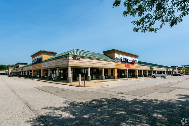
3500 State Road 38 E
Lafayette-West Lafayette, IN
Lafayette Market Place
79-07-34-201-006.000-004
LAFAYETTE MARKET PLACE LOT 5
Regionalshoppingcenterormallwithanchorstore
Tippecanoe
X
Indiana
18157C0163E
5
2024
44 SF
2024
Lafayette/Kokomo
001701
Other Market Areas
86,539 SF
DEMOGRAPHICS near 3500 State Road 38 E
1 Mile
3 Mile
5 Mile
2024 Total Population
4,772
70,066
126,511
2029 Population
4,883
72,050
130,413
Pop Growth 2024-2029
+ 2.33%
+ 2.83%
+ 3.08%
Average Age
36
37
35
2024 Total Households
2,044
30,594
50,464
HH Growth 2024-2029
+ 2.45%
+ 3.02%
+ 3.46%
Median Household Inc
$38,805
$49,531
$47,614
Avg Household Size
2.20
2.20
2.20
2024 Avg HH Vehicles
1.00
2.00
2.00
Median Home Value
$107,402
$151,246
$174,357
Median Year Built
1966
1972
1980
Nearby Places
Map Layers
Map Styles
 Street
 Aerial
- Restaurants
- Banks
- Shops
- Fitness
- Groceries
PUBLIC TRANSPORTATION
COMMUTER RAIL
Lafayette Amtrak Station (Cardinal - Amtrak)
DRIVE
WALK
Distance
Lafayette Amtrak Station (Cardinal - Amtrak)
6 min
3.5 mi
Freight Ports
Port Milwaukee
DRIVE
WALK
Distance
Port Milwaukee
250 min
208.4 mi
SALE & LEASE HISTORY
LISTING DATE
SALE/LEASE

Sep 25, 2019
For Sale
Jul 21, 2021
For Sale
Jan 05, 2017
For Lease
Apr 19, 2017
For Lease
Nearby Properties
Address
Land Use
TOTAL SIZE
Lot Size
Zoning
Address
Land Use
TOTAL SIZE
Lot Size
Zoning
2,199,963 SF
0.06 AC
Address
Land Use
TOTAL SIZE
Lot Size
Zoning
68,943 SF
0.01 AC
Address
Land Use
TOTAL SIZE
Lot Size
Zoning
122,338 SF
0.01 AC
Address
Land Use
TOTAL SIZE
Lot Size
Zoning
689,020 SF
0.01 AC
Address
Land Use
TOTAL SIZE
Lot Size
Zoning
117,351 SF
44 SF
Address
Land Use
TOTAL SIZE
Lot Size
Zoning
300,876 SF
20.47 AC
Address
Land Use
TOTAL SIZE
Lot Size
Zoning
210,829 SF
87 SF
Address
Land Use
TOTAL SIZE
Lot Size
Zoning
32.01 AC
Address
Land Use
TOTAL SIZE
Lot Size
Zoning
270,827 SF
34.90 AC
Address
Land Use
TOTAL SIZE
Lot Size
Zoning
1,449,360 SF
0.01 AC
Address
Land Use
TOTAL SIZE
Lot Size
Zoning
205,701 SF
1.27 AC
Address
Land Use
TOTAL SIZE
Lot Size
Zoning
357,301 SF
45.62 AC
Address
Land Use
TOTAL SIZE
Lot Size
Zoning
77,226 SF
0.01 AC
Address
Land Use
TOTAL SIZE
Lot Size
Zoning
27,300 SF
22.52 AC
Address
Land Use
TOTAL SIZE
Lot Size
Zoning
164,234 SF
0.88 AC
Address
Land Use
TOTAL SIZE
Lot Size
Zoning
184,441 SF
44 SF
Address
Land Use
TOTAL SIZE
Lot Size
Zoning
222,276 SF
0.31 AC
Address
Land Use
TOTAL SIZE
Lot Size
Zoning
203,830 SF
18.73 AC
Address
Land Use
TOTAL SIZE
Lot Size
Zoning
316,008 SF
27.04 AC
Address
Land Use
TOTAL SIZE
Lot Size
Zoning
518,808 SF
174 SF
Address
Land Use
TOTAL SIZE
Lot Size
Zoning
140,973 SF
131 SF
Address
Land Use
TOTAL SIZE
Lot Size
Zoning
263,826 SF
174 SF
Address
Land Use
TOTAL SIZE
Lot Size
Zoning
25,476 SF
131 SF
Address
Land Use
TOTAL SIZE
Lot Size
Zoning
135,090 SF
0.80 AC
Address
Land Use
TOTAL SIZE
Lot Size
Zoning
340,790 SF
131 SF
Address
Land Use
TOTAL SIZE
Lot Size
Zoning
70,686 SF
25.67 AC
Address
Land Use
TOTAL SIZE
Lot Size
Zoning
500,000 SF
174 SF
Address
Land Use
TOTAL SIZE
Lot Size
Zoning
160,572 SF
19.25 AC
Address
Land Use
TOTAL SIZE
Lot Size
Zoning
1,409,410 SF
170.04 AC
Address
Land Use
TOTAL SIZE
Lot Size
Zoning
295,530 SF
87 SF
The World's #1 Commercial Real Estate Marketplace
Connect with us
© 2026 CoStar Group
The information above has been obtained from sources believed reliable. While we do not doubt its accuracy we have not verified it and make no guarantee, warranty or representation about it. It is your responsibility to independently confirm its accuracy and completeness. Any projections, opinions, assumptions, or estimates used are for example only and do not represent the current or future performance of the property. The value of this transaction to you depends on tax and other factors which should be evaluated by your tax, financial, and legal advisors. You and your advisors should conduct a careful, independent investigation of the property to determine to your satisfaction the suitability of the property for your needs.