Property Record
3500 State Route 1099, Hickman, KY 42050

Save to a Folder
{{folder.Name}}
{{folder.ListingIds.length}} Properties
{{folder.ListingIds.length}} Property
Create a New Folder
Property Detail
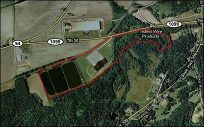
3500 State Route 1099
23-02A
10.25AC & IMP
Commercialnec
FULTON
RESIDENTIA
Kentucky
2025
10.25 AC
2025
Kentucky West Area
960200
Other Market Areas
15,000 SF
NEARBY LISTINGS FOR SALE OR LEASE
-
-
View all Hickman listings for sale on LoopNet.com
DEMOGRAPHICS near 3500 State Route 1099
1 mile
3 mile
5 mile
2025 Total Population
165
2,380
2,829
2030 Population
161
2,327
2,765
Pop Growth 2025-2030
(2.42%)
(2.23%)
(2.26%)
Average Age
43
42
42
2025 Total Households
52
923
1,075
HH Growth 2025-2030
(1.92%)
(2.38%)
(2.33%)
Median Household Inc
$38,333
$33,522
$35,324
Avg Household Size
2.20
2.20
2.20
2025 Avg HH Vehicles
2.00
2.00
2.00
Median Home Value
$66,666
$67,945
$69,255
Median Year Built
1973
1973
1974
Nearby Places
Map Layers
Map Styles
 Street
 Aerial
Layers
 Traffic
 Biking
Places
Listings with unknown addresses are not visible on the map
- Restaurants
- Banks
- Shops
- Fitness
- Groceries
Nearby Properties
Address
Land Use
TOTAL SIZE
Lot Size
Zoning
Address
Land Use
TOTAL SIZE
Lot Size
Zoning
114 AC
RESIDENTIA
Address
Land Use
TOTAL SIZE
Lot Size
Zoning
17,214 SF
RESIDENTIA
Address
Land Use
TOTAL SIZE
Lot Size
Zoning
RESIDENTIA
Address
Land Use
TOTAL SIZE
Lot Size
Zoning
4,445 SF
59.90 AC
RESIDENTIA
Address
Land Use
TOTAL SIZE
Lot Size
Zoning
3,246 SF
2.30 AC
RESIDENTIA
Address
Land Use
TOTAL SIZE
Lot Size
Zoning
12,300 SF
3.13 AC
COMMERCIAL
Address
Land Use
TOTAL SIZE
Lot Size
Zoning
RESIDENTIA
Address
Land Use
TOTAL SIZE
Lot Size
Zoning
10,000 SF
0.36 AC
RESIDENTIA
Address
Land Use
TOTAL SIZE
Lot Size
Zoning
16,528 SF
3.08 AC
RESIDENTIA
Address
Land Use
TOTAL SIZE
Lot Size
Zoning
19 AC
RESIDENTIA
Address
Land Use
TOTAL SIZE
Lot Size
Zoning
5 AC
RESIDENTIA
Address
Land Use
TOTAL SIZE
Lot Size
Zoning
RESIDENTIA
Address
Land Use
TOTAL SIZE
Lot Size
Zoning
75,000 SF
17.94 AC
RESIDENTIA
Address
Land Use
TOTAL SIZE
Lot Size
Zoning
0.64 AC
RESIDENTIA
Address
Land Use
TOTAL SIZE
Lot Size
Zoning
RESIDENTIA
Address
Land Use
TOTAL SIZE
Lot Size
Zoning
5,760 SF
RESIDENTIA
Address
Land Use
TOTAL SIZE
Lot Size
Zoning
10,564 SF
2.10 AC
RESIDENTIA
Address
Land Use
TOTAL SIZE
Lot Size
Zoning
RESIDENTIA
Address
Land Use
TOTAL SIZE
Lot Size
Zoning
10,564 SF
1.26 AC
RESIDENTIA
Address
Land Use
TOTAL SIZE
Lot Size
Zoning
RESIDENTIA
Address
Land Use
TOTAL SIZE
Lot Size
Zoning
1,200 SF
Address
Land Use
TOTAL SIZE
Lot Size
Zoning
RESIDENTIA
Address
Land Use
TOTAL SIZE
Lot Size
Zoning
0.29 AC
RESIDENTIA
Address
Land Use
TOTAL SIZE
Lot Size
Zoning
RESIDENTIA
Address
Land Use
TOTAL SIZE
Lot Size
Zoning
RESIDENTIA
Address
Land Use
TOTAL SIZE
Lot Size
Zoning
RESIDENTIA
Address
Land Use
TOTAL SIZE
Lot Size
Zoning
RESIDENTIA
Address
Land Use
TOTAL SIZE
Lot Size
Zoning
1.01 AC
RESIDENTIA
Address
Land Use
TOTAL SIZE
Lot Size
Zoning
RESIDENTIA
The World's #1 Commercial Real Estate Marketplace
Connect with us
© 2026 CoStar Group
The information above has been obtained from sources believed reliable. While we do not doubt its accuracy we have not verified it and make no guarantee, warranty or representation about it. It is your responsibility to independently confirm its accuracy and completeness. Any projections, opinions, assumptions, or estimates used are for example only and do not represent the current or future performance of the property. The value of this transaction to you depends on tax and other factors which should be evaluated by your tax, financial, and legal advisors. You and your advisors should conduct a careful, independent investigation of the property to determine to your satisfaction the suitability of the property for your needs.