Property Record
3500 Tricenter Blvd, Durham, NC 27713
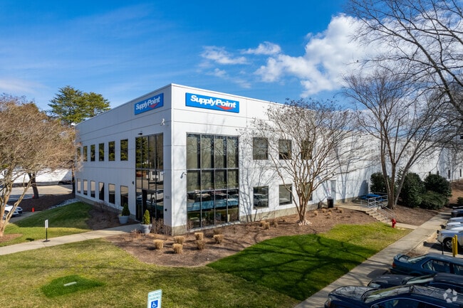


Property Detail
3500 Tricenter Blvd
203251
PROP-RESEARCH TRICENTER/L T#01 PT PL:000126-000164
Miscellaneous
Durham
IL(D)
North Carolina
B and X Area of moderate flood hazard, usually the area between the limits of the 100-year and 500-year floods.
1
2025
15.71 AC
2025
Research Triangle
002035
Raleigh/Durham
203,464 SF
Durham-Chapel Hill, NC
NEARBY LISTINGS FOR SALE OR LEASE
DEMOGRAPHICS near 3500 Tricenter Blvd
1 mile
3 mile
5 mile
2025 Total Population
5,855
54,873
182,100
2030 Population
6,264
58,248
193,982
Pop Growth 2025-2030
+ 6.99%
+ 6.15%
+ 6.52%
Average Age
36
37
38
2025 Total Households
2,583
23,520
77,201
HH Growth 2025-2030
+ 7.16%
+ 6.33%
+ 6.81%
Median Household Inc
$67,582
$79,787
$88,394
Avg Household Size
2.20
2.20
2.20
2025 Avg HH Vehicles
2.00
2.00
2.00
Median Home Value
$416,799
$398,767
$430,998
Median Year Built
1996
1998
1998
Nearby Places
Map Layers
Map Styles
 Street
 Aerial
Transit
 Traffic
 Biking
Places
Listings with unknown addresses are not visible on the map
- Restaurants
- Banks
- Shops
- Fitness
- Groceries
PUBLIC TRANSPORTATION
COMMUTER RAIL
Durham Amtrak Station (Carolinian - Amtrak, Piedmont - Amtrak)
Drive
Walk
Distance
Durham Amtrak Station (Carolinian - Amtrak, Piedmont - Amtrak)
12 min
5.9 mi
AIRPORT
Raleigh-Durham International
Drive
Walk
Distance
Raleigh-Durham International
17 min
9.3 mi
Freight Ports
Port of Wilmington
Drive
Walk
Distance
Port of Wilmington
177 min
153.5 mi
SALE & LEASE HISTORY
LISTING DATE
SALE/LEASE

Sep 25, 2016
For Lease
Sep 24, 2016
For Lease
May 08, 2018
For Lease
Mar 12, 2020
For Lease
Nearby Properties
Address
Land Use
TOTAL SIZE
Lot Size
Zoning
Address
Land Use
TOTAL SIZE
Lot Size
Zoning
2,436,024 SF
SRP
Address
Land Use
TOTAL SIZE
Lot Size
Zoning
875,384 SF
111.74 AC
SRP
Address
Land Use
TOTAL SIZE
Lot Size
Zoning
1,080,486 SF
61.68 AC
SRP
Address
Land Use
TOTAL SIZE
Lot Size
Zoning
677,504 SF
60.32 AC
SRP
Address
Land Use
TOTAL SIZE
Lot Size
Zoning
29.13 AC
CG(D)
Address
Land Use
TOTAL SIZE
Lot Size
Zoning
1,378,965 SF
183.46 AC
SRP
Address
Land Use
TOTAL SIZE
Lot Size
Zoning
868,283 SF
56.23 AC
SRP
Address
Land Use
TOTAL SIZE
Lot Size
Zoning
491,701 SF
124.48 AC
SRP
Address
Land Use
TOTAL SIZE
Lot Size
Zoning
799,818 SF
84.58 AC
IL
Address
Land Use
TOTAL SIZE
Lot Size
Zoning
444,254 SF
58.71 AC
SRP
Address
Land Use
TOTAL SIZE
Lot Size
Zoning
35.03 AC
RS-M(D)
Address
Land Use
TOTAL SIZE
Lot Size
Zoning
2,922 SF
30.57 AC
PDR 4.840
Address
Land Use
TOTAL SIZE
Lot Size
Zoning
319,275 SF
50.52 AC
SRP
Address
Land Use
TOTAL SIZE
Lot Size
Zoning
353,339 SF
25.95 AC
SRP
Address
Land Use
TOTAL SIZE
Lot Size
Zoning
2.82 AC
SRP-C
Address
Land Use
TOTAL SIZE
Lot Size
Zoning
23,889 SF
50.95 AC
OI
Address
Land Use
TOTAL SIZE
Lot Size
Zoning
441,280 SF
48.43 AC
IL
Address
Land Use
TOTAL SIZE
Lot Size
Zoning
7,080 SF
30.67 AC
OI,RS-M
Address
Land Use
TOTAL SIZE
Lot Size
Zoning
6,948 SF
21.22 AC
RS-M(D)
Address
Land Use
TOTAL SIZE
Lot Size
Zoning
10,143 SF
46.78 AC
PDR 5.940
Address
Land Use
TOTAL SIZE
Lot Size
Zoning
7,241 SF
25.34 AC
PDR 5.370
Address
Land Use
TOTAL SIZE
Lot Size
Zoning
410,000 SF
31.41 AC
IL
Address
Land Use
TOTAL SIZE
Lot Size
Zoning
8,199 SF
28.28 AC
PDR 12.000
Address
Land Use
TOTAL SIZE
Lot Size
Zoning
555,485 SF
34.84 AC
SRP
Address
Land Use
TOTAL SIZE
Lot Size
Zoning
6,180 SF
26.56 AC
RS-M(D)
Address
Land Use
TOTAL SIZE
Lot Size
Zoning
9,816 SF
26.57 AC
RS-M
Address
Land Use
TOTAL SIZE
Lot Size
Zoning
10,572 SF
27.56 AC
RS-M(D)
Address
Land Use
TOTAL SIZE
Lot Size
Zoning
5,184 SF
42.28 AC
OI(D)
Address
Land Use
TOTAL SIZE
Lot Size
Zoning
1,524 SF
11.97 AC
CG(D)
Address
Land Use
TOTAL SIZE
Lot Size
Zoning
240,537 SF
43.98 AC
IL
The World's #1 Commercial Real Estate Marketplace
Connect with us
© 2026 CoStar Group
The information above has been obtained from sources believed reliable. While we do not doubt its accuracy we have not verified it and make no guarantee, warranty or representation about it. It is your responsibility to independently confirm its accuracy and completeness. Any projections, opinions, assumptions, or estimates used are for example only and do not represent the current or future performance of the property. The value of this transaction to you depends on tax and other factors which should be evaluated by your tax, financial, and legal advisors. You and your advisors should conduct a careful, independent investigation of the property to determine to your satisfaction the suitability of the property for your needs.