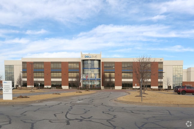
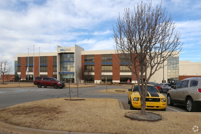
Property Record
3501 Sw 15Th St, Oklahoma City, OK 73108

NEARBY LISTINGS FOR SALE OR LEASE
Property Detail
3501 Sw 15Th St
Oklahoma City, OK
Unpltd Pt Sec 01 11N 4W
132346500
UNPLTD PT SEC 01 11N 4W 000 000 PT OF S/2 OF SEC 1 & N/2 OF SEC 12 OF 11N 4W BEG 214.97FT S & 100FT E & 342.57FT NE & 285.59FT NE & 220.08FT NE OF NW/C OF SEC 12 TH NE378.95FT NE219.35FT NE255.84FT NE101.19FT NE387.56FT NE156.56FT NE195.14FT NE334.27
Commercialnec
Oklahoma
AE
Oklahoma
40109C0280H
7
2023
55.60 AC
2024
West/Central
105600
Oklahoma City
246,774 SF
DEMOGRAPHICS near 3501 Sw 15Th St
1 Mile
3 Mile
5 Mile
2024 Total Population
4,748
77,648
228,775
2029 Population
4,892
80,151
235,768
Pop Growth 2024-2029
+ 3.03%
+ 3.22%
+ 3.06%
Average Age
32
34
35
2024 Total Households
1,546
27,623
89,866
HH Growth 2024-2029
+ 3.04%
+ 3.30%
+ 3.18%
Median Household Inc
$30,145
$42,323
$44,118
Avg Household Size
3.00
2.70
2.40
2024 Avg HH Vehicles
2.00
2.00
2.00
Median Home Value
$71,728
$78,646
$117,592
Median Year Built
1959
1955
1961
Nearby Places
Map Layers
Map Styles
 Street
 Aerial
- Restaurants
- Banks
- Shops
- Fitness
- Groceries
PUBLIC TRANSPORTATION
COMMUTER RAIL
Oklahoma City (Heartland Flyer - Amtrak)
DRIVE
WALK
Distance
Oklahoma City (Heartland Flyer - Amtrak)
10 min
4.5 mi
AIRPORT
Will Rogers World
DRIVE
WALK
Distance
Will Rogers World
16 min
5.7 mi
Freight Ports
Tulsa Port Of Catoosa
DRIVE
WALK
Distance
Tulsa Port Of Catoosa
142 min
128.4 mi
Nearby Properties
Address
Land Use
TOTAL SIZE
Lot Size
Zoning
Address
Land Use
TOTAL SIZE
Lot Size
Zoning
195,412 SF
4.42 AC
I-1
Address
Land Use
TOTAL SIZE
Lot Size
Zoning
259,726 SF
19.94 AC
PUD
Address
Land Use
TOTAL SIZE
Lot Size
Zoning
211,626 SF
12.67 AC
PUD
Address
Land Use
TOTAL SIZE
Lot Size
Zoning
279,224 SF
18.75 AC
PUD
Address
Land Use
TOTAL SIZE
Lot Size
Zoning
181,946 SF
4.42 AC
C-4
Address
Land Use
TOTAL SIZE
Lot Size
Zoning
192,771 SF
11.20 AC
I-3
Address
Land Use
TOTAL SIZE
Lot Size
Zoning
371,946 SF
31.38 AC
I-2
Address
Land Use
TOTAL SIZE
Lot Size
Zoning
178,297 SF
4.25 AC
Address
Land Use
TOTAL SIZE
Lot Size
Zoning
239,466 SF
1.73 AC
DTD-2
Address
Land Use
TOTAL SIZE
Lot Size
Zoning
2,950 SF
1.51 AC
DTD-2
Address
Land Use
TOTAL SIZE
Lot Size
Zoning
39,734 SF
5.16 AC
C-3
Address
Land Use
TOTAL SIZE
Lot Size
Zoning
336,750 SF
15.53 AC
I-3
Address
Land Use
TOTAL SIZE
Lot Size
Zoning
11,850 SF
1.49 AC
R-2
Address
Land Use
TOTAL SIZE
Lot Size
Zoning
158,150 SF
15.18 AC
I-2
Address
Land Use
TOTAL SIZE
Lot Size
Zoning
141,204 SF
6.10 AC
I-2
Address
Land Use
TOTAL SIZE
Lot Size
Zoning
246,884 SF
11.64 AC
I-2
Address
Land Use
TOTAL SIZE
Lot Size
Zoning
181,673 SF
1.31 AC
DTD-2
Address
Land Use
TOTAL SIZE
Lot Size
Zoning
166,850 SF
9.97 AC
I-2
Address
Land Use
TOTAL SIZE
Lot Size
Zoning
110,391 SF
28.91 AC
I-2
Address
Land Use
TOTAL SIZE
Lot Size
Zoning
223,679 SF
40.52 AC
PUD
Address
Land Use
TOTAL SIZE
Lot Size
Zoning
258,262 SF
15.17 AC
Address
Land Use
TOTAL SIZE
Lot Size
Zoning
83,055 SF
6.25 AC
PUD
Address
Land Use
TOTAL SIZE
Lot Size
Zoning
239,654 SF
24.50 AC
PUD
Address
Land Use
TOTAL SIZE
Lot Size
Zoning
217,328 SF
11.52 AC
I-3
Address
Land Use
TOTAL SIZE
Lot Size
Zoning
88,098 SF
5.94 AC
C-4
Address
Land Use
TOTAL SIZE
Lot Size
Zoning
39,860 SF
3.85 AC
I-2
Address
Land Use
TOTAL SIZE
Lot Size
Zoning
164,114 SF
21.70 AC
I-3
Address
Land Use
TOTAL SIZE
Lot Size
Zoning
75,440 SF
5.33 AC
PUD
Address
Land Use
TOTAL SIZE
Lot Size
Zoning
92,520 SF
2.28 AC
C-3
The World's #1 Commercial Real Estate Marketplace
Connect with us
© 2026 CoStar Group
The information above has been obtained from sources believed reliable. While we do not doubt its accuracy we have not verified it and make no guarantee, warranty or representation about it. It is your responsibility to independently confirm its accuracy and completeness. Any projections, opinions, assumptions, or estimates used are for example only and do not represent the current or future performance of the property. The value of this transaction to you depends on tax and other factors which should be evaluated by your tax, financial, and legal advisors. You and your advisors should conduct a careful, independent investigation of the property to determine to your satisfaction the suitability of the property for your needs.