Property Record
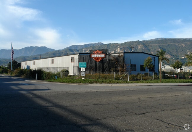
3501 Via Real, Carpinteria, CA 93013


NEARBY LISTINGS FOR SALE OR LEASE
Property Detail
3501 Via Real
005-430-035
Outside Pueblo Lands
Vehiclerentalsvehiclesales
Santa Barbara
X
California
06083C1416H
1 AC
2024
S Santa Barbara Coastal
2025
Santa Barbara/Sta Maria/Goleta
001706
Santa Maria-Santa Barbara, CA
9,868 SF
DEMOGRAPHICS near 3501 Via Real
1 Mile
3 Mile
5 Mile
2024 Total Population
2,078
15,661
23,217
2029 Population
2,097
15,716
23,412
Pop Growth 2024-2029
+ 0.91%
+ 0.35%
+ 0.84%
Average Age
47
43
45
2024 Total Households
892
6,061
9,170
HH Growth 2024-2029
+ 1.01%
+ 0.40%
+ 0.88%
Median Household Inc
$98,464
$94,221
$111,101
Avg Household Size
2.30
2.50
2.50
2024 Avg HH Vehicles
2.00
2.00
2.00
Median Home Value
$780,999
$953,765
$1,049,014
Median Year Built
1978
1973
1974
Nearby Places
Map Layers
Map Styles
 Street
 Aerial
- Restaurants
- Banks
- Shops
- Fitness
- Groceries
PUBLIC TRANSPORTATION
COMMUTER RAIL
Carpinteria Amtrak (Pacific Surfliner - Amtrak)
DRIVE
WALK
Distance
Carpinteria Amtrak (Pacific Surfliner - Amtrak)
9 min
6.0 mi
Santa Barbara (Coast Starlight - Amtrak, Pacific Surfliner - Amtrak)
DRIVE
WALK
Distance
Santa Barbara (Coast Starlight - Amtrak, Pacific Surfliner - Amtrak)
11 min
8.7 mi
AIRPORT
Santa Barbara Municipal
DRIVE
WALK
Distance
Santa Barbara Municipal
37 min
20.8 mi
Freight Ports
The Port of Hueneme
DRIVE
WALK
Distance
The Port of Hueneme
47 min
34.7 mi
Nearby Properties
Address
Land Use
TOTAL SIZE
Lot Size
Zoning
Address
Land Use
TOTAL SIZE
Lot Size
Zoning
Address
Land Use
TOTAL SIZE
Lot Size
Zoning
Address
Land Use
TOTAL SIZE
Lot Size
Zoning
2.68 AC
AGI5
Address
Land Use
TOTAL SIZE
Lot Size
Zoning
Address
Land Use
TOTAL SIZE
Lot Size
Zoning
14.66 AC
AGI10
Address
Land Use
TOTAL SIZE
Lot Size
Zoning
10.26 AC
3E1
Address
Land Use
TOTAL SIZE
Lot Size
Zoning
124,667 SF
32.92 AC
10E1
Address
Land Use
TOTAL SIZE
Lot Size
Zoning
Address
Land Use
TOTAL SIZE
Lot Size
Zoning
8,010 SF
10 AC
AGI10
Address
Land Use
TOTAL SIZE
Lot Size
Zoning
1.95 AC
Address
Land Use
TOTAL SIZE
Lot Size
Zoning
0.70 AC
Address
Land Use
TOTAL SIZE
Lot Size
Zoning
Address
Land Use
TOTAL SIZE
Lot Size
Zoning
19 AC
AGI10
Address
Land Use
TOTAL SIZE
Lot Size
Zoning
Address
Land Use
TOTAL SIZE
Lot Size
Zoning
7,657 SF
8.12 AC
AGI10
Address
Land Use
TOTAL SIZE
Lot Size
Zoning
2.69 AC
Address
Land Use
TOTAL SIZE
Lot Size
Zoning
3.64 AC
3E1
Address
Land Use
TOTAL SIZE
Lot Size
Zoning
Address
Land Use
TOTAL SIZE
Lot Size
Zoning
Address
Land Use
TOTAL SIZE
Lot Size
Zoning
3,377 SF
21.62 AC
AGI20
Address
Land Use
TOTAL SIZE
Lot Size
Zoning
1.59 AC
Address
Land Use
TOTAL SIZE
Lot Size
Zoning
56 AC
AGI40
Address
Land Use
TOTAL SIZE
Lot Size
Zoning
11.30 AC
AGI20
Address
Land Use
TOTAL SIZE
Lot Size
Zoning
6 AC
AGI10
Address
Land Use
TOTAL SIZE
Lot Size
Zoning
6.24 AC
AGI5
Address
Land Use
TOTAL SIZE
Lot Size
Zoning
2,229 SF
0.12 AC
Address
Land Use
TOTAL SIZE
Lot Size
Zoning
40.05 AC
AGI40
Address
Land Use
TOTAL SIZE
Lot Size
Zoning
28.24 AC
AGI10
Address
Land Use
TOTAL SIZE
Lot Size
Zoning
24.03 AC
AGI20
Address
Land Use
TOTAL SIZE
Lot Size
Zoning
2.88 AC
The World's #1 Commercial Real Estate Marketplace
Connect with us
© 2026 CoStar Group
The information above has been obtained from sources believed reliable. While we do not doubt its accuracy we have not verified it and make no guarantee, warranty or representation about it. It is your responsibility to independently confirm its accuracy and completeness. Any projections, opinions, assumptions, or estimates used are for example only and do not represent the current or future performance of the property. The value of this transaction to you depends on tax and other factors which should be evaluated by your tax, financial, and legal advisors. You and your advisors should conduct a careful, independent investigation of the property to determine to your satisfaction the suitability of the property for your needs.