Property Record
3505 Foothill Rd, Carpinteria, CA 93013

Property Detail
3505 Foothill Rd
Santa Maria-Santa Barbara, CA
PUEBLO MAP 16 LOT 17
005-280-015
Santa Barbara
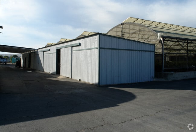
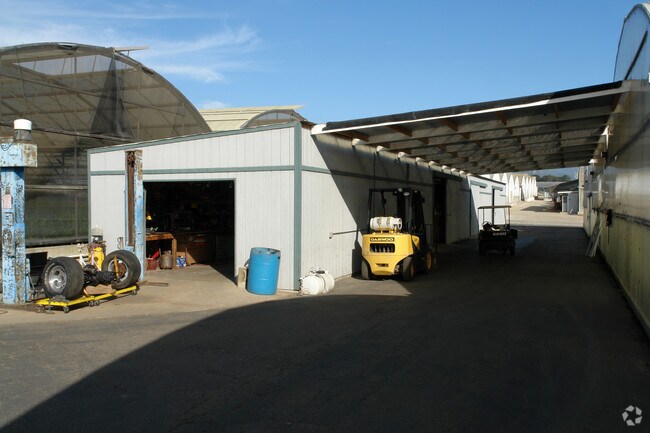
Horticulturegrowinghousesagricultural
California
AGI10
2
AE The base floodplain where base flood elevations are provided. AE Zones are now used on new format FIRMs instead of A1-A30 Zones.
9.72 AC
2024
S Santa Barbara Coastal
2025
Santa Barbara/Sta Maria/Goleta
001706
NEARBY LISTINGS FOR SALE OR LEASE
-
-
View all Carpinteria listings for sale on LoopNet.com
DEMOGRAPHICS near 3505 Foothill Rd
1 mile
3 mile
5 mile
2025 Total Population
1,132
14,577
23,587
2030 Population
1,143
14,676
23,904
Pop Growth 2025-2030
+ 0.97%
+ 0.68%
+ 1.34%
Average Age
48
44
45
2025 Total Households
473
5,685
9,381
HH Growth 2025-2030
+ 1.06%
+ 0.77%
+ 1.45%
Median Household Inc
$101,562
$111,576
$120,999
Avg Household Size
2.30
2.50
2.40
2025 Avg HH Vehicles
2.00
2.00
2.00
Median Home Value
$1,036,765
$1,083,149
$1,096,476
Median Year Built
1978
1973
1973
Nearby Places
Map Layers
Map Styles
 Street
 Aerial
Transit
 Traffic
 Biking
Places
Listings with unknown addresses are not visible on the map
- Restaurants
- Banks
- Shops
- Fitness
- Groceries
PUBLIC TRANSPORTATION
COMMUTER RAIL
Carpinteria Amtrak (Pacific Surfliner - Amtrak)
Drive
Walk
Distance
Carpinteria Amtrak (Pacific Surfliner - Amtrak)
6 min
3.3 mi
Santa Barbara (Coast Starlight - Amtrak, Pacific Surfliner - Amtrak)
Drive
Walk
Distance
Santa Barbara (Coast Starlight - Amtrak, Pacific Surfliner - Amtrak)
13 min
8.6 mi
AIRPORT
Santa Barbara Municipal
Drive
Walk
Distance
Santa Barbara Municipal
39 min
20.7 mi
Freight Ports
The Port of Hueneme
Drive
Walk
Distance
The Port of Hueneme
45 min
32.0 mi
Nearby Properties
Address
Land Use
TOTAL SIZE
Lot Size
Zoning
Address
Land Use
TOTAL SIZE
Lot Size
Zoning
51,425 SF
28.35 AC
MRP
Address
Land Use
TOTAL SIZE
Lot Size
Zoning
Address
Land Use
TOTAL SIZE
Lot Size
Zoning
Address
Land Use
TOTAL SIZE
Lot Size
Zoning
2.68 AC
AGI5
Address
Land Use
TOTAL SIZE
Lot Size
Zoning
1,280 SF
76.87 AC
2E1
Address
Land Use
TOTAL SIZE
Lot Size
Zoning
14.66 AC
AGI10
Address
Land Use
TOTAL SIZE
Lot Size
Zoning
10.26 AC
3E1
Address
Land Use
TOTAL SIZE
Lot Size
Zoning
124,667 SF
32.92 AC
10E1
Address
Land Use
TOTAL SIZE
Lot Size
Zoning
8,010 SF
10 AC
AGI10
Address
Land Use
TOTAL SIZE
Lot Size
Zoning
1.95 AC
Address
Land Use
TOTAL SIZE
Lot Size
Zoning
0.70 AC
Address
Land Use
TOTAL SIZE
Lot Size
Zoning
19 AC
AGI10
Address
Land Use
TOTAL SIZE
Lot Size
Zoning
Address
Land Use
TOTAL SIZE
Lot Size
Zoning
7,657 SF
8.12 AC
AGI10
Address
Land Use
TOTAL SIZE
Lot Size
Zoning
2.69 AC
Address
Land Use
TOTAL SIZE
Lot Size
Zoning
3.64 AC
3E1
Address
Land Use
TOTAL SIZE
Lot Size
Zoning
Address
Land Use
TOTAL SIZE
Lot Size
Zoning
Address
Land Use
TOTAL SIZE
Lot Size
Zoning
3,377 SF
21.62 AC
AGI20
Address
Land Use
TOTAL SIZE
Lot Size
Zoning
1.59 AC
Address
Land Use
TOTAL SIZE
Lot Size
Zoning
56 AC
AGI40
Address
Land Use
TOTAL SIZE
Lot Size
Zoning
1,518 SF
46.75 AC
5E1
Address
Land Use
TOTAL SIZE
Lot Size
Zoning
11.30 AC
AGI20
Address
Land Use
TOTAL SIZE
Lot Size
Zoning
6 AC
AGI10
Address
Land Use
TOTAL SIZE
Lot Size
Zoning
6.24 AC
AGI5
Address
Land Use
TOTAL SIZE
Lot Size
Zoning
2,229 SF
0.12 AC
Address
Land Use
TOTAL SIZE
Lot Size
Zoning
40.05 AC
AGI40
Address
Land Use
TOTAL SIZE
Lot Size
Zoning
2,765 SF
4.75 AC
DR33
Address
Land Use
TOTAL SIZE
Lot Size
Zoning
28.24 AC
AGI10
Address
Land Use
TOTAL SIZE
Lot Size
Zoning
24.03 AC
AGI20
The World's #1 Commercial Real Estate Marketplace
Connect with us
© 2026 CoStar Group
The information above has been obtained from sources believed reliable. While we do not doubt its accuracy we have not verified it and make no guarantee, warranty or representation about it. It is your responsibility to independently confirm its accuracy and completeness. Any projections, opinions, assumptions, or estimates used are for example only and do not represent the current or future performance of the property. The value of this transaction to you depends on tax and other factors which should be evaluated by your tax, financial, and legal advisors. You and your advisors should conduct a careful, independent investigation of the property to determine to your satisfaction the suitability of the property for your needs.