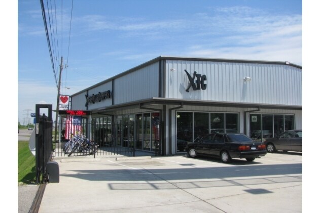
Property Record
3505 Highway 146, Bacliff, TX 77518

NEARBY LISTINGS FOR SALE OR LEASE
Property Detail
3505 Highway 146
Houston-The Woodlands-Sugar Land, TX
Miles, J Survey (Trs & Lts)
0153-0069-0001-000
ABST 153 J MILES SUR TR 69-1 0.467 ACRES
Commercialnec
Galveston
X
Texas
48167C0044G
69-1
2024
0.47 AC
2025
NASA/Clear Lake
721600
Houston
9,600 SF
DEMOGRAPHICS near 3505 Highway 146
1 Mile
3 Mile
5 Mile
2024 Total Population
8,938
34,849
95,741
2029 Population
9,427
36,369
99,887
Pop Growth 2024-2029
+ 5.47%
+ 4.36%
+ 4.33%
Average Age
36
37
38
2024 Total Households
3,036
12,456
36,674
HH Growth 2024-2029
+ 5.83%
+ 4.69%
+ 4.50%
Median Household Inc
$100,035
$105,435
$93,471
Avg Household Size
2.90
2.70
2.60
2024 Avg HH Vehicles
2.00
2.00
2.00
Median Home Value
$325,485
$275,553
$276,356
Median Year Built
1989
1996
1993
Nearby Places
Map Layers
Map Styles
 Street
 Aerial
- Restaurants
- Banks
- Shops
- Fitness
- Groceries
PUBLIC TRANSPORTATION
AIRPORT
William P Hobby
DRIVE
WALK
Distance
William P Hobby
40 min
23.9 mi
George Bush Intcntl/Houston
DRIVE
WALK
Distance
George Bush Intcntl/Houston
57 min
47.3 mi
SALE & LEASE HISTORY
LISTING DATE
SALE/LEASE

Sep 25, 2016
For Lease
Oct 23, 2019
For Lease
Mar 08, 2022
For Lease
Aug 23, 2018
For Lease
Apr 11, 2023
For Lease
Nearby Properties
Address
Land Use
TOTAL SIZE
Lot Size
Zoning
Address
Land Use
TOTAL SIZE
Lot Size
Zoning
500,000 SF
125.06 AC
Address
Land Use
TOTAL SIZE
Lot Size
Zoning
320,892 SF
15 AC
Address
Land Use
TOTAL SIZE
Lot Size
Zoning
372,456 SF
20.15 AC
Address
Land Use
TOTAL SIZE
Lot Size
Zoning
415,941 SF
14.35 AC
Address
Land Use
TOTAL SIZE
Lot Size
Zoning
370,220 SF
28.57 AC
Address
Land Use
TOTAL SIZE
Lot Size
Zoning
291,161 SF
68.71 AC
Address
Land Use
TOTAL SIZE
Lot Size
Zoning
281,944 SF
20.68 AC
Address
Land Use
TOTAL SIZE
Lot Size
Zoning
Address
Land Use
TOTAL SIZE
Lot Size
Zoning
38.73 AC
Address
Land Use
TOTAL SIZE
Lot Size
Zoning
181,500 SF
47.24 AC
Address
Land Use
TOTAL SIZE
Lot Size
Zoning
101,211 SF
12.43 AC
Address
Land Use
TOTAL SIZE
Lot Size
Zoning
254,503 SF
17.70 AC
Address
Land Use
TOTAL SIZE
Lot Size
Zoning
437,619 SF
29.38 AC
NONE
Address
Land Use
TOTAL SIZE
Lot Size
Zoning
90,291 SF
1.81 AC
Address
Land Use
TOTAL SIZE
Lot Size
Zoning
206,147 SF
20.51 AC
Address
Land Use
TOTAL SIZE
Lot Size
Zoning
79,018 SF
9.34 AC
Address
Land Use
TOTAL SIZE
Lot Size
Zoning
89,018 SF
8.34 AC
Address
Land Use
TOTAL SIZE
Lot Size
Zoning
114,488 SF
20 AC
Address
Land Use
TOTAL SIZE
Lot Size
Zoning
171,990 SF
11.85 AC
Address
Land Use
TOTAL SIZE
Lot Size
Zoning
105,218 SF
4.91 AC
Address
Land Use
TOTAL SIZE
Lot Size
Zoning
25,000 SF
2.88 AC
Address
Land Use
TOTAL SIZE
Lot Size
Zoning
60,216 SF
5.99 AC
Address
Land Use
TOTAL SIZE
Lot Size
Zoning
130,457 SF
14.12 AC
Address
Land Use
TOTAL SIZE
Lot Size
Zoning
121,266 SF
9.09 AC
Address
Land Use
TOTAL SIZE
Lot Size
Zoning
98,011 SF
13.88 AC
Address
Land Use
TOTAL SIZE
Lot Size
Zoning
94,720 SF
10.73 AC
Address
Land Use
TOTAL SIZE
Lot Size
Zoning
137,088 SF
10.08 AC
Address
Land Use
TOTAL SIZE
Lot Size
Zoning
95,882 SF
5.41 AC
Address
Land Use
TOTAL SIZE
Lot Size
Zoning
112,261 SF
1.14 AC
Address
Land Use
TOTAL SIZE
Lot Size
Zoning
107,500 SF
10.02 AC
The World's #1 Commercial Real Estate Marketplace
Connect with us
© 2025 CoStar Group
The information above has been obtained from sources believed reliable. While we do not doubt its accuracy we have not verified it and make no guarantee, warranty or representation about it. It is your responsibility to independently confirm its accuracy and completeness. Any projections, opinions, assumptions, or estimates used are for example only and do not represent the current or future performance of the property. The value of this transaction to you depends on tax and other factors which should be evaluated by your tax, financial, and legal advisors. You and your advisors should conduct a careful, independent investigation of the property to determine to your satisfaction the suitability of the property for your needs.