Property Record
3505 Ne 24Th Ave, Amarillo, TX 79107


Property Detail
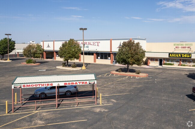
3505 Ne 24Th Ave
Amarillo, TX
SKYLINE TERRACE # 15, LOT 02B, BLK 0001, 3.6000 ACRES
314166
POTTER
Supermarket
Texas
0
02b
2025
3.60 AC
015000
Amarillo
56,235 SF
Other Market Areas
NEARBY LISTINGS FOR SALE OR LEASE
DEMOGRAPHICS near 3505 Ne 24Th Ave
1 mile
3 mile
5 mile
2025 Total Population
9,987
40,426
85,266
2030 Population
9,720
39,912
84,699
Pop Growth 2025-2030
(2.67%)
(1.27%)
(0.66%)
Average Age
33
35
37
2025 Total Households
3,170
13,454
29,654
HH Growth 2025-2030
(2.81%)
(1.31%)
(0.74%)
Median Household Inc
$42,429
$43,040
$46,687
Avg Household Size
3.00
2.90
2.70
2025 Avg HH Vehicles
2.00
2.00
2.00
Median Home Value
$91,767
$102,916
$126,359
Median Year Built
1959
1958
1958
Nearby Places
Map Layers
Map Styles
 Street
 Aerial
Transit
 Traffic
 Biking
Places
Listings with unknown addresses are not visible on the map
- Restaurants
- Banks
- Shops
- Fitness
- Groceries
PUBLIC TRANSPORTATION
AIRPORT
Rick Husband Amarillo International
Drive
Walk
Distance
Rick Husband Amarillo International
18 min
9.7 mi
SALE & LEASE HISTORY
LISTING DATE
SALE/LEASE

May 19, 2021
For Sale
Jan 31, 2024
For Sale
Dec 14, 2022
For Lease
Dec 13, 2022
For Sale
Nearby Properties
Address
Land Use
TOTAL SIZE
Lot Size
Zoning
Address
Land Use
TOTAL SIZE
Lot Size
Zoning
1,079,953 SF
106.07 AC
Address
Land Use
TOTAL SIZE
Lot Size
Zoning
414,471 SF
104.16 AC
LC
Address
Land Use
TOTAL SIZE
Lot Size
Zoning
350,459 SF
10.71 AC
Address
Land Use
TOTAL SIZE
Lot Size
Zoning
2,419 SF
8.93 AC
PD
Address
Land Use
TOTAL SIZE
Lot Size
Zoning
45,380 SF
2.62 AC
Address
Land Use
TOTAL SIZE
Lot Size
Zoning
325,727 SF
26.09 AC
2F
Address
Land Use
TOTAL SIZE
Lot Size
Zoning
133,279 SF
2.07 AC
CB
Address
Land Use
TOTAL SIZE
Lot Size
Zoning
80,476 SF
7.51 AC
I1
Address
Land Use
TOTAL SIZE
Lot Size
Zoning
193,004 SF
Address
Land Use
TOTAL SIZE
Lot Size
Zoning
132,820 SF
15.85 AC
R2
Address
Land Use
TOTAL SIZE
Lot Size
Zoning
64,847 SF
25.67 AC
R1
Address
Land Use
TOTAL SIZE
Lot Size
Zoning
128,891 SF
0.96 AC
CB
Address
Land Use
TOTAL SIZE
Lot Size
Zoning
251,206 SF
1.50 AC
Address
Land Use
TOTAL SIZE
Lot Size
Zoning
69,116 SF
4.05 AC
Address
Land Use
TOTAL SIZE
Lot Size
Zoning
136,639 SF
18.07 AC
R2
Address
Land Use
TOTAL SIZE
Lot Size
Zoning
288,936 SF
19.72 AC
MF1
Address
Land Use
TOTAL SIZE
Lot Size
Zoning
165,311 SF
2.07 AC
CB
Address
Land Use
TOTAL SIZE
Lot Size
Zoning
179,900 SF
4.68 AC
Address
Land Use
TOTAL SIZE
Lot Size
Zoning
113,214 SF
8.24 AC
MF1
Address
Land Use
TOTAL SIZE
Lot Size
Zoning
68,117 SF
2.07 AC
CB
Address
Land Use
TOTAL SIZE
Lot Size
Zoning
83,769 SF
3.80 AC
MF1
Address
Land Use
TOTAL SIZE
Lot Size
Zoning
39,430 SF
38.42 AC
Address
Land Use
TOTAL SIZE
Lot Size
Zoning
92,341 SF
9.91 AC
R3
Address
Land Use
TOTAL SIZE
Lot Size
Zoning
69,197 SF
617.85 AC
Address
Land Use
TOTAL SIZE
Lot Size
Zoning
82,432 SF
2.41 AC
CB
Address
Land Use
TOTAL SIZE
Lot Size
Zoning
70,537 SF
2.07 AC
Address
Land Use
TOTAL SIZE
Lot Size
Zoning
31,875 SF
2.07 AC
Address
Land Use
TOTAL SIZE
Lot Size
Zoning
74,509 SF
2.49 AC
Address
Land Use
TOTAL SIZE
Lot Size
Zoning
37,134 SF
3.26 AC
Address
Land Use
TOTAL SIZE
Lot Size
Zoning
76,559 SF
3.87 AC
LC
The World's #1 Commercial Real Estate Marketplace
Connect with us
© 2026 CoStar Group
The information above has been obtained from sources believed reliable. While we do not doubt its accuracy we have not verified it and make no guarantee, warranty or representation about it. It is your responsibility to independently confirm its accuracy and completeness. Any projections, opinions, assumptions, or estimates used are for example only and do not represent the current or future performance of the property. The value of this transaction to you depends on tax and other factors which should be evaluated by your tax, financial, and legal advisors. You and your advisors should conduct a careful, independent investigation of the property to determine to your satisfaction the suitability of the property for your needs.