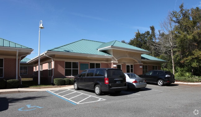
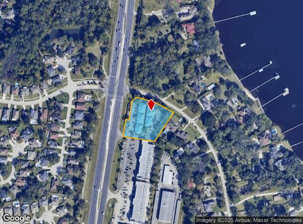
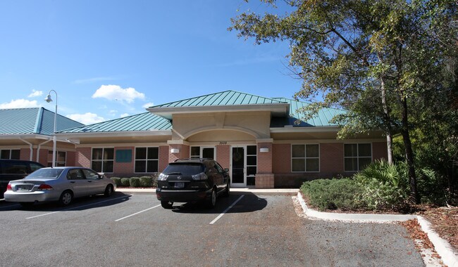
Property Record
3509 Us Highway 17, Fleming Island, FL 32003
NEARBY LISTINGS FOR SALE OR LEASE
Property Detail
3509 Us Highway 17
44-04-26-014078-001-03
PT OF S44T4R26 A/K/A PARCEL A AS REC OR 1973 PG 1740
Officebuilding
Clay
X
Florida
12019C0089E
1.48 AC
2024
Orange Park/Clay County
2025
Jacksonville (Florida)
030701
Jacksonville, FL
12,400 SF
DEMOGRAPHICS near 3509 Us Highway 17
1 Mile
3 Mile
5 Mile
2024 Total Population
1,547
29,108
108,272
2029 Population
1,672
31,479
117,565
Pop Growth 2024-2029
+ 8.08%
+ 8.15%
+ 8.58%
Average Age
47
45
42
2024 Total Households
614
11,103
41,469
HH Growth 2024-2029
+ 8.31%
+ 8.30%
+ 8.63%
Median Household Inc
$117,367
$100,096
$80,787
Avg Household Size
2.50
2.50
2.50
2024 Avg HH Vehicles
2.00
2.00
2.00
Median Home Value
$313,461
$328,537
$286,620
Median Year Built
1994
1989
1988
Nearby Places
Map Layers
Map Styles
 Street
 Aerial
- Restaurants
- Banks
- Shops
- Fitness
- Groceries
PUBLIC TRANSPORTATION
AIRPORT
Jacksonville International
DRIVE
WALK
Distance
Jacksonville International
46 min
32.2 mi
Freight Ports
Jacksonville Port
DRIVE
WALK
Distance
Jacksonville Port
36 min
20.7 mi
SALE & LEASE HISTORY
LISTING DATE
SALE/LEASE

Oct 17, 2017
For Lease
Nearby Properties
Address
Land Use
TOTAL SIZE
Lot Size
Zoning
Address
Land Use
TOTAL SIZE
Lot Size
Zoning
446,722 SF
13.26 AC
PUD
Address
Land Use
TOTAL SIZE
Lot Size
Zoning
380,002 SF
60.91 AC
RG-1
Address
Land Use
TOTAL SIZE
Lot Size
Zoning
92,193 SF
20.65 AC
PUD
Address
Land Use
TOTAL SIZE
Lot Size
Zoning
125,572 SF
7.20 AC
Address
Land Use
TOTAL SIZE
Lot Size
Zoning
137,153 SF
25.85 AC
Address
Land Use
TOTAL SIZE
Lot Size
Zoning
97,584 SF
3.54 AC
CN
Address
Land Use
TOTAL SIZE
Lot Size
Zoning
112,498 SF
40 AC
Address
Land Use
TOTAL SIZE
Lot Size
Zoning
84,047 SF
7.50 AC
BA
Address
Land Use
TOTAL SIZE
Lot Size
Zoning
89,674 SF
25 AC
RB
Address
Land Use
TOTAL SIZE
Lot Size
Zoning
203,600 SF
29.22 AC
PUD
Address
Land Use
TOTAL SIZE
Lot Size
Zoning
120,529 SF
51.50 AC
Address
Land Use
TOTAL SIZE
Lot Size
Zoning
37,942 SF
5.58 AC
Address
Land Use
TOTAL SIZE
Lot Size
Zoning
80,690 SF
9.18 AC
PUD
Address
Land Use
TOTAL SIZE
Lot Size
Zoning
41,188 SF
5.45 AC
Address
Land Use
TOTAL SIZE
Lot Size
Zoning
70,693 SF
11.89 AC
Address
Land Use
TOTAL SIZE
Lot Size
Zoning
90,705 SF
3.74 AC
PCD
Address
Land Use
TOTAL SIZE
Lot Size
Zoning
Address
Land Use
TOTAL SIZE
Lot Size
Zoning
42,718 SF
3.56 AC
Address
Land Use
TOTAL SIZE
Lot Size
Zoning
112,752 SF
6.47 AC
BB-1
Address
Land Use
TOTAL SIZE
Lot Size
Zoning
95,807 SF
9.91 AC
RS-2
Address
Land Use
TOTAL SIZE
Lot Size
Zoning
65,959 SF
7.02 AC
PUD
Address
Land Use
TOTAL SIZE
Lot Size
Zoning
76,079 SF
10.12 AC
PS-5
Address
Land Use
TOTAL SIZE
Lot Size
Zoning
Address
Land Use
TOTAL SIZE
Lot Size
Zoning
97,563 SF
30 AC
GU
Address
Land Use
TOTAL SIZE
Lot Size
Zoning
80,251 SF
3.51 AC
Address
Land Use
TOTAL SIZE
Lot Size
Zoning
66,340 SF
10.10 AC
PS-1
Address
Land Use
TOTAL SIZE
Lot Size
Zoning
31,691 SF
4.82 AC
GU
Address
Land Use
TOTAL SIZE
Lot Size
Zoning
117,968 SF
14.42 AC
PUD
Address
Land Use
TOTAL SIZE
Lot Size
Zoning
54,124 SF
4.83 AC
PUD
Address
Land Use
TOTAL SIZE
Lot Size
Zoning
130,542 SF
16.18 AC
PUD
The World's #1 Commercial Real Estate Marketplace
Connect with us
© 2025 CoStar Group
The information above has been obtained from sources believed reliable. While we do not doubt its accuracy we have not verified it and make no guarantee, warranty or representation about it. It is your responsibility to independently confirm its accuracy and completeness. Any projections, opinions, assumptions, or estimates used are for example only and do not represent the current or future performance of the property. The value of this transaction to you depends on tax and other factors which should be evaluated by your tax, financial, and legal advisors. You and your advisors should conduct a careful, independent investigation of the property to determine to your satisfaction the suitability of the property for your needs.