Property Record
351 Breneman Rd, Manheim, PA 17545
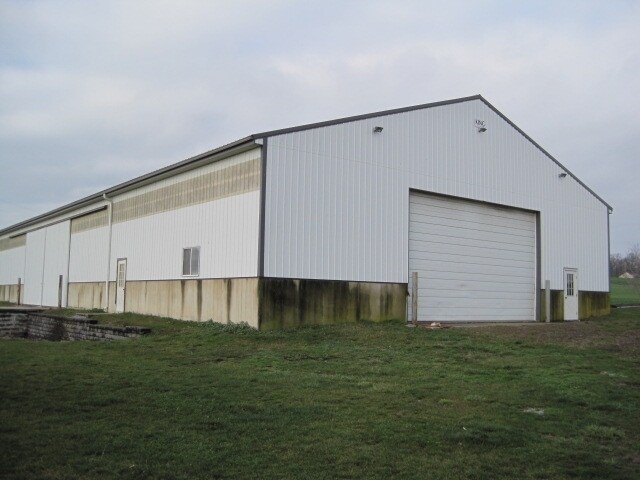

Property Detail
351 Breneman Rd
540-39682-0-0000
351 BRENEMAN RD
Dairyfarm
Lancaster
A
Pennsylvania
B and X Area of moderate flood hazard, usually the area between the limits of the 100-year and 500-year floods.
4
2025
115.90 AC
2026
Lancaster County
010501
Philadelphia
3,115 SF
Lancaster, PA
NEARBY LISTINGS FOR SALE OR LEASE
-
-
View all Manheim listings for sale on LoopNet.com
DEMOGRAPHICS near 351 Breneman Rd
1 mile
3 mile
5 mile
2025 Total Population
687
11,480
43,895
2030 Population
714
11,708
44,723
Pop Growth 2025-2030
+ 3.93%
+ 1.99%
+ 1.89%
Average Age
48
45
42
2025 Total Households
294
4,898
17,349
HH Growth 2025-2030
+ 4.08%
+ 2.12%
+ 1.99%
Median Household Inc
$38,845
$77,196
$86,013
Avg Household Size
2.30
2.30
2.50
2025 Avg HH Vehicles
2.00
2.00
2.00
Median Home Value
$277,777
$317,252
$304,105
Median Year Built
1984
1987
1978
Nearby Places
Map Layers
Map Styles
 Street
 Aerial
Layers
 Traffic
 Biking
Places
Listings with unknown addresses are not visible on the map
- Restaurants
- Banks
- Shops
- Fitness
- Groceries
PUBLIC TRANSPORTATION
COMMUTER RAIL
Mount Joy Amtrak (Keystone Service - Amtrak)
Drive
Walk
Distance
Mount Joy Amtrak (Keystone Service - Amtrak)
8 min
3.5 mi
AIRPORT
Harrisburg International
Drive
Walk
Distance
Harrisburg International
30 min
22.1 mi
Freight Ports
Port of Wilmington, RI
Drive
Walk
Distance
Port of Wilmington, RI
108 min
64.5 mi
Nearby Properties
Address
Land Use
TOTAL SIZE
Lot Size
Zoning
Address
Land Use
TOTAL SIZE
Lot Size
Zoning
431,583 SF
24.30 AC
R-2
Address
Land Use
TOTAL SIZE
Lot Size
Zoning
4,020 SF
41.94 AC
HC
Address
Land Use
TOTAL SIZE
Lot Size
Zoning
686,568 SF
61.43 AC
Address
Land Use
TOTAL SIZE
Lot Size
Zoning
410,000 SF
30.35 AC
I
Address
Land Use
TOTAL SIZE
Lot Size
Zoning
112,675 SF
61.94 AC
Address
Land Use
TOTAL SIZE
Lot Size
Zoning
302,400 SF
32.51 AC
I
Address
Land Use
TOTAL SIZE
Lot Size
Zoning
102,465 SF
17.14 AC
GC
Address
Land Use
TOTAL SIZE
Lot Size
Zoning
181,478 SF
20.96 AC
CI
Address
Land Use
TOTAL SIZE
Lot Size
Zoning
239,448 SF
28.74 AC
Address
Land Use
TOTAL SIZE
Lot Size
Zoning
231,575 SF
21.11 AC
I
Address
Land Use
TOTAL SIZE
Lot Size
Zoning
108,699 SF
65.62 AC
Address
Land Use
TOTAL SIZE
Lot Size
Zoning
104,882 SF
24.06 AC
HC
Address
Land Use
TOTAL SIZE
Lot Size
Zoning
59,142 SF
15.59 AC
HC
Address
Land Use
TOTAL SIZE
Lot Size
Zoning
55,728 SF
2.33 AC
Address
Land Use
TOTAL SIZE
Lot Size
Zoning
50,904 SF
Address
Land Use
TOTAL SIZE
Lot Size
Zoning
49,730 SF
14 AC
I
Address
Land Use
TOTAL SIZE
Lot Size
Zoning
70,515 SF
10.60 AC
HC
Address
Land Use
TOTAL SIZE
Lot Size
Zoning
57,780 SF
3.38 AC
R-2
Address
Land Use
TOTAL SIZE
Lot Size
Zoning
34,753 SF
10 AC
Address
Land Use
TOTAL SIZE
Lot Size
Zoning
90,120 SF
17.92 AC
I
Address
Land Use
TOTAL SIZE
Lot Size
Zoning
40,028 SF
43.40 AC
HC
Address
Land Use
TOTAL SIZE
Lot Size
Zoning
48,454 SF
89.90 AC
A
Address
Land Use
TOTAL SIZE
Lot Size
Zoning
144,878 SF
22.50 AC
CI
Address
Land Use
TOTAL SIZE
Lot Size
Zoning
52,500 SF
10.02 AC
Address
Land Use
TOTAL SIZE
Lot Size
Zoning
31,330 SF
6 AC
Address
Land Use
TOTAL SIZE
Lot Size
Zoning
19,142 SF
163.67 AC
A
Address
Land Use
TOTAL SIZE
Lot Size
Zoning
34,610 SF
5.33 AC
HC
Address
Land Use
TOTAL SIZE
Lot Size
Zoning
70,726 SF
26.08 AC
GI
Address
Land Use
TOTAL SIZE
Lot Size
Zoning
11,654 SF
131.10 AC
RURAL
Address
Land Use
TOTAL SIZE
Lot Size
Zoning
31,450 SF
19.20 AC
A
The World's #1 Commercial Real Estate Marketplace
Connect with us
© 2026 CoStar Group
The information above has been obtained from sources believed reliable. While we do not doubt its accuracy we have not verified it and make no guarantee, warranty or representation about it. It is your responsibility to independently confirm its accuracy and completeness. Any projections, opinions, assumptions, or estimates used are for example only and do not represent the current or future performance of the property. The value of this transaction to you depends on tax and other factors which should be evaluated by your tax, financial, and legal advisors. You and your advisors should conduct a careful, independent investigation of the property to determine to your satisfaction the suitability of the property for your needs.