Property Record
351 Isaac Stevens Rd, Midway, GA 31320


NEARBY LISTINGS FOR SALE OR LEASE
Property Detail
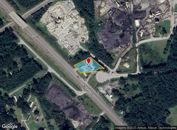
351 Isaac Stevens Rd
102-039
Gmass Commercial
Commercialnec
1.00 AC NE/S E OGLETHORPE HWY PARCELS 1 2 & 3
A
Liberty
13179C0235F
Georgia
2024
0.78 AC
2024
Liberty County
010401
Savannah
2,480 SF
Hinesville, GA
DEMOGRAPHICS near 351 Isaac Stevens Rd
1 Mile
3 Mile
5 Mile
2024 Total Population
395
1,886
15,552
2029 Population
426
1,988
16,304
Pop Growth 2024-2029
+ 7.85%
+ 5.41%
+ 4.84%
Average Age
39
38
36
2024 Total Households
142
675
6,061
HH Growth 2024-2029
+ 7.75%
+ 5.63%
+ 5.08%
Median Household Inc
$47,142
$46,510
$45,377
Avg Household Size
2.70
2.70
2.50
2024 Avg HH Vehicles
2.00
2.00
2.00
Median Home Value
$128,750
$144,034
$158,170
Median Year Built
1996
1992
1989
Nearby Places
Map Layers
Map Styles
 Street
 Aerial
- Restaurants
- Banks
- Shops
- Fitness
- Groceries
PUBLIC TRANSPORTATION
AIRPORT
Savannah/Hilton Head International
DRIVE
WALK
Distance
Savannah/Hilton Head International
46 min
33.3 mi
Freight Ports
Georgia Ports - Savannah
DRIVE
WALK
Distance
Georgia Ports - Savannah
49 min
36.0 mi
SALE & LEASE HISTORY
LISTING DATE
SALE/LEASE

Dec 12, 2018
For Sale
Nearby Properties
Address
Land Use
TOTAL SIZE
Lot Size
Zoning
Address
Land Use
TOTAL SIZE
Lot Size
Zoning
315,645 SF
57.37 AC
A1/R8
Address
Land Use
TOTAL SIZE
Lot Size
Zoning
10.67 AC
PUD
Address
Land Use
TOTAL SIZE
Lot Size
Zoning
4,599 SF
4 AC
AR1
Address
Land Use
TOTAL SIZE
Lot Size
Zoning
15,976 SF
1.50 AC
AR1/C3
Address
Land Use
TOTAL SIZE
Lot Size
Zoning
203.32 AC
PUD
Address
Land Use
TOTAL SIZE
Lot Size
Zoning
1,026.20 AC
A1
Address
Land Use
TOTAL SIZE
Lot Size
Zoning
12,000 SF
3.16 AC
C3
Address
Land Use
TOTAL SIZE
Lot Size
Zoning
141.40 AC
R12
Address
Land Use
TOTAL SIZE
Lot Size
Zoning
9,217 SF
2 AC
C3
Address
Land Use
TOTAL SIZE
Lot Size
Zoning
126.02 AC
A1/AR1/R12
Address
Land Use
TOTAL SIZE
Lot Size
Zoning
318.47 AC
A1/AR1/R12
Address
Land Use
TOTAL SIZE
Lot Size
Zoning
4,320 SF
8.27 AC
A1/C3/R8
Address
Land Use
TOTAL SIZE
Lot Size
Zoning
3,111 SF
1.15 AC
C3
Address
Land Use
TOTAL SIZE
Lot Size
Zoning
60.19 AC
B2/I1
Address
Land Use
TOTAL SIZE
Lot Size
Zoning
457 AC
A1/R8
Address
Land Use
TOTAL SIZE
Lot Size
Zoning
4,474 SF
2 AC
C3
Address
Land Use
TOTAL SIZE
Lot Size
Zoning
2,900 SF
16.77 AC
PUD
Address
Land Use
TOTAL SIZE
Lot Size
Zoning
17,358 SF
2.90 AC
C3
Address
Land Use
TOTAL SIZE
Lot Size
Zoning
15,000 SF
7.71 AC
C2
Address
Land Use
TOTAL SIZE
Lot Size
Zoning
550.84 AC
A1
Address
Land Use
TOTAL SIZE
Lot Size
Zoning
2,810 SF
6.22 AC
AR1
Address
Land Use
TOTAL SIZE
Lot Size
Zoning
4,421 SF
12.75 AC
C3
Address
Land Use
TOTAL SIZE
Lot Size
Zoning
2,812 SF
1.22 AC
AR1
Address
Land Use
TOTAL SIZE
Lot Size
Zoning
0.59 AC
PUD
Address
Land Use
TOTAL SIZE
Lot Size
Zoning
418 AC
A1
Address
Land Use
TOTAL SIZE
Lot Size
Zoning
3,843 SF
3 AC
C2
Address
Land Use
TOTAL SIZE
Lot Size
Zoning
357 AC
A1
Address
Land Use
TOTAL SIZE
Lot Size
Zoning
0.15 AC
PUD
Address
Land Use
TOTAL SIZE
Lot Size
Zoning
3,000 SF
8.31 AC
I1
Address
Land Use
TOTAL SIZE
Lot Size
Zoning
26.24 AC
C3/R8
The World's #1 Commercial Real Estate Marketplace
Connect with us
© 2025 CoStar Group
The information above has been obtained from sources believed reliable. While we do not doubt its accuracy we have not verified it and make no guarantee, warranty or representation about it. It is your responsibility to independently confirm its accuracy and completeness. Any projections, opinions, assumptions, or estimates used are for example only and do not represent the current or future performance of the property. The value of this transaction to you depends on tax and other factors which should be evaluated by your tax, financial, and legal advisors. You and your advisors should conduct a careful, independent investigation of the property to determine to your satisfaction the suitability of the property for your needs.