Property Record
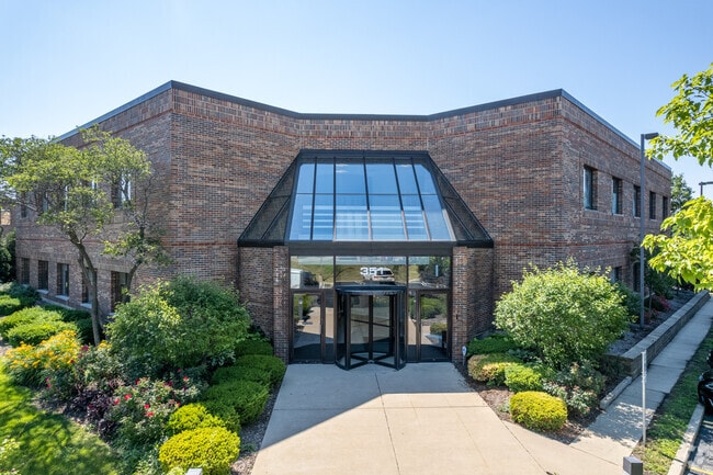
351 S Main Pl, Carol Stream, IL 60188

Property Detail
351 S Main Pl
Chicago-Naperville-Elgin, IL-IN
UNIT ONE OF CAROL STREAM INDUSTRIAL PK IN NE 1/4 SW 1/4 SEC 4 39 10
05-04-303-002
DuPage
Commercialnec
Illinois
V
1
B and X Area of moderate flood hazard, usually the area between the limits of the 100-year and 500-year floods.
0.69 AC
2024
North DuPage
2024
Chicago
841704
NEARBY LISTINGS FOR SALE OR LEASE
DEMOGRAPHICS near 351 S Main Pl
1 mile
3 mile
5 mile
2025 Total Population
11,554
115,566
255,327
2030 Population
11,661
116,419
257,175
Pop Growth 2025-2030
+ 0.93%
+ 0.74%
+ 0.72%
Average Age
38
40
41
2025 Total Households
4,552
40,533
92,451
HH Growth 2025-2030
+ 1.01%
+ 0.80%
+ 0.74%
Median Household Inc
$85,279
$108,799
$109,820
Avg Household Size
2.50
2.70
2.70
2025 Avg HH Vehicles
2.00
2.00
2.00
Median Home Value
$349,109
$363,567
$369,951
Median Year Built
1979
1975
1976
Nearby Places
Map Layers
Map Styles
 Street
 Aerial
Layers
 Traffic
 Biking
Places
Listings with unknown addresses are not visible on the map
- Restaurants
- Banks
- Shops
- Fitness
- Groceries
SALE & LEASE HISTORY
LISTING DATE
SALE/LEASE

Sep 25, 2016
For Lease
May 10, 2018
For Lease
Jan 25, 2024
For Lease
Jan 16, 2023
For Lease
Feb 15, 2017
For Lease
Nearby Properties
Address
Land Use
TOTAL SIZE
Lot Size
Zoning
Address
Land Use
TOTAL SIZE
Lot Size
Zoning
818,262 SF
13.70 AC
M
Address
Land Use
TOTAL SIZE
Lot Size
Zoning
594,125 SF
2.60 AC
Address
Land Use
TOTAL SIZE
Lot Size
Zoning
693,153 SF
46.17 AC
Address
Land Use
TOTAL SIZE
Lot Size
Zoning
545,570 SF
22.66 AC
C
Address
Land Use
TOTAL SIZE
Lot Size
Zoning
260,424 SF
16.87 AC
M
Address
Land Use
TOTAL SIZE
Lot Size
Zoning
268,400 SF
15.87 AC
M
Address
Land Use
TOTAL SIZE
Lot Size
Zoning
146,492 SF
0.42 AC
Address
Land Use
TOTAL SIZE
Lot Size
Zoning
235,131 SF
14.18 AC
I
Address
Land Use
TOTAL SIZE
Lot Size
Zoning
258,793 SF
16.44 AC
M
Address
Land Use
TOTAL SIZE
Lot Size
Zoning
251,091 SF
32.67 AC
R-4
Address
Land Use
TOTAL SIZE
Lot Size
Zoning
9.34 AC
M
Address
Land Use
TOTAL SIZE
Lot Size
Zoning
216,720 SF
12.40 AC
M
Address
Land Use
TOTAL SIZE
Lot Size
Zoning
290,280 SF
14 AC
Address
Land Use
TOTAL SIZE
Lot Size
Zoning
204,464 SF
16.53 AC
Address
Land Use
TOTAL SIZE
Lot Size
Zoning
515,497 SF
21.98 AC
I
Address
Land Use
TOTAL SIZE
Lot Size
Zoning
235,203 SF
1.28 AC
Address
Land Use
TOTAL SIZE
Lot Size
Zoning
527,079 SF
29.01 AC
I
Address
Land Use
TOTAL SIZE
Lot Size
Zoning
149,460 SF
10.62 AC
M
Address
Land Use
TOTAL SIZE
Lot Size
Zoning
367,020 SF
26.13 AC
I
Address
Land Use
TOTAL SIZE
Lot Size
Zoning
582,089 SF
41.71 AC
C
Address
Land Use
TOTAL SIZE
Lot Size
Zoning
381,600 SF
24.47 AC
Address
Land Use
TOTAL SIZE
Lot Size
Zoning
304,976 SF
23.98 AC
Address
Land Use
TOTAL SIZE
Lot Size
Zoning
400,032 SF
21.12 AC
I
Address
Land Use
TOTAL SIZE
Lot Size
Zoning
436,765 SF
7 AC
M
Address
Land Use
TOTAL SIZE
Lot Size
Zoning
311,052 SF
20.97 AC
M
Address
Land Use
TOTAL SIZE
Lot Size
Zoning
393,516 SF
18.08 AC
I
Address
Land Use
TOTAL SIZE
Lot Size
Zoning
347,400 SF
15.31 AC
I
Address
Land Use
TOTAL SIZE
Lot Size
Zoning
352,089 SF
21.13 AC
I
Address
Land Use
TOTAL SIZE
Lot Size
Zoning
6.20 AC
M
Address
Land Use
TOTAL SIZE
Lot Size
Zoning
302,986 SF
16.04 AC
The World's #1 Commercial Real Estate Marketplace
Connect with us
© 2026 CoStar Group
The information above has been obtained from sources believed reliable. While we do not doubt its accuracy we have not verified it and make no guarantee, warranty or representation about it. It is your responsibility to independently confirm its accuracy and completeness. Any projections, opinions, assumptions, or estimates used are for example only and do not represent the current or future performance of the property. The value of this transaction to you depends on tax and other factors which should be evaluated by your tax, financial, and legal advisors. You and your advisors should conduct a careful, independent investigation of the property to determine to your satisfaction the suitability of the property for your needs.