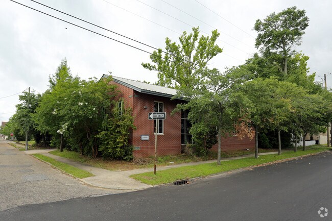
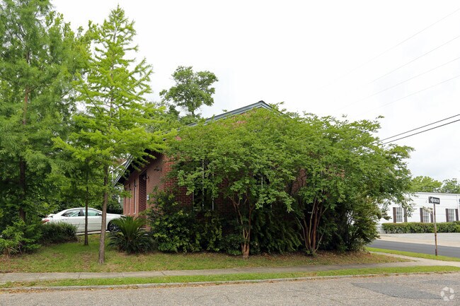
Property Record
351 State St, Mobile, AL 36603

Property Detail
351 State St
Mobile, AL
LOTS 3 & 4 DETONTI SQ COMM DEV PROG BLK 514 MAP 1 MBK 37/35 #SEC 40 T4S R1W #MP29 06 40 0 003
29-06-40-0-003-200
Mobile
Officebuilding
Alabama
C and X Area of minimal flood hazard, usually depicted on FIRMs as above the 500-year flood level.
3-4
2025
0.14 AC
2025
CBD
000200
Mobile
1,704 SF
NEARBY LISTINGS FOR SALE OR LEASE
DEMOGRAPHICS near 351 State St
1 mile
3 mile
5 mile
2024 Total Population
6,434
41,178
87,930
2029 Population
6,664
42,280
89,950
Pop Growth 2024-2029
+ 3.57%
+ 2.68%
+ 2.30%
Average Age
41
41
41
2024 Total Households
3,022
17,412
36,499
HH Growth 2024-2029
+ 3.54%
+ 2.62%
+ 2.27%
Median Household Inc
$33,508
$39,771
$37,724
Avg Household Size
1.90
2.20
2.20
2024 Avg HH Vehicles
1.00
1.00
1.00
Median Home Value
$168,346
$151,168
$99,288
Median Year Built
1972
1958
1961
Nearby Places
Map Layers
Map Styles
 Street
 Aerial
Transit
 Traffic
 Biking
Places
Listings with unknown addresses are not visible on the map
- Restaurants
- Banks
- Shops
- Fitness
- Groceries
PUBLIC TRANSPORTATION
AIRPORT
Mobile International
Drive
Walk
Distance
Mobile International
9 min
5.0 mi
Mobile Regional
Drive
Walk
Distance
Mobile Regional
30 min
14.2 mi
Freight Ports
Port of Mobile
Drive
Walk
Distance
Port of Mobile
1 min
0.5 mi
SALE & LEASE HISTORY
LISTING DATE
SALE/LEASE

Oct 18, 2017
For Lease
Nearby Properties
Address
Land Use
TOTAL SIZE
Lot Size
Zoning
Address
Land Use
TOTAL SIZE
Lot Size
Zoning
62,699 SF
2.47 AC
Address
Land Use
TOTAL SIZE
Lot Size
Zoning
410,802 SF
109.06 AC
Address
Land Use
TOTAL SIZE
Lot Size
Zoning
368,115 SF
86.30 AC
Address
Land Use
TOTAL SIZE
Lot Size
Zoning
171,670 SF
20.19 AC
Address
Land Use
TOTAL SIZE
Lot Size
Zoning
8,000 SF
0.90 AC
Address
Land Use
TOTAL SIZE
Lot Size
Zoning
22,980 SF
24.46 AC
Address
Land Use
TOTAL SIZE
Lot Size
Zoning
109,359 SF
1.67 AC
Address
Land Use
TOTAL SIZE
Lot Size
Zoning
339,141 SF
7.18 AC
Address
Land Use
TOTAL SIZE
Lot Size
Zoning
224,336 SF
2.43 AC
Address
Land Use
TOTAL SIZE
Lot Size
Zoning
106,800 SF
8 AC
Address
Land Use
TOTAL SIZE
Lot Size
Zoning
318,096 SF
6.80 AC
Address
Land Use
TOTAL SIZE
Lot Size
Zoning
288,486 SF
16.32 AC
Address
Land Use
TOTAL SIZE
Lot Size
Zoning
128,384 SF
106.56 AC
Address
Land Use
TOTAL SIZE
Lot Size
Zoning
32,556 SF
11.38 AC
Address
Land Use
TOTAL SIZE
Lot Size
Zoning
24,437 SF
32.74 AC
Address
Land Use
TOTAL SIZE
Lot Size
Zoning
137,712 SF
61.95 AC
Address
Land Use
TOTAL SIZE
Lot Size
Zoning
131,906 SF
4.62 AC
Address
Land Use
TOTAL SIZE
Lot Size
Zoning
104,160 SF
2.20 AC
Address
Land Use
TOTAL SIZE
Lot Size
Zoning
30,504 SF
16.45 AC
Address
Land Use
TOTAL SIZE
Lot Size
Zoning
602,638 SF
85.74 AC
Address
Land Use
TOTAL SIZE
Lot Size
Zoning
272,912 SF
3.32 AC
Address
Land Use
TOTAL SIZE
Lot Size
Zoning
31.14 AC
Address
Land Use
TOTAL SIZE
Lot Size
Zoning
70,366 SF
3.75 AC
Address
Land Use
TOTAL SIZE
Lot Size
Zoning
58,192 SF
1.81 AC
Address
Land Use
TOTAL SIZE
Lot Size
Zoning
153,780 SF
Address
Land Use
TOTAL SIZE
Lot Size
Zoning
5,411 SF
58.27 AC
Address
Land Use
TOTAL SIZE
Lot Size
Zoning
126,847 SF
86.30 AC
Address
Land Use
TOTAL SIZE
Lot Size
Zoning
334,636 SF
38 AC
Address
Land Use
TOTAL SIZE
Lot Size
Zoning
4,320 SF
26.79 AC
Address
Land Use
TOTAL SIZE
Lot Size
Zoning
90,040 SF
64.03 AC
The World's #1 Commercial Real Estate Marketplace
Connect with us
© 2026 CoStar Group
The information above has been obtained from sources believed reliable. While we do not doubt its accuracy we have not verified it and make no guarantee, warranty or representation about it. It is your responsibility to independently confirm its accuracy and completeness. Any projections, opinions, assumptions, or estimates used are for example only and do not represent the current or future performance of the property. The value of this transaction to you depends on tax and other factors which should be evaluated by your tax, financial, and legal advisors. You and your advisors should conduct a careful, independent investigation of the property to determine to your satisfaction the suitability of the property for your needs.