Property Record
3510 Adams St, Riverside, CA 92504
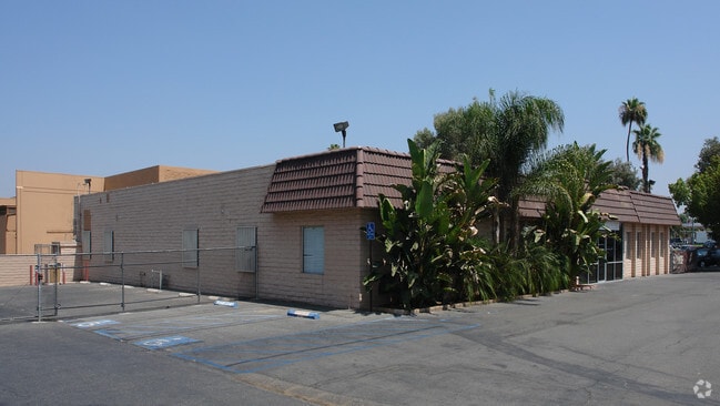


Property Detail
3510 Adams St
231-080-034
3.47 ACRES M/L IN PAR 2 PM 004/054 AND POR PAR 3 PM 037/046 PM 268
Commercialnec
Riverside
C2
California
B and X Area of moderate flood hazard, usually the area between the limits of the 100-year and 500-year floods.
23
2024
3.47 AC
2025
Riverside
031501
Inland Empire (California)
483,726 SF
Riverside-San Bernardino-Ontario, CA
NEARBY LISTINGS FOR SALE OR LEASE
DEMOGRAPHICS near 3510 Adams St
1 mile
3 mile
5 mile
2025 Total Population
18,814
118,849
275,493
2030 Population
19,423
121,567
281,580
Pop Growth 2025-2030
+ 3.24%
+ 2.29%
+ 2.21%
Average Age
36
37
37
2025 Total Households
5,373
35,143
80,390
HH Growth 2025-2030
+ 2.92%
+ 1.84%
+ 1.78%
Median Household Inc
$83,668
$83,656
$94,394
Avg Household Size
3.00
3.20
3.20
2025 Avg HH Vehicles
2.00
2.00
2.00
Median Home Value
$592,598
$596,669
$656,430
Median Year Built
1970
1970
1975
Nearby Places
Map Layers
Map Styles
 Street
 Aerial
Layers
 Traffic
 Biking
Places
Listings with unknown addresses are not visible on the map
- Restaurants
- Banks
- Shops
- Fitness
- Groceries
PUBLIC TRANSPORTATION
COMMUTER RAIL
Riverside-La Sierra (91 Line - Southern California Regional Rail Authority (Metrolink), Inland Empire-Orange County Line - Southern California Regional Rail Authority (Metrolink))
Drive
Walk
Distance
Riverside-La Sierra (91 Line - Southern California Regional Rail Authority (Metrolink), Inland Empire-Orange County Line - Southern California Regional Rail Authority (Metrolink))
7 min
4.4 mi
Riverside-Downtown (91 Line - Southern California Regional Rail Authority (Metrolink), Inland Empire-Orange County Line - Southern California Regional Rail Authority (Metrolink), Riverside Line - Southern California Regional Rail Authority (Metrolink))
Drive
Walk
Distance
Riverside-Downtown (91 Line - Southern California Regional Rail Authority (Metrolink), Inland Empire-Orange County Line - Southern California Regional Rail Authority (Metrolink), Riverside Line - Southern California Regional Rail Authority (Metrolink))
8 min
5.2 mi
AIRPORT
Ontario International
Drive
Walk
Distance
Ontario International
26 min
16.3 mi
Freight Ports
Port of Long Beach
Drive
Walk
Distance
Port of Long Beach
66 min
51.6 mi
Nearby Properties
Address
Land Use
TOTAL SIZE
Lot Size
Zoning
Address
Land Use
TOTAL SIZE
Lot Size
Zoning
263,807 SF
13.14 AC
Address
Land Use
TOTAL SIZE
Lot Size
Zoning
412,950 SF
23.16 AC
C2
Address
Land Use
TOTAL SIZE
Lot Size
Zoning
154,680 SF
3.13 AC
R1
Address
Land Use
TOTAL SIZE
Lot Size
Zoning
45,862 SF
5.12 AC
Address
Land Use
TOTAL SIZE
Lot Size
Zoning
32,830 SF
6.66 AC
Address
Land Use
TOTAL SIZE
Lot Size
Zoning
169,980 SF
10.51 AC
C3
Address
Land Use
TOTAL SIZE
Lot Size
Zoning
27,916 SF
8.50 AC
R3
Address
Land Use
TOTAL SIZE
Lot Size
Zoning
43,152 SF
6.76 AC
R3S2
Address
Land Use
TOTAL SIZE
Lot Size
Zoning
37,729 SF
3.23 AC
Address
Land Use
TOTAL SIZE
Lot Size
Zoning
234,750 SF
13.31 AC
R3150
Address
Land Use
TOTAL SIZE
Lot Size
Zoning
25,808 SF
6.21 AC
Address
Land Use
TOTAL SIZE
Lot Size
Zoning
855,621 SF
46.79 AC
I
Address
Land Use
TOTAL SIZE
Lot Size
Zoning
129,739 SF
5.08 AC
Address
Land Use
TOTAL SIZE
Lot Size
Zoning
249,729 SF
15.60 AC
R3
Address
Land Use
TOTAL SIZE
Lot Size
Zoning
179,589 SF
18.62 AC
Address
Land Use
TOTAL SIZE
Lot Size
Zoning
157,112 SF
10.83 AC
Address
Land Use
TOTAL SIZE
Lot Size
Zoning
8.75 AC
R1065
Address
Land Use
TOTAL SIZE
Lot Size
Zoning
14,068 SF
6.61 AC
R3
Address
Land Use
TOTAL SIZE
Lot Size
Zoning
127,770 SF
12.94 AC
Address
Land Use
TOTAL SIZE
Lot Size
Zoning
4,562 SF
6.42 AC
Address
Land Use
TOTAL SIZE
Lot Size
Zoning
163,325 SF
6.42 AC
R1
Address
Land Use
TOTAL SIZE
Lot Size
Zoning
110,680 SF
11.88 AC
MP
Address
Land Use
TOTAL SIZE
Lot Size
Zoning
73,538 SF
4.11 AC
R3150
Address
Land Use
TOTAL SIZE
Lot Size
Zoning
125,169 SF
5 AC
C1
Address
Land Use
TOTAL SIZE
Lot Size
Zoning
63,718 SF
7.25 AC
R3
Address
Land Use
TOTAL SIZE
Lot Size
Zoning
96,543 SF
3.34 AC
Address
Land Use
TOTAL SIZE
Lot Size
Zoning
18,480 SF
7.19 AC
Address
Land Use
TOTAL SIZE
Lot Size
Zoning
1,732 SF
9.14 AC
The World's #1 Commercial Real Estate Marketplace
Connect with us
© 2026 CoStar Group
The information above has been obtained from sources believed reliable. While we do not doubt its accuracy we have not verified it and make no guarantee, warranty or representation about it. It is your responsibility to independently confirm its accuracy and completeness. Any projections, opinions, assumptions, or estimates used are for example only and do not represent the current or future performance of the property. The value of this transaction to you depends on tax and other factors which should be evaluated by your tax, financial, and legal advisors. You and your advisors should conduct a careful, independent investigation of the property to determine to your satisfaction the suitability of the property for your needs.