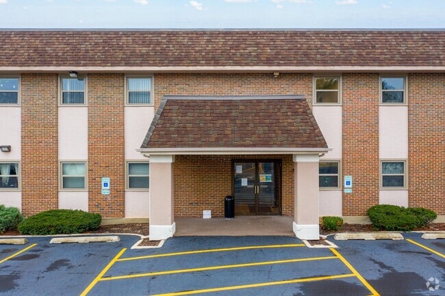
Property Record
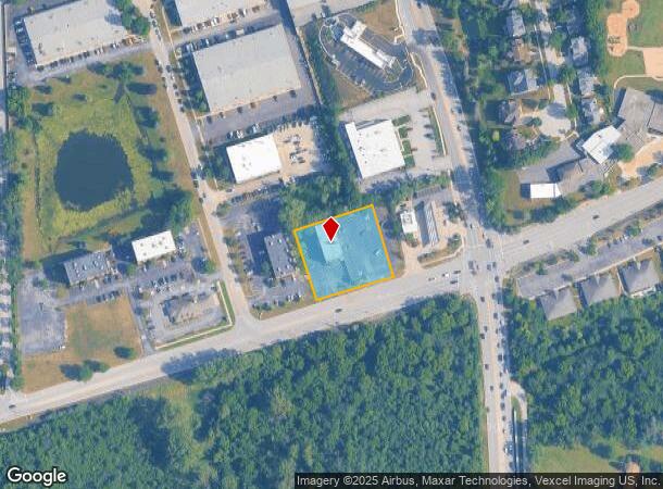
3510 Hobson Rd, Woodridge, IL 60517
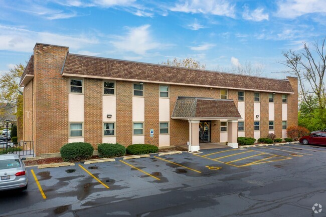

This Property Is For Sale
NEARBY LISTINGS FOR SALE OR LEASE
Property Detail
3510 Hobson Rd
Chicago-Naperville-Elgin, IL-IN-WI
Terris Sub
08-23-300-007
TERRIS SUB E 220FT
Commercialnec
DuPage
X
Illinois
17043C0164J
3
2024
1 AC
2024
Western East/West Corr
846313
Chicago
DEMOGRAPHICS near 3510 Hobson Rd
1 Mile
3 Mile
5 Mile
2024 Total Population
7,868
94,589
262,249
2029 Population
7,675
93,474
258,975
Pop Growth 2024-2029
(2.45%)
(1.18%)
(1.25%)
Average Age
42
41
41
2024 Total Households
3,288
37,783
100,343
HH Growth 2024-2029
(2.37%)
(1.19%)
(1.29%)
Median Household Inc
$107,500
$102,698
$101,894
Avg Household Size
2.40
2.40
2.50
2024 Avg HH Vehicles
2.00
2.00
2.00
Median Home Value
$320,580
$358,515
$372,556
Median Year Built
1981
1979
1977
Nearby Places
- Restaurants
- Banks
- Shops
- Fitness
- Groceries
PUBLIC TRANSPORTATION
COMMUTER RAIL
Lisle Station (Burlington Northern-Santa Fe Railway Line - Northeast Illinois Regional Commuter Railroad (Metra))
DRIVE
WALK
Distance
Lisle Station (Burlington Northern-Santa Fe Railway Line - Northeast Illinois Regional Commuter Railroad (Metra))
6 min
3.0 mi
Belmont Station (Burlington Northern-Santa Fe Railway Line - Northeast Illinois Regional Commuter Railroad (Metra))
DRIVE
WALK
Distance
Belmont Station (Burlington Northern-Santa Fe Railway Line - Northeast Illinois Regional Commuter Railroad (Metra))
8 min
3.6 mi
AIRPORT
Chicago Midway International
DRIVE
WALK
Distance
Chicago Midway International
31 min
19.5 mi
Chicago O'Hare International
DRIVE
WALK
Distance
Chicago O'Hare International
38 min
25.4 mi
Freight Ports
Port Milwaukee
DRIVE
WALK
Distance
Port Milwaukee
119 min
97.1 mi
Nearby Properties
Address
Land Use
TOTAL SIZE
Lot Size
Zoning
Address
Land Use
TOTAL SIZE
Lot Size
Zoning
12.96 AC
M
Address
Land Use
TOTAL SIZE
Lot Size
Zoning
5.13 AC
M
Address
Land Use
TOTAL SIZE
Lot Size
Zoning
6.03 AC
M
Address
Land Use
TOTAL SIZE
Lot Size
Zoning
22.17 AC
M
Address
Land Use
TOTAL SIZE
Lot Size
Zoning
16.28 AC
M
Address
Land Use
TOTAL SIZE
Lot Size
Zoning
19.58 AC
C
Address
Land Use
TOTAL SIZE
Lot Size
Zoning
13.53 AC
M
Address
Land Use
TOTAL SIZE
Lot Size
Zoning
2.37 AC
Address
Land Use
TOTAL SIZE
Lot Size
Zoning
18.23 AC
M
Address
Land Use
TOTAL SIZE
Lot Size
Zoning
315,708 SF
21.95 AC
M
Address
Land Use
TOTAL SIZE
Lot Size
Zoning
19.02 AC
M
Address
Land Use
TOTAL SIZE
Lot Size
Zoning
8.53 AC
M
Address
Land Use
TOTAL SIZE
Lot Size
Zoning
13.44 AC
C
Address
Land Use
TOTAL SIZE
Lot Size
Zoning
14.98 AC
M
Address
Land Use
TOTAL SIZE
Lot Size
Zoning
308,196 SF
17.65 AC
M
Address
Land Use
TOTAL SIZE
Lot Size
Zoning
9.58 AC
M
Address
Land Use
TOTAL SIZE
Lot Size
Zoning
25.64 AC
Address
Land Use
TOTAL SIZE
Lot Size
Zoning
47.33 AC
Address
Land Use
TOTAL SIZE
Lot Size
Zoning
126,165 SF
20.34 AC
Address
Land Use
TOTAL SIZE
Lot Size
Zoning
9.97 AC
M
Address
Land Use
TOTAL SIZE
Lot Size
Zoning
11.87 AC
Address
Land Use
TOTAL SIZE
Lot Size
Zoning
5.91 AC
Address
Land Use
TOTAL SIZE
Lot Size
Zoning
12.94 AC
M
Address
Land Use
TOTAL SIZE
Lot Size
Zoning
13.46 AC
M
Address
Land Use
TOTAL SIZE
Lot Size
Zoning
314,196 SF
21.08 AC
Address
Land Use
TOTAL SIZE
Lot Size
Zoning
98,767 SF
3.02 AC
Address
Land Use
TOTAL SIZE
Lot Size
Zoning
3,913 SF
16.86 AC
Address
Land Use
TOTAL SIZE
Lot Size
Zoning
13.09 AC
C
Address
Land Use
TOTAL SIZE
Lot Size
Zoning
Address
Land Use
TOTAL SIZE
Lot Size
Zoning
13.81 AC
M
The World's #1 Commercial Real Estate Marketplace
Connect with us
© 2025 CoStar Group
The information above has been obtained from sources believed reliable. While we do not doubt its accuracy we have not verified it and make no guarantee, warranty or representation about it. It is your responsibility to independently confirm its accuracy and completeness. Any projections, opinions, assumptions, or estimates used are for example only and do not represent the current or future performance of the property. The value of this transaction to you depends on tax and other factors which should be evaluated by your tax, financial, and legal advisors. You and your advisors should conduct a careful, independent investigation of the property to determine to your satisfaction the suitability of the property for your needs.