Property Record
3513 Rives Rd, South Prince George, VA 23805

NEARBY LISTINGS FOR SALE OR LEASE
Property Detail
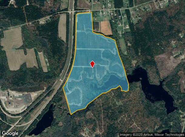
3513 Rives Rd
Richmond, VA
NEW BOHEMIA; ACRES:141.8233;
330-0A-00-024-0
Prince George
Agriculturalland
Virginia
A
24
51149C0175C
141.82 AC
2024
Prince George
2025
Richmond VA
850502
DEMOGRAPHICS near 3513 Rives Rd
1 Mile
3 Mile
5 Mile
2024 Total Population
607
10,926
34,082
2029 Population
611
10,724
33,938
Pop Growth 2024-2029
+ 0.66%
(1.85%)
(0.42%)
Average Age
43
42
39
2024 Total Households
229
4,650
13,657
HH Growth 2024-2029
+ 0.87%
(2.15%)
(0.77%)
Median Household Inc
$72,307
$65,024
$57,604
Avg Household Size
2.60
2.30
2.40
2024 Avg HH Vehicles
3.00
2.00
2.00
Median Home Value
$168,518
$176,207
$175,449
Median Year Built
1982
1982
1977
Nearby Places
Map Layers
Map Styles
 Street
 Aerial
- Restaurants
- Banks
- Shops
- Fitness
- Groceries
PUBLIC TRANSPORTATION
COMMUTER RAIL
Petersburg Amtrak Station (Carolinian - Amtrak, Northeast Regional - Amtrak, Palmetto - Amtrak, Silver Meteor - Amtrak, Silver Star - Amtrak)
DRIVE
WALK
Distance
Petersburg Amtrak Station (Carolinian - Amtrak, Northeast Regional - Amtrak, Palmetto - Amtrak, Silver Meteor - Amtrak, Silver Star - Amtrak)
14 min
9.8 mi
AIRPORT
Richmond International
DRIVE
WALK
Distance
Richmond International
38 min
30.6 mi
Freight Ports
Virginia Port Authority - Richmond
DRIVE
WALK
Distance
Virginia Port Authority - Richmond
36 min
26.0 mi
SALE & LEASE HISTORY
LISTING DATE
SALE/LEASE

Sep 24, 2016
For Sale
Nearby Properties
Address
Land Use
TOTAL SIZE
Lot Size
Zoning
Address
Land Use
TOTAL SIZE
Lot Size
Zoning
24.02 AC
B-2C
Address
Land Use
TOTAL SIZE
Lot Size
Zoning
28.17 AC
PUD
Address
Land Use
TOTAL SIZE
Lot Size
Zoning
816,246 SF
71.25 AC
I1
Address
Land Use
TOTAL SIZE
Lot Size
Zoning
17.09 AC
PUD
Address
Land Use
TOTAL SIZE
Lot Size
Zoning
138,804 SF
74.15 AC
M2
Address
Land Use
TOTAL SIZE
Lot Size
Zoning
264,335 SF
70 AC
M-2
Address
Land Use
TOTAL SIZE
Lot Size
Zoning
11.57 AC
PUD
Address
Land Use
TOTAL SIZE
Lot Size
Zoning
205,626 SF
151.04 AC
M-2
Address
Land Use
TOTAL SIZE
Lot Size
Zoning
407,650 SF
136.67 AC
M-2
Address
Land Use
TOTAL SIZE
Lot Size
Zoning
62,104 SF
20 AC
I1
Address
Land Use
TOTAL SIZE
Lot Size
Zoning
42,561 SF
6.91 AC
B-2C
Address
Land Use
TOTAL SIZE
Lot Size
Zoning
151,980 SF
23.12 AC
PUD
Address
Land Use
TOTAL SIZE
Lot Size
Zoning
149,472 SF
14.68 AC
R-4
Address
Land Use
TOTAL SIZE
Lot Size
Zoning
8.72 AC
PUD
Address
Land Use
TOTAL SIZE
Lot Size
Zoning
1.09 AC
PUD
Address
Land Use
TOTAL SIZE
Lot Size
Zoning
102,424 SF
14.71 AC
PUD
Address
Land Use
TOTAL SIZE
Lot Size
Zoning
278,833 SF
806.30 AC
I1
Address
Land Use
TOTAL SIZE
Lot Size
Zoning
84,064 SF
15.54 AC
PUD
Address
Land Use
TOTAL SIZE
Lot Size
Zoning
128,816 SF
26.11 AC
I1
Address
Land Use
TOTAL SIZE
Lot Size
Zoning
33,360 SF
0.45 AC
B-2C
Address
Land Use
TOTAL SIZE
Lot Size
Zoning
68,713 SF
2.33 AC
11
Address
Land Use
TOTAL SIZE
Lot Size
Zoning
960 SF
13.24 AC
B-1
Address
Land Use
TOTAL SIZE
Lot Size
Zoning
143,904 SF
14.44 AC
Address
Land Use
TOTAL SIZE
Lot Size
Zoning
58,986 SF
3.83 AC
11
Address
Land Use
TOTAL SIZE
Lot Size
Zoning
44,311 SF
9.05 AC
R-1
Address
Land Use
TOTAL SIZE
Lot Size
Zoning
8 AC
PUD
Address
Land Use
TOTAL SIZE
Lot Size
Zoning
130,548 SF
13.11 AC
Address
Land Use
TOTAL SIZE
Lot Size
Zoning
16 AC
R-A
Address
Land Use
TOTAL SIZE
Lot Size
Zoning
136,293 SF
23.70 AC
PUD
Address
Land Use
TOTAL SIZE
Lot Size
Zoning
40,884 SF
2.50 AC
The World's #1 Commercial Real Estate Marketplace
Connect with us
© 2026 CoStar Group
The information above has been obtained from sources believed reliable. While we do not doubt its accuracy we have not verified it and make no guarantee, warranty or representation about it. It is your responsibility to independently confirm its accuracy and completeness. Any projections, opinions, assumptions, or estimates used are for example only and do not represent the current or future performance of the property. The value of this transaction to you depends on tax and other factors which should be evaluated by your tax, financial, and legal advisors. You and your advisors should conduct a careful, independent investigation of the property to determine to your satisfaction the suitability of the property for your needs.