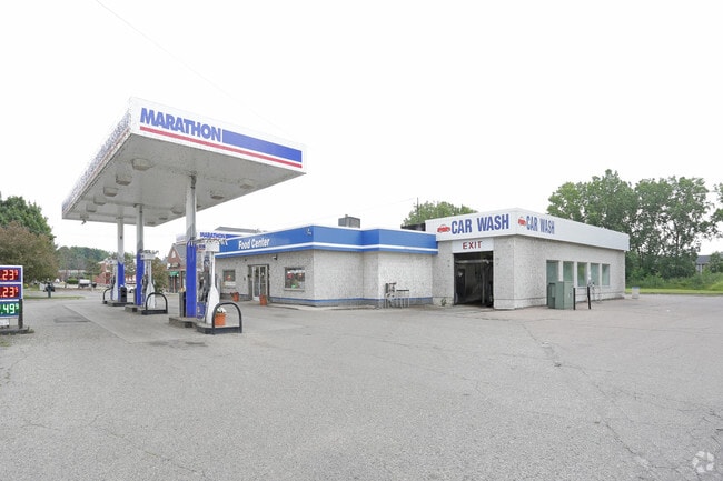
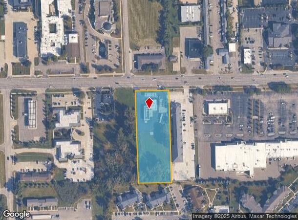
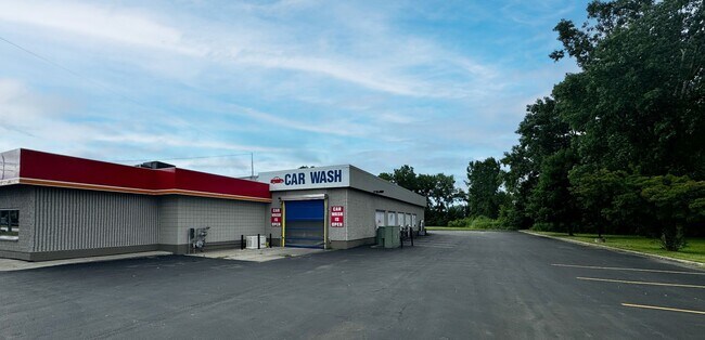
Property Record
35130 23 Mile Rd, New Baltimore, MI 48047
NEARBY LISTINGS FOR SALE OR LEASE
Property Detail
35130 23 Mile Rd
Detroit-Warren-Dearborn, MI
Assessors Plat No 7
06-09-24-101-049
PORTION LOT256
Supermarket
Macomb
X
Michigan
26099C0267J
256
2024
2.46 AC
2025
Macomb East
220002
Detroit
2,852 SF
DEMOGRAPHICS near 35130 23 Mile Rd
1 Mile
3 Mile
5 Mile
2024 Total Population
7,217
36,669
67,824
2029 Population
7,183
36,617
67,690
Pop Growth 2024-2029
(0.47%)
(0.14%)
(0.20%)
Average Age
44
41
40
2024 Total Households
3,022
14,178
25,708
HH Growth 2024-2029
(0.33%)
(0.06%)
(0.18%)
Median Household Inc
$65,269
$85,064
$79,012
Avg Household Size
2.30
2.50
2.50
2024 Avg HH Vehicles
2.00
2.00
2.00
Median Home Value
$292,953
$263,787
$249,619
Median Year Built
1988
1992
1994
Nearby Places
Map Layers
Map Styles
 Street
 Aerial
- Restaurants
- Banks
- Shops
- Fitness
- Groceries
PUBLIC TRANSPORTATION
AIRPORT
Windsor International
DRIVE
WALK
Distance
Windsor International
67 min
43.8 mi
Freight Ports
Port of Toledo
DRIVE
WALK
Distance
Port of Toledo
116 min
94.1 mi
SALE & LEASE HISTORY
LISTING DATE
SALE/LEASE

Oct 11, 2017
For Lease
Jul 15, 2024
For Lease
Nearby Properties
Address
Land Use
TOTAL SIZE
Lot Size
Zoning
Address
Land Use
TOTAL SIZE
Lot Size
Zoning
808,240 SF
60.31 AC
RM 3 MU
Address
Land Use
TOTAL SIZE
Lot Size
Zoning
Address
Land Use
TOTAL SIZE
Lot Size
Zoning
147,578 SF
12.84 AC
GC
Address
Land Use
TOTAL SIZE
Lot Size
Zoning
124,902 SF
11.38 AC
RM2 MU
Address
Land Use
TOTAL SIZE
Lot Size
Zoning
88,183 SF
27.97 AC
RM1 MU
Address
Land Use
TOTAL SIZE
Lot Size
Zoning
112,151 SF
9.31 AC
C3 GEN
Address
Land Use
TOTAL SIZE
Lot Size
Zoning
169,535 SF
12.20 AC
I
Address
Land Use
TOTAL SIZE
Lot Size
Zoning
5,541 SF
130.51 AC
MHP MO
Address
Land Use
TOTAL SIZE
Lot Size
Zoning
179,200 SF
10.12 AC
RT TECH
Address
Land Use
TOTAL SIZE
Lot Size
Zoning
276,497 SF
31.19 AC
I-1
Address
Land Use
TOTAL SIZE
Lot Size
Zoning
124,280 SF
11.50 AC
RM-1
Address
Land Use
TOTAL SIZE
Lot Size
Zoning
7.70 AC
R1A RES
Address
Land Use
TOTAL SIZE
Lot Size
Zoning
41,125 SF
3.55 AC
RM 3 MU
Address
Land Use
TOTAL SIZE
Lot Size
Zoning
74,952 SF
6.05 AC
RM-2
Address
Land Use
TOTAL SIZE
Lot Size
Zoning
50,091 SF
4.80 AC
RM1 MU
Address
Land Use
TOTAL SIZE
Lot Size
Zoning
Address
Land Use
TOTAL SIZE
Lot Size
Zoning
22,140 SF
I
Address
Land Use
TOTAL SIZE
Lot Size
Zoning
30,240 SF
3.03 AC
GC
Address
Land Use
TOTAL SIZE
Lot Size
Zoning
8.66 AC
GC
Address
Land Use
TOTAL SIZE
Lot Size
Zoning
40,804 SF
3.53 AC
RM-1
Address
Land Use
TOTAL SIZE
Lot Size
Zoning
70,070 SF
21.41 AC
RT TECH
Address
Land Use
TOTAL SIZE
Lot Size
Zoning
53,540 SF
7.99 AC
I
Address
Land Use
TOTAL SIZE
Lot Size
Zoning
27,027 SF
15.71 AC
C3 GEN
Address
Land Use
TOTAL SIZE
Lot Size
Zoning
74,542 SF
6.09 AC
RT TECH
Address
Land Use
TOTAL SIZE
Lot Size
Zoning
1,034 SF
36.86 AC
MHP MO
Address
Land Use
TOTAL SIZE
Lot Size
Zoning
Address
Land Use
TOTAL SIZE
Lot Size
Zoning
17,880 SF
4.78 AC
I
Address
Land Use
TOTAL SIZE
Lot Size
Zoning
51,780 SF
8.80 AC
RT TECH
Address
Land Use
TOTAL SIZE
Lot Size
Zoning
39,072 SF
2 AC
WF WAT
Address
Land Use
TOTAL SIZE
Lot Size
Zoning
48,639 SF
10.78 AC
C3 GEN
The World's #1 Commercial Real Estate Marketplace
Connect with us
© 2025 CoStar Group
The information above has been obtained from sources believed reliable. While we do not doubt its accuracy we have not verified it and make no guarantee, warranty or representation about it. It is your responsibility to independently confirm its accuracy and completeness. Any projections, opinions, assumptions, or estimates used are for example only and do not represent the current or future performance of the property. The value of this transaction to you depends on tax and other factors which should be evaluated by your tax, financial, and legal advisors. You and your advisors should conduct a careful, independent investigation of the property to determine to your satisfaction the suitability of the property for your needs.