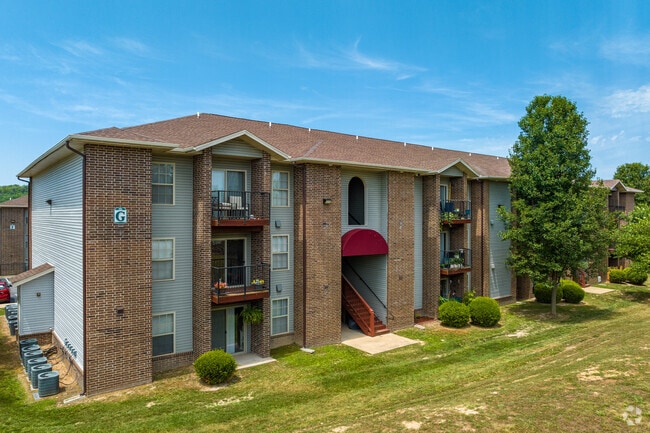
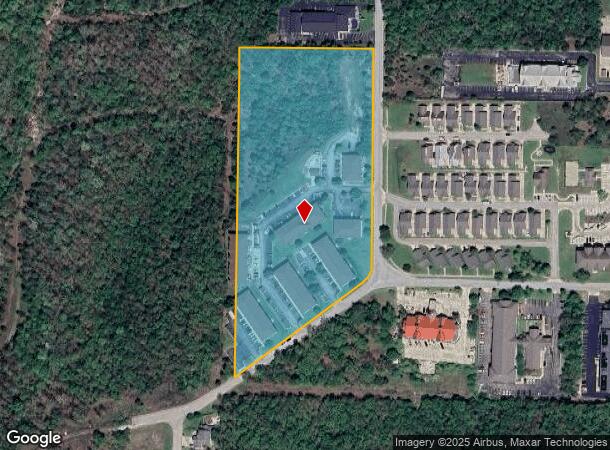
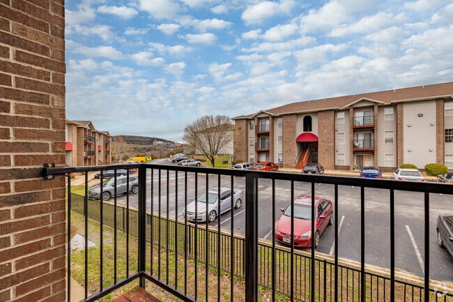
Property Record
3515 Arlene Dr, Branson, MO 65616
NEARBY LISTINGS FOR SALE OR LEASE
-
-
View all Branson listings for sale on LoopNet.com
Property Detail
3515 Arlene Dr
Other Market Areas
City Of Branson
Branson, MO
Taney
18-1.0-02-002-001-003.003
Missouri
Residentialnec
9.17 AC
X
Branson
29209C0225D
DEMOGRAPHICS near 3515 Arlene Dr
1 Mile
3 Mile
5 Mile
2024 Total Population
1,920
12,382
30,949
2029 Population
2,019
13,237
32,591
Pop Growth 2024-2029
+ 5.16%
+ 6.91%
+ 5.31%
Average Age
39
44
43
2024 Total Households
961
5,617
12,914
HH Growth 2024-2029
+ 4.79%
+ 6.82%
+ 5.47%
Median Household Inc
$42,222
$52,784
$53,584
Avg Household Size
2.00
2.10
2.20
2024 Avg HH Vehicles
2.00
2.00
2.00
Median Home Value
$201,667
$174,593
$188,048
Median Year Built
2006
1996
1996
Nearby Places
Map Layers
Map Styles
 Street
 Aerial
- Restaurants
- Banks
- Shops
- Fitness
- Groceries
SALE & LEASE HISTORY
LISTING DATE
SALE/LEASE

Aug 06, 2019
For Sale
Nearby Properties
Address
Land Use
TOTAL SIZE
Lot Size
Zoning
Address
Land Use
TOTAL SIZE
Lot Size
Zoning
107,469 SF
21.35 AC
Address
Land Use
TOTAL SIZE
Lot Size
Zoning
350,270 SF
40 AC
Address
Land Use
TOTAL SIZE
Lot Size
Zoning
140,093 SF
8.37 AC
Address
Land Use
TOTAL SIZE
Lot Size
Zoning
26,658 SF
6.30 AC
Address
Land Use
TOTAL SIZE
Lot Size
Zoning
43,276 SF
5.93 AC
Address
Land Use
TOTAL SIZE
Lot Size
Zoning
18,781 SF
4.70 AC
Address
Land Use
TOTAL SIZE
Lot Size
Zoning
27,496 SF
3.34 AC
Address
Land Use
TOTAL SIZE
Lot Size
Zoning
12,542 SF
3.87 AC
Address
Land Use
TOTAL SIZE
Lot Size
Zoning
32,464 SF
2.16 AC
Address
Land Use
TOTAL SIZE
Lot Size
Zoning
45,680 SF
11.85 AC
Address
Land Use
TOTAL SIZE
Lot Size
Zoning
55,651 SF
3.95 AC
Address
Land Use
TOTAL SIZE
Lot Size
Zoning
85,644 SF
6.64 AC
Address
Land Use
TOTAL SIZE
Lot Size
Zoning
53,728 SF
6.74 AC
Address
Land Use
TOTAL SIZE
Lot Size
Zoning
17,313 SF
5.18 AC
Address
Land Use
TOTAL SIZE
Lot Size
Zoning
48,182 SF
15 AC
Address
Land Use
TOTAL SIZE
Lot Size
Zoning
51,842 SF
3.48 AC
Address
Land Use
TOTAL SIZE
Lot Size
Zoning
44,871 SF
4.57 AC
Address
Land Use
TOTAL SIZE
Lot Size
Zoning
51,904 SF
5.08 AC
Address
Land Use
TOTAL SIZE
Lot Size
Zoning
28,639 SF
2.51 AC
Address
Land Use
TOTAL SIZE
Lot Size
Zoning
18,330 SF
2.80 AC
Address
Land Use
TOTAL SIZE
Lot Size
Zoning
10,860 SF
0.29 AC
Address
Land Use
TOTAL SIZE
Lot Size
Zoning
39,644 SF
7.02 AC
Address
Land Use
TOTAL SIZE
Lot Size
Zoning
49,886 SF
8.16 AC
Address
Land Use
TOTAL SIZE
Lot Size
Zoning
19,196 SF
2.78 AC
Address
Land Use
TOTAL SIZE
Lot Size
Zoning
118,200 SF
4.20 AC
Address
Land Use
TOTAL SIZE
Lot Size
Zoning
14,616 SF
1.97 AC
Address
Land Use
TOTAL SIZE
Lot Size
Zoning
46,896 SF
135.58 AC
Address
Land Use
TOTAL SIZE
Lot Size
Zoning
104,062 SF
2.63 AC
Address
Land Use
TOTAL SIZE
Lot Size
Zoning
43,445 SF
4.36 AC
Address
Land Use
TOTAL SIZE
Lot Size
Zoning
20,617 SF
2.18 AC
The World's #1 Commercial Real Estate Marketplace
Connect with us
© 2025 CoStar Group
The information above has been obtained from sources believed reliable. While we do not doubt its accuracy we have not verified it and make no guarantee, warranty or representation about it. It is your responsibility to independently confirm its accuracy and completeness. Any projections, opinions, assumptions, or estimates used are for example only and do not represent the current or future performance of the property. The value of this transaction to you depends on tax and other factors which should be evaluated by your tax, financial, and legal advisors. You and your advisors should conduct a careful, independent investigation of the property to determine to your satisfaction the suitability of the property for your needs.