Property Record
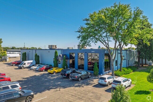
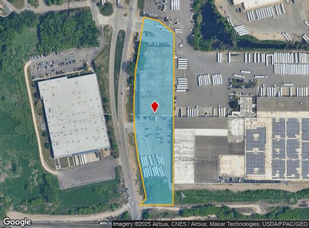
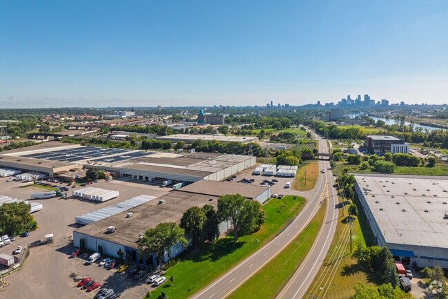
3515 Marshall St Ne, Minneapolis, MN 55418
NEARBY LISTINGS FOR SALE OR LEASE
Property Detail
3515 Marshall St Ne
Minneapolis-St. Paul-Bloomington, MN-WI
Auditors Subd. No. 035
03-029-24-13-0015
LOT 010 A AUDITORS SUBD. NO. 035 THAT PART OF LOTS 10 TO 13 INCL LYING N OF S 99.3 FT OF SAID LOT 10 AND ELY OF CO RD NO 23 AND W OF W LINE OF MPLS ANOKA & CUYUNA RANGE RR AND ITS T IRREGULAR
Industrialgeneral
Hennepin
X
Minnesota
27053C0217F
10
2024
4.45 AC
2024
Minneapolis
100500
Minneapolis/St Paul
64,048 SF
DEMOGRAPHICS near 3515 Marshall St Ne
1 Mile
3 Mile
5 Mile
2024 Total Population
8,314
142,303
377,890
2029 Population
8,228
140,458
373,930
Pop Growth 2024-2029
(1.03%)
(1.30%)
(1.05%)
Average Age
36
37
37
2024 Total Households
3,119
56,386
158,734
HH Growth 2024-2029
(1.12%)
(1.40%)
(1.00%)
Median Household Inc
$54,636
$67,328
$65,964
Avg Household Size
2.50
2.40
2.20
2024 Avg HH Vehicles
1.00
2.00
1.00
Median Home Value
$230,485
$249,463
$271,990
Median Year Built
1950
1955
1965
Nearby Places
Map Layers
Map Styles
 Street
 Aerial
- Restaurants
- Banks
- Shops
- Fitness
- Groceries
PUBLIC TRANSPORTATION
COMMUTER RAIL
Fridley Station (Northstar Corridor - Northstar Commuter Rail)
DRIVE
WALK
Distance
Fridley Station (Northstar Corridor - Northstar Commuter Rail)
6 min
3.6 mi
Target Field Station (Northstar Corridor - Northstar Commuter Rail)
DRIVE
WALK
Distance
Target Field Station (Northstar Corridor - Northstar Commuter Rail)
11 min
4.0 mi
AIRPORT
Minneapolis-St Paul International/Wold-Chamberlain
DRIVE
WALK
Distance
Minneapolis-St Paul International/Wold-Chamberlain
30 min
14.6 mi
Freight Ports
Port Milwaukee
DRIVE
WALK
Distance
Port Milwaukee
383 min
347.2 mi
Nearby Properties
Address
Land Use
TOTAL SIZE
Lot Size
Zoning
Address
Land Use
TOTAL SIZE
Lot Size
Zoning
1 SF
69.72 AC
I3
Address
Land Use
TOTAL SIZE
Lot Size
Zoning
557,654 SF
3.15 AC
C2
Address
Land Use
TOTAL SIZE
Lot Size
Zoning
478,616 SF
2.28 AC
C2
Address
Land Use
TOTAL SIZE
Lot Size
Zoning
341,894 SF
2.62 AC
R6
Address
Land Use
TOTAL SIZE
Lot Size
Zoning
142,933 SF
5.57 AC
Address
Land Use
TOTAL SIZE
Lot Size
Zoning
431,472 SF
7.04 AC
Address
Land Use
TOTAL SIZE
Lot Size
Zoning
405,028 SF
B4N
Address
Land Use
TOTAL SIZE
Lot Size
Zoning
225,845 SF
1 AC
C3A
Address
Land Use
TOTAL SIZE
Lot Size
Zoning
Address
Land Use
TOTAL SIZE
Lot Size
Zoning
264,574 SF
12.71 AC
Address
Land Use
TOTAL SIZE
Lot Size
Zoning
458,954 SF
1.73 AC
B4N
Address
Land Use
TOTAL SIZE
Lot Size
Zoning
265,561 SF
1.22 AC
B4N
Address
Land Use
TOTAL SIZE
Lot Size
Zoning
166.50 AC
Address
Land Use
TOTAL SIZE
Lot Size
Zoning
204,510 SF
2.74 AC
I2
Address
Land Use
TOTAL SIZE
Lot Size
Zoning
229,978 SF
2.43 AC
C3A
Address
Land Use
TOTAL SIZE
Lot Size
Zoning
Address
Land Use
TOTAL SIZE
Lot Size
Zoning
183,782 SF
0.82 AC
C3A
Address
Land Use
TOTAL SIZE
Lot Size
Zoning
249,357 SF
6 AC
Address
Land Use
TOTAL SIZE
Lot Size
Zoning
19,514 SF
70.59 AC
Address
Land Use
TOTAL SIZE
Lot Size
Zoning
255,096 SF
2.61 AC
Address
Land Use
TOTAL SIZE
Lot Size
Zoning
65,400 SF
3.03 AC
OR2
Address
Land Use
TOTAL SIZE
Lot Size
Zoning
187,386 SF
1.06 AC
R5
Address
Land Use
TOTAL SIZE
Lot Size
Zoning
274,859 SF
0.72 AC
I1
Address
Land Use
TOTAL SIZE
Lot Size
Zoning
205,287 SF
0.98 AC
B4N
Address
Land Use
TOTAL SIZE
Lot Size
Zoning
249,884 SF
Address
Land Use
TOTAL SIZE
Lot Size
Zoning
150,341 SF
12.86 AC
C3S
Address
Land Use
TOTAL SIZE
Lot Size
Zoning
19.10 AC
Address
Land Use
TOTAL SIZE
Lot Size
Zoning
147,486 SF
0.78 AC
I2
Address
Land Use
TOTAL SIZE
Lot Size
Zoning
266,084 SF
15.60 AC
Address
Land Use
TOTAL SIZE
Lot Size
Zoning
393,252 SF
40 AC
The World's #1 Commercial Real Estate Marketplace
Connect with us
© 2025 CoStar Group
The information above has been obtained from sources believed reliable. While we do not doubt its accuracy we have not verified it and make no guarantee, warranty or representation about it. It is your responsibility to independently confirm its accuracy and completeness. Any projections, opinions, assumptions, or estimates used are for example only and do not represent the current or future performance of the property. The value of this transaction to you depends on tax and other factors which should be evaluated by your tax, financial, and legal advisors. You and your advisors should conduct a careful, independent investigation of the property to determine to your satisfaction the suitability of the property for your needs.