Property Record
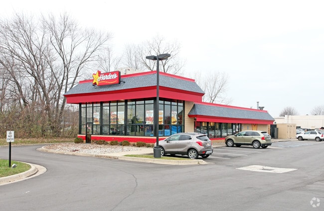
35155 Mound Rd, Sterling Heights, MI 48310


Property Detail
35155 Mound Rd
10-10-29-478-025
SUPERVISOR'S PLAT NO. 6 LOTS 29 & 30, AND THE S 18.0 FT OF LOT 28 {SPLIT & COMBINED FROM -022, -012, AND -013 FOR 1998}
Restaurantdrivein
Macomb
C-3
Michigan
B and X Area of moderate flood hazard, usually the area between the limits of the 100-year and 500-year floods.
28-30
2025
1.09 AC
2025
Macomb West
231700
Detroit
3,220 SF
Detroit-Warren-Dearborn, MI
NEARBY LISTINGS FOR SALE OR LEASE
DEMOGRAPHICS near 35155 Mound Rd
1 mile
3 mile
5 mile
2025 Total Population
8,876
99,311
291,203
2030 Population
8,989
99,802
294,262
Pop Growth 2025-2030
+ 1.27%
+ 0.49%
+ 1.05%
Average Age
41
42
42
2025 Total Households
3,219
37,932
116,234
HH Growth 2025-2030
+ 1.65%
+ 0.61%
+ 1.19%
Median Household Inc
$77,052
$72,460
$75,567
Avg Household Size
2.70
2.50
2.40
2025 Avg HH Vehicles
2.00
2.00
2.00
Median Home Value
$266,020
$251,833
$250,214
Median Year Built
1976
1972
1971
Nearby Places
Map Layers
Map Styles
 Street
 Aerial
Transit
 Traffic
 Biking
Places
Listings with unknown addresses are not visible on the map
- Restaurants
- Banks
- Shops
- Fitness
- Groceries
PUBLIC TRANSPORTATION
COMMUTER RAIL
Troy Amtrak Station (Wolverine - Amtrak)
Drive
Walk
Distance
Troy Amtrak Station (Wolverine - Amtrak)
16 min
7.8 mi
AIRPORT
Windsor International
Drive
Walk
Distance
Windsor International
49 min
28.9 mi
Detroit Metro Wayne County
Drive
Walk
Distance
Detroit Metro Wayne County
54 min
38.5 mi
Freight Ports
Port of Toledo
Drive
Walk
Distance
Port of Toledo
99 min
79.4 mi
Nearby Properties
Address
Land Use
TOTAL SIZE
Lot Size
Zoning
Address
Land Use
TOTAL SIZE
Lot Size
Zoning
3,988,890 SF
223.80 AC
M-3
Address
Land Use
TOTAL SIZE
Lot Size
Zoning
1,727,664 SF
167.66 AC
M-3
Address
Land Use
TOTAL SIZE
Lot Size
Zoning
1,177,879 SF
104 AC
MZ
Address
Land Use
TOTAL SIZE
Lot Size
Zoning
920,611 SF
M-2
Address
Land Use
TOTAL SIZE
Lot Size
Zoning
1,596,307 SF
Address
Land Use
TOTAL SIZE
Lot Size
Zoning
1,024,233 SF
287.20 AC
M-2
Address
Land Use
TOTAL SIZE
Lot Size
Zoning
1,107,643 SF
173.73 AC
MZ
Address
Land Use
TOTAL SIZE
Lot Size
Zoning
322,580 SF
Address
Land Use
TOTAL SIZE
Lot Size
Zoning
983,373 SF
60.16 AC
M-2
Address
Land Use
TOTAL SIZE
Lot Size
Zoning
136,137 SF
12.28 AC
RM2
Address
Land Use
TOTAL SIZE
Lot Size
Zoning
2,726,159 SF
199.39 AC
M-2
Address
Land Use
TOTAL SIZE
Lot Size
Zoning
40.32 AC
RM-2
Address
Land Use
TOTAL SIZE
Lot Size
Zoning
146.36 AC
MHP
Address
Land Use
TOTAL SIZE
Lot Size
Zoning
569,813 SF
62.54 AC
M-2
Address
Land Use
TOTAL SIZE
Lot Size
Zoning
2,727,131 SF
155.26 AC
M-2
Address
Land Use
TOTAL SIZE
Lot Size
Zoning
207,605 SF
20.56 AC
PUD
Address
Land Use
TOTAL SIZE
Lot Size
Zoning
251,735 SF
10.57 AC
RM3
Address
Land Use
TOTAL SIZE
Lot Size
Zoning
226,380 SF
46.45 AC
M-1
Address
Land Use
TOTAL SIZE
Lot Size
Zoning
229,624 SF
13.55 AC
M-2
Address
Land Use
TOTAL SIZE
Lot Size
Zoning
645 SF
23.16 AC
RM-2
Address
Land Use
TOTAL SIZE
Lot Size
Zoning
2,984,492 SF
M-2
Address
Land Use
TOTAL SIZE
Lot Size
Zoning
423,027 SF
46.73 AC
M-1
Address
Land Use
TOTAL SIZE
Lot Size
Zoning
94,228 SF
17.66 AC
Address
Land Use
TOTAL SIZE
Lot Size
Zoning
201,873 SF
M-1
Address
Land Use
TOTAL SIZE
Lot Size
Zoning
559,929 SF
41.57 AC
M-1
Address
Land Use
TOTAL SIZE
Lot Size
Zoning
135,274 SF
20.55 AC
RM-2
Address
Land Use
TOTAL SIZE
Lot Size
Zoning
139,846 SF
16 AC
RM-2
Address
Land Use
TOTAL SIZE
Lot Size
Zoning
207,605 SF
19.39 AC
RETAIL5KSF
Address
Land Use
TOTAL SIZE
Lot Size
Zoning
236,900 SF
20.34 AC
RM1
Address
Land Use
TOTAL SIZE
Lot Size
Zoning
378,412 SF
M1LT
The World's #1 Commercial Real Estate Marketplace
Connect with us
© 2026 CoStar Group
The information above has been obtained from sources believed reliable. While we do not doubt its accuracy we have not verified it and make no guarantee, warranty or representation about it. It is your responsibility to independently confirm its accuracy and completeness. Any projections, opinions, assumptions, or estimates used are for example only and do not represent the current or future performance of the property. The value of this transaction to you depends on tax and other factors which should be evaluated by your tax, financial, and legal advisors. You and your advisors should conduct a careful, independent investigation of the property to determine to your satisfaction the suitability of the property for your needs.