Property Record
3517 E Kiest Blvd, Dallas, TX 75203
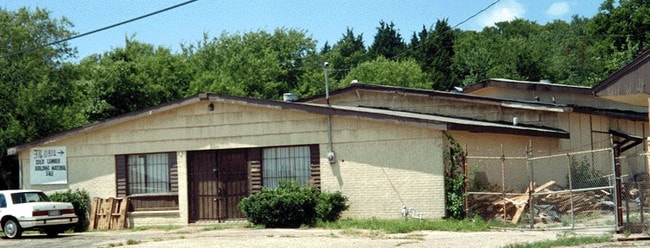

Property Detail
3517 E Kiest Blvd
Dallas-Fort Worth-Arlington, TX
BLKS 7530 & 7528 TR 7.2 ACS 0.62 INT202000320478 DD11122020 CO-DC 7530 000 00702 2007530 000
00000749605000000
DALLAS
Commercialacreage
Texas
Z116
7
AE The base floodplain where base flood elevations are provided. AE Zones are now used on new format FIRMs instead of A1-A30 Zones.
0.62 AC
2024
SE Dallas/I-45
2025
Dallas/Ft Worth
005500
NEARBY LISTINGS FOR SALE OR LEASE
DEMOGRAPHICS near 3517 E Kiest Blvd
1 mile
3 mile
5 mile
2025 Total Population
6,401
107,511
331,074
2030 Population
6,675
112,483
345,424
Pop Growth 2025-2030
+ 4.28%
+ 4.62%
+ 4.33%
Average Age
37
37
37
2025 Total Households
2,245
37,741
131,806
HH Growth 2025-2030
+ 4.23%
+ 4.81%
+ 4.75%
Median Household Inc
$43,171
$48,662
$65,248
Avg Household Size
2.70
2.70
2.40
2025 Avg HH Vehicles
2.00
2.00
2.00
Median Home Value
$202,676
$193,978
$252,445
Median Year Built
1956
1963
1977
Nearby Places
Map Layers
Map Styles
 Street
 Aerial
Layers
 Traffic
 Biking
Places
Listings with unknown addresses are not visible on the map
- Restaurants
- Banks
- Shops
- Fitness
- Groceries
PUBLIC TRANSPORTATION
COMMUTER RAIL
Drive
Walk
Distance
10 min
5.3 mi
Drive
Walk
Distance
14 min
7.9 mi
AIRPORT
Dallas Love Field
Drive
Walk
Distance
Dallas Love Field
20 min
10.3 mi
Dallas-Fort Worth International
Drive
Walk
Distance
Dallas-Fort Worth International
34 min
24.4 mi
Nearby Properties
Address
Land Use
TOTAL SIZE
Lot Size
Zoning
Address
Land Use
TOTAL SIZE
Lot Size
Zoning
1,298,826 SF
33.16 AC
Z163
Address
Land Use
TOTAL SIZE
Lot Size
Zoning
271,956 SF
23.18 AC
Z298
Address
Land Use
TOTAL SIZE
Lot Size
Zoning
26,896 SF
3.56 AC
Z239
Address
Land Use
TOTAL SIZE
Lot Size
Zoning
698.53 AC
Z46
Address
Land Use
TOTAL SIZE
Lot Size
Zoning
179,370 SF
13.18 AC
Z248
Address
Land Use
TOTAL SIZE
Lot Size
Zoning
452,834 SF
2.76 AC
Z21
Address
Land Use
TOTAL SIZE
Lot Size
Zoning
381,448 SF
19.99 AC
Z151
Address
Land Use
TOTAL SIZE
Lot Size
Zoning
513,833 SF
0.17 AC
Z59
Address
Land Use
TOTAL SIZE
Lot Size
Zoning
339,086 SF
4.35 AC
Z163
Address
Land Use
TOTAL SIZE
Lot Size
Zoning
512,628 SF
2.72 AC
Z239
Address
Land Use
TOTAL SIZE
Lot Size
Zoning
213,616 SF
16.31 AC
Z239
Address
Land Use
TOTAL SIZE
Lot Size
Zoning
290,902 SF
13.90 AC
Z151
Address
Land Use
TOTAL SIZE
Lot Size
Zoning
380,000 SF
6.52 AC
Z21
Address
Land Use
TOTAL SIZE
Lot Size
Zoning
428,759 SF
16.39 AC
Z239
Address
Land Use
TOTAL SIZE
Lot Size
Zoning
457,920 SF
3.20 AC
Z21
Address
Land Use
TOTAL SIZE
Lot Size
Zoning
343,006 SF
0.53 AC
Z239
Address
Land Use
TOTAL SIZE
Lot Size
Zoning
223,496 SF
3.94 AC
Z164
Address
Land Use
TOTAL SIZE
Lot Size
Zoning
320,240 SF
1.93 AC
Z21
Address
Land Use
TOTAL SIZE
Lot Size
Zoning
423,864 SF
3.56 AC
Z164
Address
Land Use
TOTAL SIZE
Lot Size
Zoning
73,708 SF
1.82 AC
Z239
Address
Land Use
TOTAL SIZE
Lot Size
Zoning
13.95 AC
Z115
Address
Land Use
TOTAL SIZE
Lot Size
Zoning
260,602 SF
6.64 AC
Address
Land Use
TOTAL SIZE
Lot Size
Zoning
333,215 SF
3.04 AC
Address
Land Use
TOTAL SIZE
Lot Size
Zoning
473,025 SF
3.92 AC
Z239
Address
Land Use
TOTAL SIZE
Lot Size
Zoning
337,587 SF
0.16 AC
Z297
Address
Land Use
TOTAL SIZE
Lot Size
Zoning
286,203 SF
1.37 AC
Z239
Address
Land Use
TOTAL SIZE
Lot Size
Zoning
358,714 SF
2.85 AC
Z151
Address
Land Use
TOTAL SIZE
Lot Size
Zoning
141,588 SF
20.33 AC
Z46
Address
Land Use
TOTAL SIZE
Lot Size
Zoning
532,726 SF
64.28 AC
Z248
Address
Land Use
TOTAL SIZE
Lot Size
Zoning
556,046 SF
2.23 AC
Z239
The World's #1 Commercial Real Estate Marketplace
Connect with us
© 2026 CoStar Group
The information above has been obtained from sources believed reliable. While we do not doubt its accuracy we have not verified it and make no guarantee, warranty or representation about it. It is your responsibility to independently confirm its accuracy and completeness. Any projections, opinions, assumptions, or estimates used are for example only and do not represent the current or future performance of the property. The value of this transaction to you depends on tax and other factors which should be evaluated by your tax, financial, and legal advisors. You and your advisors should conduct a careful, independent investigation of the property to determine to your satisfaction the suitability of the property for your needs.