Property Record
3518 Gwynnbrook Ave, Owings Mills, MD 21117
NEARBY LISTINGS FOR SALE OR LEASE
Property Detail
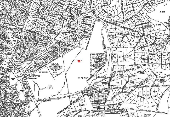
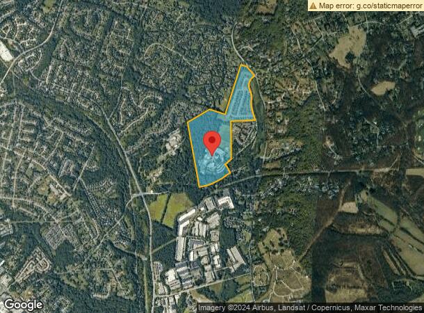
3518 Gwynnbrook Ave
Baltimore-Columbia-Towson, MD
Associated Way
04-0416075025
49.3752 AC PARTIAL
Commercialacreage
Baltimore
X
Maryland
24013C0350D
1
2024
49.38 AC
2025
Reisterstown Rd Corridor
404900
Baltimore
DEMOGRAPHICS near 3518 Gwynnbrook Ave
1 Mile
3 Mile
5 Mile
2024 Total Population
4,609
53,663
109,398
2029 Population
4,550
53,010
108,204
Pop Growth 2024-2029
(1.28%)
(1.22%)
(1.09%)
Average Age
47
39
40
2024 Total Households
1,901
20,034
42,662
HH Growth 2024-2029
(1.32%)
(1.27%)
(1.13%)
Median Household Inc
$135,642
$85,372
$95,140
Avg Household Size
2.40
2.50
2.50
2024 Avg HH Vehicles
2.00
2.00
2.00
Median Home Value
$491,357
$380,787
$360,155
Median Year Built
1992
1982
1990
Nearby Places
Map Layers
Map Styles
 Street
 Aerial
- Restaurants
- Banks
- Shops
- Fitness
- Groceries
PUBLIC TRANSPORTATION
AIRPORT
Baltimore/Washington International Thurgood Marshall
DRIVE
WALK
Distance
Baltimore/Washington International Thurgood Marshall
38 min
22.9 mi
Freight Ports
Port of Baltimore
DRIVE
WALK
Distance
Port of Baltimore
39 min
23.4 mi
Nearby Properties
Address
Land Use
TOTAL SIZE
Lot Size
Zoning
Address
Land Use
TOTAL SIZE
Lot Size
Zoning
408,321 SF
39.16 AC
BM
Address
Land Use
TOTAL SIZE
Lot Size
Zoning
569,200 SF
8.82 AC
BM
Address
Land Use
TOTAL SIZE
Lot Size
Zoning
250,000 SF
1.61 AC
BMCT
Address
Land Use
TOTAL SIZE
Lot Size
Zoning
23.07 AC
DR16
Address
Land Use
TOTAL SIZE
Lot Size
Zoning
159.90 AC
Address
Land Use
TOTAL SIZE
Lot Size
Zoning
464,593 SF
6.38 AC
BM
Address
Land Use
TOTAL SIZE
Lot Size
Zoning
333,600 SF
8.39 AC
ML
Address
Land Use
TOTAL SIZE
Lot Size
Zoning
756,000 SF
2.63 AC
Address
Land Use
TOTAL SIZE
Lot Size
Zoning
589,225 SF
1.96 AC
Address
Land Use
TOTAL SIZE
Lot Size
Zoning
146,149 SF
1.08 AC
BM-CT
Address
Land Use
TOTAL SIZE
Lot Size
Zoning
285,044 SF
15.16 AC
MLIM
Address
Land Use
TOTAL SIZE
Lot Size
Zoning
18.87 AC
DR16
Address
Land Use
TOTAL SIZE
Lot Size
Zoning
91,160 SF
2.53 AC
Address
Land Use
TOTAL SIZE
Lot Size
Zoning
151,140 SF
39.06 AC
Address
Land Use
TOTAL SIZE
Lot Size
Zoning
55,470 SF
9.69 AC
BM
Address
Land Use
TOTAL SIZE
Lot Size
Zoning
16.86 AC
Address
Land Use
TOTAL SIZE
Lot Size
Zoning
199,573 SF
6.35 AC
ML
Address
Land Use
TOTAL SIZE
Lot Size
Zoning
190,501 SF
1.63 AC
Address
Land Use
TOTAL SIZE
Lot Size
Zoning
114,141 SF
54.89 AC
Address
Land Use
TOTAL SIZE
Lot Size
Zoning
164,453 SF
4.49 AC
ML
Address
Land Use
TOTAL SIZE
Lot Size
Zoning
279,000 SF
21.85 AC
BM
Address
Land Use
TOTAL SIZE
Lot Size
Zoning
29.54 AC
BM
Address
Land Use
TOTAL SIZE
Lot Size
Zoning
15.86 AC
DR16
Address
Land Use
TOTAL SIZE
Lot Size
Zoning
4,762 SF
15.93 AC
BMCCC
Address
Land Use
TOTAL SIZE
Lot Size
Zoning
261,295 SF
8.62 AC
BM
Address
Land Use
TOTAL SIZE
Lot Size
Zoning
205,549 SF
7.32 AC
OT
Address
Land Use
TOTAL SIZE
Lot Size
Zoning
148,744 SF
1 AC
BM-CT
Address
Land Use
TOTAL SIZE
Lot Size
Zoning
17.47 AC
DR16
Address
Land Use
TOTAL SIZE
Lot Size
Zoning
157,288 SF
1.18 AC
BM-CT
Address
Land Use
TOTAL SIZE
Lot Size
Zoning
11.76 AC
DR3.5
The World's #1 Commercial Real Estate Marketplace
Connect with us
© 2026 CoStar Group
The information above has been obtained from sources believed reliable. While we do not doubt its accuracy we have not verified it and make no guarantee, warranty or representation about it. It is your responsibility to independently confirm its accuracy and completeness. Any projections, opinions, assumptions, or estimates used are for example only and do not represent the current or future performance of the property. The value of this transaction to you depends on tax and other factors which should be evaluated by your tax, financial, and legal advisors. You and your advisors should conduct a careful, independent investigation of the property to determine to your satisfaction the suitability of the property for your needs.