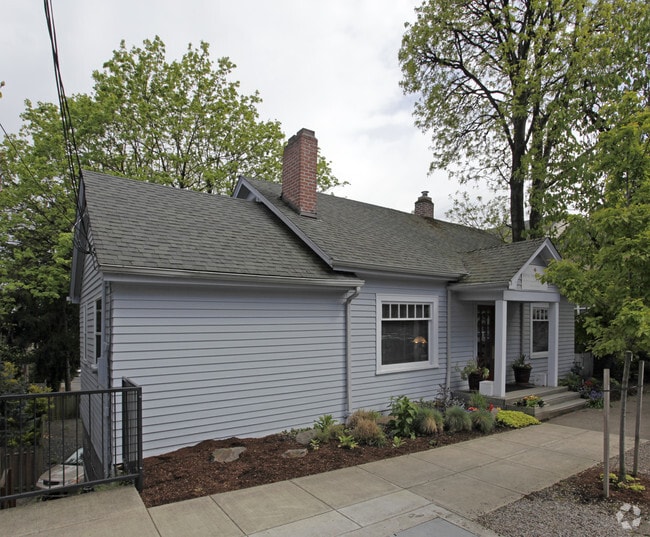
Property Record
3518 S Corbett Ave, Portland, OR 97239
Property Detail
3518 S Corbett Ave
R129178
CARUTHERS ADD, BLOCK 144, LOT 6 TL 5601
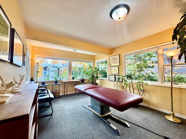
Commercialnec
Multnomah
CS
Oregon
B and X Area of moderate flood hazard, usually the area between the limits of the 100-year and 500-year floods.
6
2025
0.12 AC
2025
Barbur Blvd/Capitol Hwy
005901
Portland
7,784 SF
Portland-Vancouver-Hillsboro, OR-WA
NEARBY LISTINGS FOR SALE OR LEASE
DEMOGRAPHICS near 3518 S Corbett Ave
1 mile
3 mile
5 mile
2025 Total Population
19,326
193,240
437,269
2030 Population
19,851
192,914
434,620
Pop Growth 2025-2030
+ 2.72%
(0.17%)
(0.61%)
Average Age
40
41
41
2025 Total Households
10,905
100,278
204,142
HH Growth 2025-2030
+ 2.61%
(0.23%)
(0.66%)
Median Household Inc
$94,540
$85,582
$96,350
Avg Household Size
1.70
1.80
2.00
2025 Avg HH Vehicles
1.00
1.00
1.00
Median Home Value
$700,174
$740,966
$708,663
Median Year Built
2001
1973
1965
Nearby Places
Map Layers
Map Styles
 Street
 Aerial
Transit
 Traffic
 Biking
Places
Listings with unknown addresses are not visible on the map
- Restaurants
- Banks
- Shops
- Fitness
- Groceries
PUBLIC TRANSPORTATION
TRANSIT/SUBWAY
OHSU Commons (Portland Streetcar - Tri-County Metropolitan Transportation District of Oregon Rail (TriMet Rail))
Drive
Walk
Distance
OHSU Commons (Portland Streetcar - Tri-County Metropolitan Transportation District of Oregon Rail (TriMet Rail))
4 min
8 min
0.4 mi
SW Moody & Gaines (Portland Streetcar - Tri-County Metropolitan Transportation District of Oregon Rail (TriMet Rail))
Drive
Walk
Distance
SW Moody & Gaines (Portland Streetcar - Tri-County Metropolitan Transportation District of Oregon Rail (TriMet Rail))
3 min
11 min
0.6 mi
SW Lowell & Bond (Portland Streetcar - Tri-County Metropolitan Transportation District of Oregon Rail (TriMet Rail))
Drive
Walk
Distance
SW Lowell & Bond (Portland Streetcar - Tri-County Metropolitan Transportation District of Oregon Rail (TriMet Rail))
2 min
11 min
0.6 mi
SW Bond & Lane (Portland Streetcar - Tri-County Metropolitan Transportation District of Oregon Rail (TriMet Rail))
Drive
Walk
Distance
SW Bond & Lane (Portland Streetcar - Tri-County Metropolitan Transportation District of Oregon Rail (TriMet Rail))
2 min
12 min
0.6 mi
SW River Pkwy & Moody (Portland Streetcar - Tri-County Metropolitan Transportation District of Oregon Rail (TriMet Rail))
Drive
Walk
Distance
SW River Pkwy & Moody (Portland Streetcar - Tri-County Metropolitan Transportation District of Oregon Rail (TriMet Rail))
5 min
18 min
0.9 mi
COMMUTER RAIL
Drive
Walk
Distance
9 min
3.0 mi
Beaverton Transit Center (West Side Express) (Westside Express Service - Tri-County Metropolitan Transportation District of Oregon Rail (TriMet Rail))
Drive
Walk
Distance
Beaverton Transit Center (West Side Express) (Westside Express Service - Tri-County Metropolitan Transportation District of Oregon Rail (TriMet Rail))
16 min
8.7 mi
AIRPORT
Portland International
Drive
Walk
Distance
Portland International
25 min
14.2 mi
Freight Ports
Port of Portland
Drive
Walk
Distance
Port of Portland
10 min
4.4 mi
SALE & LEASE HISTORY
LISTING DATE
SALE/LEASE

Nov 11, 2024
For Sale
Nearby Properties
Address
Land Use
TOTAL SIZE
Lot Size
Zoning
Address
Land Use
TOTAL SIZE
Lot Size
Zoning
27.58 AC
EX
Address
Land Use
TOTAL SIZE
Lot Size
Zoning
627,500 SF
16.60 AC
CX
Address
Land Use
TOTAL SIZE
Lot Size
Zoning
822,867 SF
103.39 AC
CI1
Address
Land Use
TOTAL SIZE
Lot Size
Zoning
57,314 SF
60.69 AC
OS
Address
Land Use
TOTAL SIZE
Lot Size
Zoning
560,000 SF
0.15 AC
CX
Address
Land Use
TOTAL SIZE
Lot Size
Zoning
20.71 AC
OS
Address
Land Use
TOTAL SIZE
Lot Size
Zoning
409,260 SF
7.41 AC
EX
Address
Land Use
TOTAL SIZE
Lot Size
Zoning
1.09 AC
EX
Address
Land Use
TOTAL SIZE
Lot Size
Zoning
2.24 AC
CX
Address
Land Use
TOTAL SIZE
Lot Size
Zoning
326,547 SF
2.42 AC
RH
Address
Land Use
TOTAL SIZE
Lot Size
Zoning
304,836 SF
10.85 AC
CX
Address
Land Use
TOTAL SIZE
Lot Size
Zoning
417,324 SF
0.68 AC
CX
Address
Land Use
TOTAL SIZE
Lot Size
Zoning
598,328 SF
12.32 AC
CX
Address
Land Use
TOTAL SIZE
Lot Size
Zoning
257,700 SF
2.89 AC
EX
Address
Land Use
TOTAL SIZE
Lot Size
Zoning
128,500 SF
6.95 AC
OS
Address
Land Use
TOTAL SIZE
Lot Size
Zoning
460,000 SF
0.92 AC
CX
Address
Land Use
TOTAL SIZE
Lot Size
Zoning
689,840 SF
0.92 AC
CX
Address
Land Use
TOTAL SIZE
Lot Size
Zoning
125,217 SF
0.23 AC
CX
Address
Land Use
TOTAL SIZE
Lot Size
Zoning
97,465 SF
107.18 AC
OS
Address
Land Use
TOTAL SIZE
Lot Size
Zoning
7.78 AC
EX
Address
Land Use
TOTAL SIZE
Lot Size
Zoning
426,742 SF
0.53 AC
RXD
Address
Land Use
TOTAL SIZE
Lot Size
Zoning
584,483 SF
0.90 AC
CX
Address
Land Use
TOTAL SIZE
Lot Size
Zoning
247,520 SF
7.74 AC
CX
Address
Land Use
TOTAL SIZE
Lot Size
Zoning
306,000 SF
1.21 AC
NULL
Address
Land Use
TOTAL SIZE
Lot Size
Zoning
251,293 SF
14.15 AC
IR
Address
Land Use
TOTAL SIZE
Lot Size
Zoning
596,161 SF
0.92 AC
CX
Address
Land Use
TOTAL SIZE
Lot Size
Zoning
456,760 SF
0.53 AC
EX
Address
Land Use
TOTAL SIZE
Lot Size
Zoning
387,000 SF
0.88 AC
CXD
Address
Land Use
TOTAL SIZE
Lot Size
Zoning
473,746 SF
1.68 AC
Address
Land Use
TOTAL SIZE
Lot Size
Zoning
291,451 SF
1.64 AC
RH
The World's #1 Commercial Real Estate Marketplace
Connect with us
© 2026 CoStar Group
The information above has been obtained from sources believed reliable. While we do not doubt its accuracy we have not verified it and make no guarantee, warranty or representation about it. It is your responsibility to independently confirm its accuracy and completeness. Any projections, opinions, assumptions, or estimates used are for example only and do not represent the current or future performance of the property. The value of this transaction to you depends on tax and other factors which should be evaluated by your tax, financial, and legal advisors. You and your advisors should conduct a careful, independent investigation of the property to determine to your satisfaction the suitability of the property for your needs.