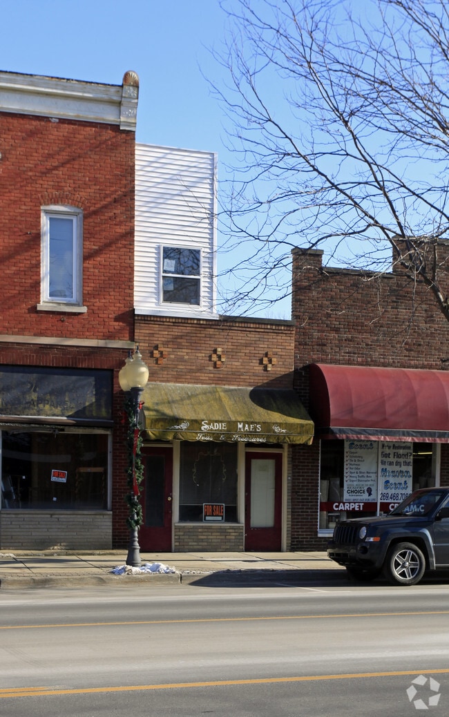
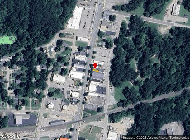
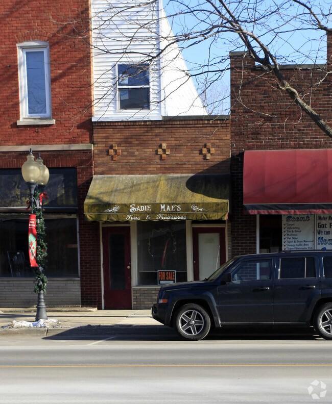
Property Record
352 N Main St, Watervliet, MI 49098
NEARBY LISTINGS FOR SALE OR LEASE
-
-
View all Watervliet listings for sale on LoopNet.com
Property Detail
352 N Main St
Niles-Benton Harbor, MI
Revised Of City Of Watervliet
11-78-0340-0034-01-6
PRT OF THE NLY1/2 OF LOT 34 OF THE REVISED PLAT OF CITY OF WATERVLIET DES AS COM AT SW COR OF SD NLY1/2 TH ELY ON S LN OF SD NLY1/2 51.13' NLY PAR TO MAIN ST 4.37' TH WLY PAR TO S LN OF SD NLY1/2 13.96' NLY PAR TO MAIN ST 6.73' WLY PAR TO S LN OF SD
Storebuilding
Berrien
X
Michigan
26159C0275D
34
2024
0.01 AC
2025
Michigan Southwest Area
010300
Other Market Areas
708 SF
DEMOGRAPHICS near 352 N Main St
1 Mile
3 Mile
5 Mile
2024 Total Population
3,288
10,390
15,916
2029 Population
3,267
10,445
15,878
Pop Growth 2024-2029
(0.64%)
+ 0.53%
(0.24%)
Average Age
41
43
42
2024 Total Households
1,343
4,322
6,367
HH Growth 2024-2029
(0.60%)
+ 0.56%
(0.25%)
Median Household Inc
$48,355
$52,541
$50,915
Avg Household Size
2.40
2.30
2.40
2024 Avg HH Vehicles
2.00
2.00
2.00
Median Home Value
$99,166
$148,059
$150,503
Median Year Built
1966
1968
1971
Nearby Places
Map Layers
Map Styles
 Street
 Aerial
- Restaurants
- Banks
- Shops
- Fitness
- Groceries
PUBLIC TRANSPORTATION
AIRPORT
South Bend International
DRIVE
WALK
Distance
South Bend International
58 min
43.4 mi
SALE & LEASE HISTORY
LISTING DATE
SALE/LEASE

Sep 12, 2025
For Sale
Nearby Properties
Address
Land Use
TOTAL SIZE
Lot Size
Zoning
Address
Land Use
TOTAL SIZE
Lot Size
Zoning
28.80 AC
Address
Land Use
TOTAL SIZE
Lot Size
Zoning
95,940 SF
AG-P
Address
Land Use
TOTAL SIZE
Lot Size
Zoning
3.37 AC
C
Address
Land Use
TOTAL SIZE
Lot Size
Zoning
Address
Land Use
TOTAL SIZE
Lot Size
Zoning
74.04 AC
Address
Land Use
TOTAL SIZE
Lot Size
Zoning
214,600 SF
23 AC
Address
Land Use
TOTAL SIZE
Lot Size
Zoning
22,017 SF
3 AC
C-1
Address
Land Use
TOTAL SIZE
Lot Size
Zoning
Address
Land Use
TOTAL SIZE
Lot Size
Zoning
36,946 SF
10.20 AC
C-1
Address
Land Use
TOTAL SIZE
Lot Size
Zoning
69,000 SF
R-1A
Address
Land Use
TOTAL SIZE
Lot Size
Zoning
12.40 AC
R1A
Address
Land Use
TOTAL SIZE
Lot Size
Zoning
6,562 SF
5 AC
Address
Land Use
TOTAL SIZE
Lot Size
Zoning
94,750 SF
17.36 AC
AG-P
Address
Land Use
TOTAL SIZE
Lot Size
Zoning
56,600 SF
5.67 AC
C-1
Address
Land Use
TOTAL SIZE
Lot Size
Zoning
25.92 AC
AG
Address
Land Use
TOTAL SIZE
Lot Size
Zoning
23.02 AC
RMH
Address
Land Use
TOTAL SIZE
Lot Size
Zoning
Address
Land Use
TOTAL SIZE
Lot Size
Zoning
13,440 SF
4.12 AC
C-1
Address
Land Use
TOTAL SIZE
Lot Size
Zoning
4 AC
C
Address
Land Use
TOTAL SIZE
Lot Size
Zoning
11,223 SF
1.92 AC
C-1
Address
Land Use
TOTAL SIZE
Lot Size
Zoning
1.50 AC
Address
Land Use
TOTAL SIZE
Lot Size
Zoning
3,012 SF
92.89 AC
AG
Address
Land Use
TOTAL SIZE
Lot Size
Zoning
Address
Land Use
TOTAL SIZE
Lot Size
Zoning
6,740 SF
14.21 AC
RMH
Address
Land Use
TOTAL SIZE
Lot Size
Zoning
3,400 SF
1 AC
Address
Land Use
TOTAL SIZE
Lot Size
Zoning
15.33 AC
RMH
Address
Land Use
TOTAL SIZE
Lot Size
Zoning
153.75 AC
L-1
Address
Land Use
TOTAL SIZE
Lot Size
Zoning
0.91 AC
C
Address
Land Use
TOTAL SIZE
Lot Size
Zoning
9,790 SF
4.47 AC
C-1
Address
Land Use
TOTAL SIZE
Lot Size
Zoning
4,696 SF
0.77 AC
C-1
The World's #1 Commercial Real Estate Marketplace
Connect with us
© 2026 CoStar Group
The information above has been obtained from sources believed reliable. While we do not doubt its accuracy we have not verified it and make no guarantee, warranty or representation about it. It is your responsibility to independently confirm its accuracy and completeness. Any projections, opinions, assumptions, or estimates used are for example only and do not represent the current or future performance of the property. The value of this transaction to you depends on tax and other factors which should be evaluated by your tax, financial, and legal advisors. You and your advisors should conduct a careful, independent investigation of the property to determine to your satisfaction the suitability of the property for your needs.