Property Record
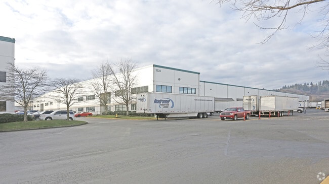
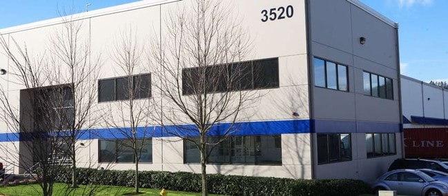
3520 142Nd Ave E, Sumner, WA 98390

Property Detail
3520 142Nd Ave E
042013-2034
SECTION 13 TOWNSHIP 20 RANGE 04 QUARTER 24 : PARCEL 1 OF DBLR 2002-04-25-5001 DESC AS COM AT N 1/4 COR OF SEC TH S ALG E LI OF NW 642.31 FT TH W 725.65 FT TH S 621.14 FT TO POB TH E 49.64 FT TO W LI OF E 1/2 OF E 1/2 OF NW TH S ALG SD W LI 490.26 FT
Warehouse
Pierce
M1
Washington
AE The base floodplain where base flood elevations are provided. AE Zones are now used on new format FIRMs instead of A1-A30 Zones.
1
2024
8.94 AC
2025
Puyallup/S Hill
073301
Seattle/Puget Sound
185,700 SF
Seattle-Tacoma-Bellevue, WA
NEARBY LISTINGS FOR SALE OR LEASE
DEMOGRAPHICS near 3520 142Nd Ave E
1 mile
3 mile
5 mile
2025 Total Population
515
53,790
166,513
2030 Population
526
54,904
169,993
Pop Growth 2025-2030
+ 2.14%
+ 2.07%
+ 2.09%
Average Age
41
39
39
2025 Total Households
190
20,680
61,409
HH Growth 2025-2030
+ 2.11%
+ 2.06%
+ 2.07%
Median Household Inc
$93,928
$109,834
$105,915
Avg Household Size
2.70
2.60
2.60
2025 Avg HH Vehicles
3.00
2.00
2.00
Median Home Value
$707,500
$648,410
$609,287
Median Year Built
1988
1993
1989
Nearby Places
Map Layers
Map Styles
 Street
 Aerial
Transit
 Traffic
 Biking
Places
Listings with unknown addresses are not visible on the map
- Restaurants
- Banks
- Shops
- Fitness
- Groceries
PUBLIC TRANSPORTATION
AIRPORT
Seattle-Tacoma International
Drive
Walk
Distance
Seattle-Tacoma International
34 min
19.6 mi
Freight Ports
Port of Tacoma
Drive
Walk
Distance
Port of Tacoma
23 min
12.3 mi
SALE & LEASE HISTORY
LISTING DATE
SALE/LEASE

Sep 25, 2016
For Lease
Nearby Properties
Address
Land Use
TOTAL SIZE
Lot Size
Zoning
Address
Land Use
TOTAL SIZE
Lot Size
Zoning
833,773 SF
94.01 AC
M1
Address
Land Use
TOTAL SIZE
Lot Size
Zoning
957,681 SF
56.53 AC
ML
Address
Land Use
TOTAL SIZE
Lot Size
Zoning
438,065 SF
20.43 AC
PUY
Address
Land Use
TOTAL SIZE
Lot Size
Zoning
321,680 SF
31.59 AC
RM
Address
Land Use
TOTAL SIZE
Lot Size
Zoning
648,679 SF
27.43 AC
M1
Address
Land Use
TOTAL SIZE
Lot Size
Zoning
425,832 SF
11 AC
RM-20
Address
Land Use
TOTAL SIZE
Lot Size
Zoning
Address
Land Use
TOTAL SIZE
Lot Size
Zoning
501,104 SF
21.73 AC
Address
Land Use
TOTAL SIZE
Lot Size
Zoning
506,925 SF
24.22 AC
M1
Address
Land Use
TOTAL SIZE
Lot Size
Zoning
521,674 SF
24.55 AC
M1
Address
Land Use
TOTAL SIZE
Lot Size
Zoning
255,871 SF
11.17 AC
EDGWD
Address
Land Use
TOTAL SIZE
Lot Size
Zoning
208,900 SF
8.72 AC
EDGWD
Address
Land Use
TOTAL SIZE
Lot Size
Zoning
492,124 SF
21.54 AC
M1
Address
Land Use
TOTAL SIZE
Lot Size
Zoning
441,316 SF
20.26 AC
Address
Land Use
TOTAL SIZE
Lot Size
Zoning
251,498 SF
13.79 AC
LAKELAND H
Address
Land Use
TOTAL SIZE
Lot Size
Zoning
476,362 SF
26.61 AC
Address
Land Use
TOTAL SIZE
Lot Size
Zoning
503,526 SF
16.52 AC
M1
Address
Land Use
TOTAL SIZE
Lot Size
Zoning
215,619 SF
21.57 AC
TV
Address
Land Use
TOTAL SIZE
Lot Size
Zoning
430,880 SF
23.46 AC
M1
Address
Land Use
TOTAL SIZE
Lot Size
Zoning
428,056 SF
17.45 AC
M1
Address
Land Use
TOTAL SIZE
Lot Size
Zoning
204,727 SF
18.63 AC
TV
Address
Land Use
TOTAL SIZE
Lot Size
Zoning
218,293 SF
12.20 AC
RM-20
Address
Land Use
TOTAL SIZE
Lot Size
Zoning
223,969 SF
16.97 AC
RM-20
Address
Land Use
TOTAL SIZE
Lot Size
Zoning
401,076 SF
16.77 AC
M1
Address
Land Use
TOTAL SIZE
Lot Size
Zoning
385,468 SF
18.22 AC
M1
Address
Land Use
TOTAL SIZE
Lot Size
Zoning
427,253 SF
18.46 AC
M1
Address
Land Use
TOTAL SIZE
Lot Size
Zoning
382,800 SF
19.15 AC
M1
Address
Land Use
TOTAL SIZE
Lot Size
Zoning
370,087 SF
15.61 AC
M1
Address
Land Use
TOTAL SIZE
Lot Size
Zoning
350,075 SF
16.66 AC
M1
Address
Land Use
TOTAL SIZE
Lot Size
Zoning
333,180 SF
18.13 AC
The World's #1 Commercial Real Estate Marketplace
Connect with us
© 2026 CoStar Group
The information above has been obtained from sources believed reliable. While we do not doubt its accuracy we have not verified it and make no guarantee, warranty or representation about it. It is your responsibility to independently confirm its accuracy and completeness. Any projections, opinions, assumptions, or estimates used are for example only and do not represent the current or future performance of the property. The value of this transaction to you depends on tax and other factors which should be evaluated by your tax, financial, and legal advisors. You and your advisors should conduct a careful, independent investigation of the property to determine to your satisfaction the suitability of the property for your needs.