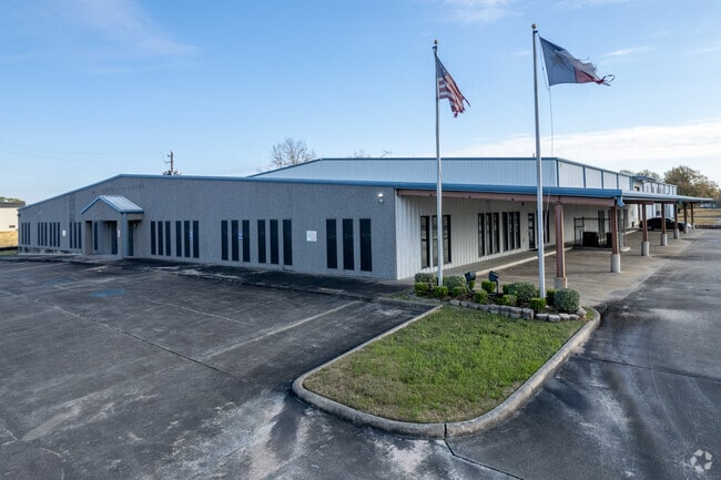
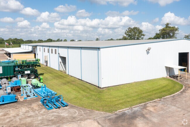
Property Record
3520 E Sam Houston Pkwy N, Houston, TX 77015
NEARBY LISTINGS FOR SALE OR LEASE
Property Detail
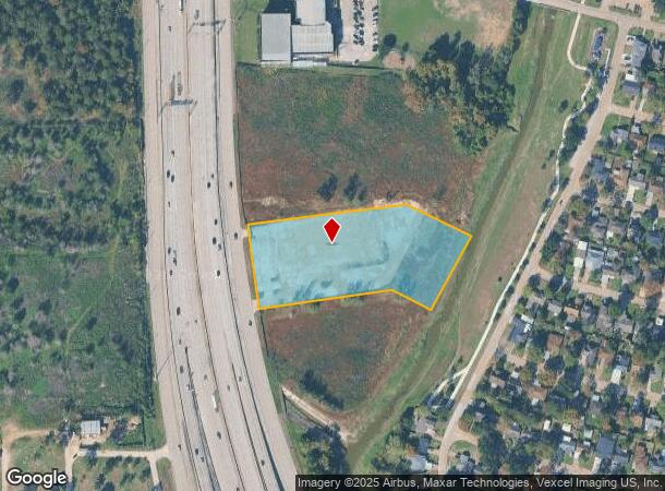
3520 E Sam Houston Pkwy N
1193860010002
Joplin Beltway
Outdoorrecreationbeachmountaindesert
RES B BLK 1 JOPLIN BELTWAY
AE
Harris
48201C0720M
Texas
2024
4.06 AC
2025
Northeast Hwy 90
252400
Houston
202,544 SF
Houston-The Woodlands-Sugar Land, TX
DEMOGRAPHICS near 3520 E Sam Houston Pkwy N
1 Mile
3 Mile
5 Mile
2024 Total Population
15,140
93,874
146,096
2029 Population
15,398
94,954
148,686
Pop Growth 2024-2029
+ 1.70%
+ 1.15%
+ 1.77%
Average Age
33
34
34
2024 Total Households
4,292
28,871
44,554
HH Growth 2024-2029
+ 1.65%
+ 1.07%
+ 1.71%
Median Household Inc
$50,150
$56,142
$54,929
Avg Household Size
3.40
3.20
3.20
2024 Avg HH Vehicles
2.00
2.00
2.00
Median Home Value
$111,596
$154,957
$151,273
Median Year Built
1980
1984
1983
Nearby Places
Map Layers
Map Styles
 Street
 Aerial
- Restaurants
- Banks
- Shops
- Fitness
- Groceries
PUBLIC TRANSPORTATION
AIRPORT
William P Hobby
DRIVE
WALK
Distance
William P Hobby
35 min
20.6 mi
George Bush Intcntl/Houston
DRIVE
WALK
Distance
George Bush Intcntl/Houston
27 min
22.2 mi
Freight Ports
Port of Houston
DRIVE
WALK
Distance
Port of Houston
22 min
12.6 mi
SALE & LEASE HISTORY
LISTING DATE
SALE/LEASE

Aug 02, 2021
For Lease
Aug 02, 2021
For Sale
Nearby Properties
Address
Land Use
TOTAL SIZE
Lot Size
Zoning
Address
Land Use
TOTAL SIZE
Lot Size
Zoning
10,093,711 SF
30.83 AC
Address
Land Use
TOTAL SIZE
Lot Size
Zoning
8,203,364 SF
183.34 AC
Address
Land Use
TOTAL SIZE
Lot Size
Zoning
2,936,644 SF
59.90 AC
Address
Land Use
TOTAL SIZE
Lot Size
Zoning
158.48 AC
Address
Land Use
TOTAL SIZE
Lot Size
Zoning
760,851 SF
41.87 AC
Address
Land Use
TOTAL SIZE
Lot Size
Zoning
59.10 AC
Address
Land Use
TOTAL SIZE
Lot Size
Zoning
2,124,914 SF
243.08 AC
Address
Land Use
TOTAL SIZE
Lot Size
Zoning
30.84 AC
Address
Land Use
TOTAL SIZE
Lot Size
Zoning
730,000 SF
11.57 AC
Address
Land Use
TOTAL SIZE
Lot Size
Zoning
398,995 SF
27.39 AC
Address
Land Use
TOTAL SIZE
Lot Size
Zoning
271,428 SF
10.57 AC
Address
Land Use
TOTAL SIZE
Lot Size
Zoning
485,662 SF
48.80 AC
Address
Land Use
TOTAL SIZE
Lot Size
Zoning
11,203 SF
5.85 AC
Address
Land Use
TOTAL SIZE
Lot Size
Zoning
17.40 AC
Address
Land Use
TOTAL SIZE
Lot Size
Zoning
248,293 SF
13.20 AC
Address
Land Use
TOTAL SIZE
Lot Size
Zoning
187,726 SF
32.24 AC
Address
Land Use
TOTAL SIZE
Lot Size
Zoning
526,975 SF
21.08 AC
Address
Land Use
TOTAL SIZE
Lot Size
Zoning
195,732 SF
19.50 AC
Address
Land Use
TOTAL SIZE
Lot Size
Zoning
49,384 SF
69.01 AC
Address
Land Use
TOTAL SIZE
Lot Size
Zoning
235,624 SF
10.06 AC
Address
Land Use
TOTAL SIZE
Lot Size
Zoning
205,001 SF
16.63 AC
Address
Land Use
TOTAL SIZE
Lot Size
Zoning
208,648 SF
8.99 AC
Address
Land Use
TOTAL SIZE
Lot Size
Zoning
537,768 SF
12.46 AC
Address
Land Use
TOTAL SIZE
Lot Size
Zoning
377,109 SF
17.36 AC
Address
Land Use
TOTAL SIZE
Lot Size
Zoning
197,953 SF
8.29 AC
Address
Land Use
TOTAL SIZE
Lot Size
Zoning
246,277 SF
10.91 AC
Address
Land Use
TOTAL SIZE
Lot Size
Zoning
104,829 SF
26.14 AC
Address
Land Use
TOTAL SIZE
Lot Size
Zoning
451,243 SF
20.10 AC
Address
Land Use
TOTAL SIZE
Lot Size
Zoning
202,747 SF
15.93 AC
The World's #1 Commercial Real Estate Marketplace
Connect with us
© 2026 CoStar Group
The information above has been obtained from sources believed reliable. While we do not doubt its accuracy we have not verified it and make no guarantee, warranty or representation about it. It is your responsibility to independently confirm its accuracy and completeness. Any projections, opinions, assumptions, or estimates used are for example only and do not represent the current or future performance of the property. The value of this transaction to you depends on tax and other factors which should be evaluated by your tax, financial, and legal advisors. You and your advisors should conduct a careful, independent investigation of the property to determine to your satisfaction the suitability of the property for your needs.