Property Record
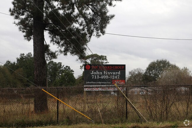
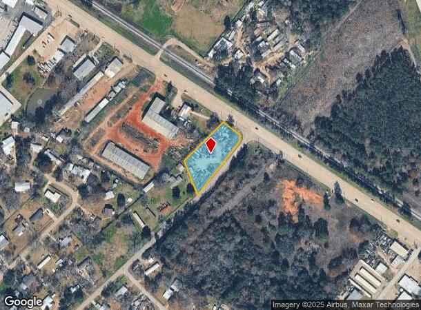
35207 State Highway 249, Pinehurst, TX 77362

NEARBY LISTINGS FOR SALE OR LEASE
Property Detail
35207 State Highway 249
Houston-Pasadena-The Woodlands, TX
Canfield Beckman
0120-01-01000
A0120 - CANFIELD BECKMAN, TRACT 10, ACRES 0.9434
Residentialacreage
Montgomery
X
Texas
48339C0495G
0.94 AC
2024
Northwest Outlier
2025
Houston
690206
DEMOGRAPHICS near 35207 State Highway 249
1 Mile
3 Mile
5 Mile
2024 Total Population
2,169
17,755
52,456
2029 Population
2,721
21,836
63,680
Pop Growth 2024-2029
+ 25.45%
+ 22.99%
+ 21.40%
Average Age
39
39
39
2024 Total Households
719
5,858
17,321
HH Growth 2024-2029
+ 25.45%
+ 23.11%
+ 21.37%
Median Household Inc
$127,631
$95,010
$94,326
Avg Household Size
2.90
2.90
2.90
2024 Avg HH Vehicles
2.00
2.00
2.00
Median Home Value
$436,250
$371,777
$365,780
Median Year Built
2010
2001
2003
Nearby Places
Map Layers
Map Styles
 Street
 Aerial
- Restaurants
- Banks
- Shops
- Fitness
- Groceries
PUBLIC TRANSPORTATION
AIRPORT
George Bush Intcntl/Houston
DRIVE
WALK
Distance
George Bush Intcntl/Houston
41 min
33.4 mi
Freight Ports
Port of Houston
DRIVE
WALK
Distance
Port of Houston
61 min
44.0 mi
SALE & LEASE HISTORY
LISTING DATE
SALE/LEASE

Sep 24, 2016
For Sale
May 08, 2018
For Lease
Nearby Properties
Address
Land Use
TOTAL SIZE
Lot Size
Zoning
Address
Land Use
TOTAL SIZE
Lot Size
Zoning
108,038 SF
7.58 AC
Address
Land Use
TOTAL SIZE
Lot Size
Zoning
87,278 SF
2.65 AC
I2
Address
Land Use
TOTAL SIZE
Lot Size
Zoning
14,865 SF
1.98 AC
2
Address
Land Use
TOTAL SIZE
Lot Size
Zoning
32,624 SF
7.54 AC
Address
Land Use
TOTAL SIZE
Lot Size
Zoning
100,389 SF
5.47 AC
2
Address
Land Use
TOTAL SIZE
Lot Size
Zoning
55,247 SF
10.38 AC
Address
Land Use
TOTAL SIZE
Lot Size
Zoning
103,710 SF
7.50 AC
2
Address
Land Use
TOTAL SIZE
Lot Size
Zoning
68,950 SF
18.57 AC
2
Address
Land Use
TOTAL SIZE
Lot Size
Zoning
55,656 SF
5.09 AC
2
Address
Land Use
TOTAL SIZE
Lot Size
Zoning
1,722 SF
31.19 AC
2
Address
Land Use
TOTAL SIZE
Lot Size
Zoning
48,444 SF
9.55 AC
Address
Land Use
TOTAL SIZE
Lot Size
Zoning
25,050 SF
2.16 AC
Address
Land Use
TOTAL SIZE
Lot Size
Zoning
43,400 SF
6.05 AC
2
Address
Land Use
TOTAL SIZE
Lot Size
Zoning
13,280 SF
4 AC
Address
Land Use
TOTAL SIZE
Lot Size
Zoning
5,353 SF
37.56 AC
Address
Land Use
TOTAL SIZE
Lot Size
Zoning
4,365 SF
0.99 AC
Address
Land Use
TOTAL SIZE
Lot Size
Zoning
13,545 SF
4.56 AC
2
Address
Land Use
TOTAL SIZE
Lot Size
Zoning
52,800 SF
3.81 AC
2
Address
Land Use
TOTAL SIZE
Lot Size
Zoning
10,500 SF
1.64 AC
Address
Land Use
TOTAL SIZE
Lot Size
Zoning
8,958 SF
40.19 AC
2
Address
Land Use
TOTAL SIZE
Lot Size
Zoning
11,723 SF
2.50 AC
2
Address
Land Use
TOTAL SIZE
Lot Size
Zoning
34,400 SF
5 AC
Address
Land Use
TOTAL SIZE
Lot Size
Zoning
37,512 SF
9.91 AC
2
Address
Land Use
TOTAL SIZE
Lot Size
Zoning
13,871 SF
1.68 AC
2
Address
Land Use
TOTAL SIZE
Lot Size
Zoning
31,627 SF
11.46 AC
Address
Land Use
TOTAL SIZE
Lot Size
Zoning
44,301 SF
4.23 AC
2
Address
Land Use
TOTAL SIZE
Lot Size
Zoning
24,000 SF
1 AC
Address
Land Use
TOTAL SIZE
Lot Size
Zoning
13,260 SF
2.41 AC
2
Address
Land Use
TOTAL SIZE
Lot Size
Zoning
8,320 SF
1.37 AC
Address
Land Use
TOTAL SIZE
Lot Size
Zoning
8,650 SF
1.19 AC
The World's #1 Commercial Real Estate Marketplace
Connect with us
© 2026 CoStar Group
The information above has been obtained from sources believed reliable. While we do not doubt its accuracy we have not verified it and make no guarantee, warranty or representation about it. It is your responsibility to independently confirm its accuracy and completeness. Any projections, opinions, assumptions, or estimates used are for example only and do not represent the current or future performance of the property. The value of this transaction to you depends on tax and other factors which should be evaluated by your tax, financial, and legal advisors. You and your advisors should conduct a careful, independent investigation of the property to determine to your satisfaction the suitability of the property for your needs.