Property Record
3521 Outer Loop, Louisville, KY 40219


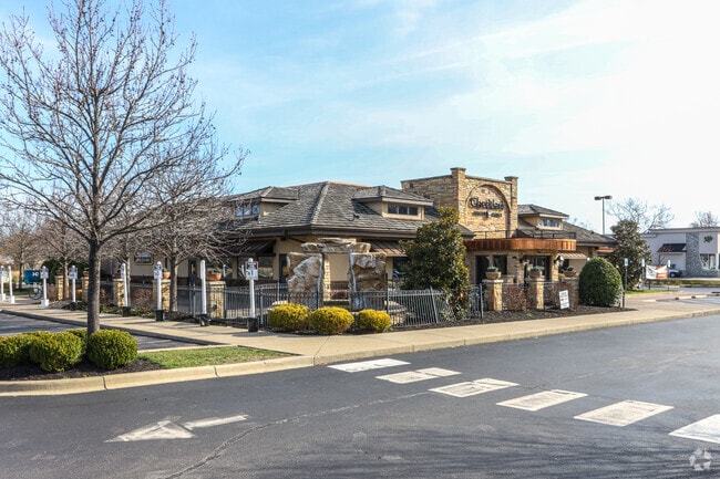
Property Detail
3521 Outer Loop
064104390000
2.344 AC TRACT 2 MINOR PLAT 9219X994 OUTER LOOP NEAR MINYARD DR
Restaurantbuilding
Jefferson
B and X Area of moderate flood hazard, usually the area between the limits of the 100-year and 500-year floods.
Kentucky
2025
2.31 AC
2025
South Central
011904
Louisville
8,412 SF
Louisville/Jefferson County, KY-IN
NEARBY LISTINGS FOR SALE OR LEASE
DEMOGRAPHICS near 3521 Outer Loop
1 mile
3 mile
5 mile
2025 Total Population
8,462
61,815
176,568
2030 Population
8,705
63,052
180,546
Pop Growth 2025-2030
+ 2.87%
+ 2.00%
+ 2.25%
Average Age
38
38
39
2025 Total Households
3,414
24,461
70,449
HH Growth 2025-2030
+ 3.05%
+ 2.06%
+ 2.30%
Median Household Inc
$47,537
$52,301
$58,985
Avg Household Size
2.40
2.40
2.40
2025 Avg HH Vehicles
2.00
2.00
2.00
Median Home Value
$169,234
$183,831
$194,266
Median Year Built
1971
1970
1971
Nearby Places
Map Layers
Map Styles
 Street
 Aerial
Layers
 Traffic
 Biking
Places
Listings with unknown addresses are not visible on the map
- Restaurants
- Banks
- Shops
- Fitness
- Groceries
PUBLIC TRANSPORTATION
AIRPORT
Louisville Muhammad Ali International
Drive
Walk
Distance
Louisville Muhammad Ali International
12 min
5.3 mi
SALE & LEASE HISTORY
LISTING DATE
SALE/LEASE

Nov 16, 2017
For Lease
Aug 22, 2022
For Sale
Nearby Properties
Address
Land Use
TOTAL SIZE
Lot Size
Zoning
Address
Land Use
TOTAL SIZE
Lot Size
Zoning
226,400 SF
150.18 AC
EZ1-ENTERP
Address
Land Use
TOTAL SIZE
Lot Size
Zoning
257,385 SF
176.30 AC
Address
Land Use
TOTAL SIZE
Lot Size
Zoning
109.84 AC
R5-RESIDEN
Address
Land Use
TOTAL SIZE
Lot Size
Zoning
221,115 SF
97.92 AC
EZ1-ENTERP
Address
Land Use
TOTAL SIZE
Lot Size
Zoning
61.37 AC
C2-COMMERC
Address
Land Use
TOTAL SIZE
Lot Size
Zoning
822,500 SF
44.75 AC
EZ1-ENTERP
Address
Land Use
TOTAL SIZE
Lot Size
Zoning
Address
Land Use
TOTAL SIZE
Lot Size
Zoning
34.73 AC
Address
Land Use
TOTAL SIZE
Lot Size
Zoning
39.61 AC
Address
Land Use
TOTAL SIZE
Lot Size
Zoning
35 AC
C2-COMMERC
Address
Land Use
TOTAL SIZE
Lot Size
Zoning
517,000 SF
31.95 AC
EZ1-ENTERP
Address
Land Use
TOTAL SIZE
Lot Size
Zoning
679,250 SF
35.34 AC
Address
Land Use
TOTAL SIZE
Lot Size
Zoning
19.16 AC
Address
Land Use
TOTAL SIZE
Lot Size
Zoning
1,484 SF
17.11 AC
R4-RESIDEN
Address
Land Use
TOTAL SIZE
Lot Size
Zoning
22.14 AC
EZ1-ENTERP
Address
Land Use
TOTAL SIZE
Lot Size
Zoning
102,600 SF
173.89 AC
EZ1-ENTERP
Address
Land Use
TOTAL SIZE
Lot Size
Zoning
12,972 SF
28.36 AC
R6-RESIDEN
Address
Land Use
TOTAL SIZE
Lot Size
Zoning
14,166 SF
16.32 AC
C1-COMMERC
Address
Land Use
TOTAL SIZE
Lot Size
Zoning
407,840 SF
25.51 AC
C2-COMMERC
Address
Land Use
TOTAL SIZE
Lot Size
Zoning
4,745 SF
17.95 AC
Address
Land Use
TOTAL SIZE
Lot Size
Zoning
636,716 SF
33.71 AC
Address
Land Use
TOTAL SIZE
Lot Size
Zoning
396,422 SF
23.30 AC
PEC-PLANNE
Address
Land Use
TOTAL SIZE
Lot Size
Zoning
500,000 SF
27.89 AC
Address
Land Use
TOTAL SIZE
Lot Size
Zoning
402,560 SF
23.70 AC
PEC-PLANNE
Address
Land Use
TOTAL SIZE
Lot Size
Zoning
273,585 SF
42.27 AC
Address
Land Use
TOTAL SIZE
Lot Size
Zoning
18.37 AC
Address
Land Use
TOTAL SIZE
Lot Size
Zoning
5,200 SF
7.55 AC
R7-RESIDEN
Address
Land Use
TOTAL SIZE
Lot Size
Zoning
9.44 AC
R5-RESIDEN
Address
Land Use
TOTAL SIZE
Lot Size
Zoning
27.92 AC
EZ1-ENTERP
Address
Land Use
TOTAL SIZE
Lot Size
Zoning
23.20 AC
EZ1-ENTERP
The World's #1 Commercial Real Estate Marketplace
Connect with us
© 2026 CoStar Group
The information above has been obtained from sources believed reliable. While we do not doubt its accuracy we have not verified it and make no guarantee, warranty or representation about it. It is your responsibility to independently confirm its accuracy and completeness. Any projections, opinions, assumptions, or estimates used are for example only and do not represent the current or future performance of the property. The value of this transaction to you depends on tax and other factors which should be evaluated by your tax, financial, and legal advisors. You and your advisors should conduct a careful, independent investigation of the property to determine to your satisfaction the suitability of the property for your needs.