Property Record
3521 W Eisenhower Blvd, Loveland, CO 80537
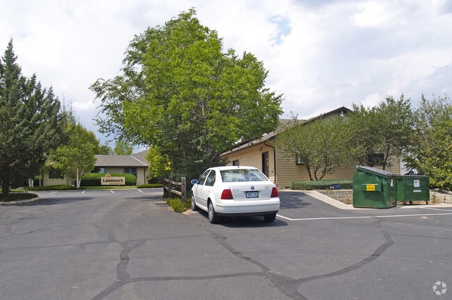


Property Detail
3521 W Eisenhower Blvd
95093-11-901
LOT 1, VANGUARD FAMLECO 3RD SUB, LOV
Fratsororityhouse
Larimer
T
Colorado
B and X Area of moderate flood hazard, usually the area between the limits of the 100-year and 500-year floods.
1
2024
1.99 AC
2025
Outlying Larimer County
001902
Denver
10,088 SF
Fort Collins-Loveland, CO
NEARBY LISTINGS FOR SALE OR LEASE
DEMOGRAPHICS near 3521 W Eisenhower Blvd
1 mile
3 mile
5 mile
2025 Total Population
4,873
45,584
83,836
2030 Population
4,996
46,433
85,779
Pop Growth 2025-2030
+ 2.52%
+ 1.86%
+ 2.32%
Average Age
46
44
43
2025 Total Households
2,007
18,980
34,813
HH Growth 2025-2030
+ 2.59%
+ 1.93%
+ 2.39%
Median Household Inc
$85,454
$87,278
$83,887
Avg Household Size
2.40
2.30
2.30
2025 Avg HH Vehicles
2.00
2.00
2.00
Median Home Value
$600,118
$489,097
$489,143
Median Year Built
1989
1984
1988
Nearby Places
Map Layers
Map Styles
 Street
 Aerial
Transit
 Traffic
 Biking
Places
Listings with unknown addresses are not visible on the map
- Restaurants
- Banks
- Shops
- Fitness
- Groceries
SALE & LEASE HISTORY
LISTING DATE
SALE/LEASE

Mar 15, 2021
For Sale
Nearby Properties
Address
Land Use
TOTAL SIZE
Lot Size
Zoning
Address
Land Use
TOTAL SIZE
Lot Size
Zoning
201,500 SF
28.43 AC
R1E
Address
Land Use
TOTAL SIZE
Lot Size
Zoning
117,434 SF
29.34 AC
R1
Address
Land Use
TOTAL SIZE
Lot Size
Zoning
200,420 SF
41.52 AC
R1
Address
Land Use
TOTAL SIZE
Lot Size
Zoning
115,599 SF
13.15 AC
P38
Address
Land Use
TOTAL SIZE
Lot Size
Zoning
147,663 SF
5.01 AC
R3E
Address
Land Use
TOTAL SIZE
Lot Size
Zoning
745,209 SF
63.03 AC
I
Address
Land Use
TOTAL SIZE
Lot Size
Zoning
139,289 SF
23.55 AC
I
Address
Land Use
TOTAL SIZE
Lot Size
Zoning
59.21 AC
FA
Address
Land Use
TOTAL SIZE
Lot Size
Zoning
296,360 SF
11.88 AC
B
Address
Land Use
TOTAL SIZE
Lot Size
Zoning
162,703 SF
14.92 AC
B
Address
Land Use
TOTAL SIZE
Lot Size
Zoning
117,496 SF
6.24 AC
Address
Land Use
TOTAL SIZE
Lot Size
Zoning
137,950 SF
10.16 AC
Address
Land Use
TOTAL SIZE
Lot Size
Zoning
87,518 SF
8.02 AC
Address
Land Use
TOTAL SIZE
Lot Size
Zoning
93,908 SF
28.86 AC
R1
Address
Land Use
TOTAL SIZE
Lot Size
Zoning
303,858 SF
30.21 AC
Address
Land Use
TOTAL SIZE
Lot Size
Zoning
269,696 SF
1.97 AC
Address
Land Use
TOTAL SIZE
Lot Size
Zoning
97,225 SF
4.60 AC
P55
Address
Land Use
TOTAL SIZE
Lot Size
Zoning
41,580 SF
1.83 AC
B
Address
Land Use
TOTAL SIZE
Lot Size
Zoning
114,864 SF
0.71 AC
Address
Land Use
TOTAL SIZE
Lot Size
Zoning
62,966 SF
0.83 AC
Address
Land Use
TOTAL SIZE
Lot Size
Zoning
34,430 SF
2.59 AC
B
Address
Land Use
TOTAL SIZE
Lot Size
Zoning
51,209 SF
4.23 AC
P7
Address
Land Use
TOTAL SIZE
Lot Size
Zoning
50,715 SF
10.23 AC
R1
Address
Land Use
TOTAL SIZE
Lot Size
Zoning
48,000 SF
10 AC
P58
Address
Land Use
TOTAL SIZE
Lot Size
Zoning
50,098 SF
4.49 AC
B
Address
Land Use
TOTAL SIZE
Lot Size
Zoning
71,337 SF
1.72 AC
BE
Address
Land Use
TOTAL SIZE
Lot Size
Zoning
58,901 SF
3.64 AC
B
Address
Land Use
TOTAL SIZE
Lot Size
Zoning
55,598 SF
5 AC
R3E
Address
Land Use
TOTAL SIZE
Lot Size
Zoning
31,800 SF
2.99 AC
B
Address
Land Use
TOTAL SIZE
Lot Size
Zoning
99,341 SF
0.31 AC
The World's #1 Commercial Real Estate Marketplace
Connect with us
© 2026 CoStar Group
The information above has been obtained from sources believed reliable. While we do not doubt its accuracy we have not verified it and make no guarantee, warranty or representation about it. It is your responsibility to independently confirm its accuracy and completeness. Any projections, opinions, assumptions, or estimates used are for example only and do not represent the current or future performance of the property. The value of this transaction to you depends on tax and other factors which should be evaluated by your tax, financial, and legal advisors. You and your advisors should conduct a careful, independent investigation of the property to determine to your satisfaction the suitability of the property for your needs.