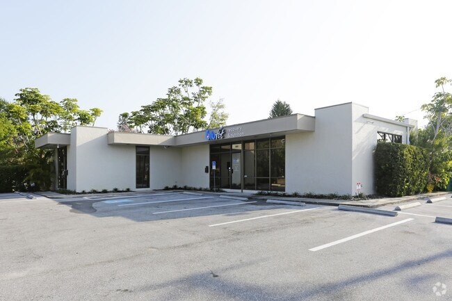
Property Record
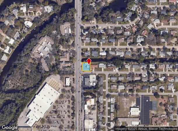
3525 S Tuttle Ave, Sarasota, FL 34239
Current Lease Availabilities
NEARBY LISTINGS FOR SALE OR LEASE
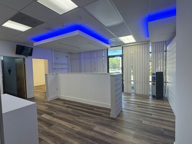
Property Detail
3525 S Tuttle Ave
North Port-Sarasota-Bradenton, FL
South Gate Unit 19
0059-12-0051
LOT 1 BLK 74 SOUTH GATE UNIT 19
Officebuilding
Sarasota
AE
Florida
12115C0142G
1
2023
0.23 AC
2024
Sarasota
001602
Tampa/St Petersburg
2,136 SF
DEMOGRAPHICS near 3525 S Tuttle Ave
1 Mile
3 Mile
5 Mile
2024 Total Population
10,645
85,975
185,157
2029 Population
12,010
98,317
213,388
Pop Growth 2024-2029
+ 12.82%
+ 14.36%
+ 15.25%
Average Age
44
47
48
2024 Total Households
4,842
38,619
84,557
HH Growth 2024-2029
+ 12.70%
+ 14.38%
+ 15.47%
Median Household Inc
$63,042
$68,723
$71,520
Avg Household Size
2.10
2.10
2.10
2024 Avg HH Vehicles
2.00
2.00
2.00
Median Home Value
$329,991
$339,266
$357,723
Median Year Built
1966
1975
1979
Nearby Places
- Restaurants
- Banks
- Shops
- Fitness
- Groceries
PUBLIC TRANSPORTATION
AIRPORT
Sarasota/Bradenton International
DRIVE
WALK
Distance
Sarasota/Bradenton International
21 min
9.1 mi
Freight Ports
Port Manatee
DRIVE
WALK
Distance
Port Manatee
1 min
23.1 mi
Nearby Properties
Address
Land Use
TOTAL SIZE
Lot Size
Zoning
Address
Land Use
TOTAL SIZE
Lot Size
Zoning
2,010,667 SF
14.38 AC
SMH
Address
Land Use
TOTAL SIZE
Lot Size
Zoning
439,798 SF
4.20 AC
DTC
Address
Land Use
TOTAL SIZE
Lot Size
Zoning
595,745 SF
42.33 AC
GU
Address
Land Use
TOTAL SIZE
Lot Size
Zoning
437,836 SF
72.05 AC
GU
Address
Land Use
TOTAL SIZE
Lot Size
Zoning
912,253 SF
43.46 AC
PID
Address
Land Use
TOTAL SIZE
Lot Size
Zoning
950 SF
27.44 AC
G
Address
Land Use
TOTAL SIZE
Lot Size
Zoning
463,072 SF
2.21 AC
DTC
Address
Land Use
TOTAL SIZE
Lot Size
Zoning
223,241 SF
7.80 AC
DTE
Address
Land Use
TOTAL SIZE
Lot Size
Zoning
263,961 SF
18.88 AC
RMF3
Address
Land Use
TOTAL SIZE
Lot Size
Zoning
199,653 SF
0.38 AC
DTC
Address
Land Use
TOTAL SIZE
Lot Size
Zoning
91,324 SF
2.18 AC
SMH
Address
Land Use
TOTAL SIZE
Lot Size
Zoning
146,948 SF
1.08 AC
SMH
Address
Land Use
TOTAL SIZE
Lot Size
Zoning
296,092 SF
38.78 AC
G
Address
Land Use
TOTAL SIZE
Lot Size
Zoning
287,086 SF
44.66 AC
G
Address
Land Use
TOTAL SIZE
Lot Size
Zoning
211,459 SF
2.36 AC
DTC
Address
Land Use
TOTAL SIZE
Lot Size
Zoning
19,464 SF
38.95 AC
G
Address
Land Use
TOTAL SIZE
Lot Size
Zoning
237,930 SF
1.58 AC
DTC
Address
Land Use
TOTAL SIZE
Lot Size
Zoning
332,822 SF
34.74 AC
CG
Address
Land Use
TOTAL SIZE
Lot Size
Zoning
532,515 SF
1.65 AC
DTC
Address
Land Use
TOTAL SIZE
Lot Size
Zoning
157,854 SF
8.32 AC
OPI
Address
Land Use
TOTAL SIZE
Lot Size
Zoning
26,202 SF
1.21 AC
G
Address
Land Use
TOTAL SIZE
Lot Size
Zoning
196,633 SF
14.73 AC
BG
Address
Land Use
TOTAL SIZE
Lot Size
Zoning
150,433 SF
10.55 AC
RMF4
Address
Land Use
TOTAL SIZE
Lot Size
Zoning
200,598 SF
1.49 AC
DTC
Address
Land Use
TOTAL SIZE
Lot Size
Zoning
223,929 SF
28.24 AC
RMF1
Address
Land Use
TOTAL SIZE
Lot Size
Zoning
205,136 SF
17.32 AC
RMF2
Address
Land Use
TOTAL SIZE
Lot Size
Zoning
233,075 SF
19.49 AC
RMF2
Address
Land Use
TOTAL SIZE
Lot Size
Zoning
48,427 SF
3.80 AC
CSCC
Address
Land Use
TOTAL SIZE
Lot Size
Zoning
133,430 SF
19.60 AC
GU
Address
Land Use
TOTAL SIZE
Lot Size
Zoning
202,976 SF
5.13 AC
DTC
The World's #1 Commercial Real Estate Marketplace
Connect with us
© 2025 CoStar Group
The information above has been obtained from sources believed reliable. While we do not doubt its accuracy we have not verified it and make no guarantee, warranty or representation about it. It is your responsibility to independently confirm its accuracy and completeness. Any projections, opinions, assumptions, or estimates used are for example only and do not represent the current or future performance of the property. The value of this transaction to you depends on tax and other factors which should be evaluated by your tax, financial, and legal advisors. You and your advisors should conduct a careful, independent investigation of the property to determine to your satisfaction the suitability of the property for your needs.