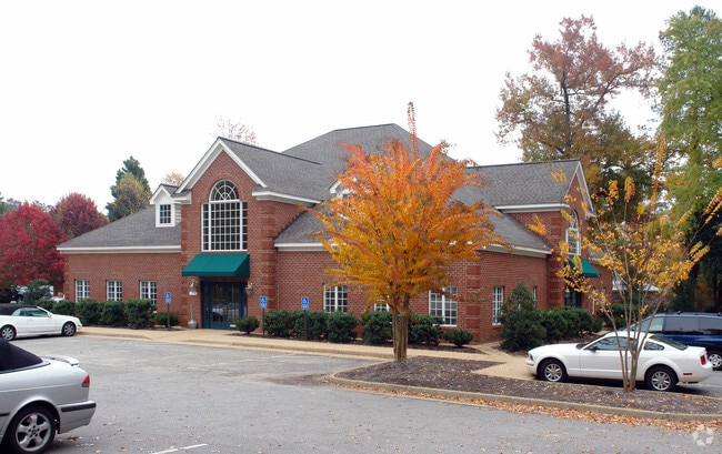
Property Record
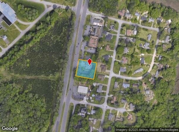
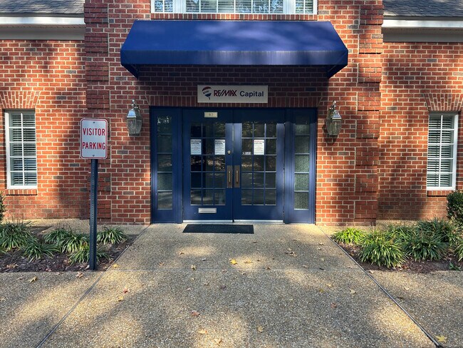
3526 George Washington Mem Hwy, Yorktown, VA 23693
Current Lease Availabilities
NEARBY LISTINGS FOR SALE OR LEASE
Property Detail
3526 George Washington Mem Hwy
Virginia Beach-Norfolk-Newport News, VA-NC
Mill Farm
S04B-3267-3425
MILL FARM SEC 3 LOT 31B(RESUB MILL FARM PARCEL 2)
Officebuilding
York
X
Virginia
51199C0139D
31b
2024
0.81 AC
2025
York
050205
Hampton Roads
8,574 SF
DEMOGRAPHICS near 3526 George Washington Mem Hwy
1 Mile
3 Mile
5 Mile
2024 Total Population
3,774
47,629
158,204
2029 Population
3,981
48,932
159,449
Pop Growth 2024-2029
+ 5.48%
+ 2.74%
+ 0.79%
Average Age
44
40
39
2024 Total Households
1,419
18,614
63,614
HH Growth 2024-2029
+ 5.50%
+ 2.45%
+ 0.58%
Median Household Inc
$108,956
$93,424
$75,967
Avg Household Size
2.60
2.50
2.40
2024 Avg HH Vehicles
3.00
2.00
2.00
Median Home Value
$395,085
$352,200
$294,945
Median Year Built
1986
1990
1986
Nearby Places
- Restaurants
- Banks
- Shops
- Fitness
- Groceries
PUBLIC TRANSPORTATION
COMMUTER RAIL
Newport News (Northeast Regional - Amtrak)
DRIVE
WALK
Distance
Newport News (Northeast Regional - Amtrak)
17 min
8.9 mi
AIRPORT
Newport News/Williamsburg International
DRIVE
WALK
Distance
Newport News/Williamsburg International
12 min
5.9 mi
Norfolk International
DRIVE
WALK
Distance
Norfolk International
40 min
26.9 mi
Freight Ports
Virginia Port Authority - Newport News
DRIVE
WALK
Distance
Virginia Port Authority - Newport News
21 min
14.8 mi
Nearby Properties
Address
Land Use
TOTAL SIZE
Lot Size
Zoning
Address
Land Use
TOTAL SIZE
Lot Size
Zoning
717,621 SF
141.28 AC
M1
Address
Land Use
TOTAL SIZE
Lot Size
Zoning
464,936 SF
33.26 AC
R7
Address
Land Use
TOTAL SIZE
Lot Size
Zoning
565,343 SF
46.70 AC
C1
Address
Land Use
TOTAL SIZE
Lot Size
Zoning
75,168 SF
824.63 AC
M1
Address
Land Use
TOTAL SIZE
Lot Size
Zoning
393,640 SF
14.12 AC
PLANNED DE
Address
Land Use
TOTAL SIZE
Lot Size
Zoning
210,585 SF
32.06 AC
R9
Address
Land Use
TOTAL SIZE
Lot Size
Zoning
100 SF
7.27 AC
R9
Address
Land Use
TOTAL SIZE
Lot Size
Zoning
39,492 SF
798.51 AC
RESOURCE C
Address
Land Use
TOTAL SIZE
Lot Size
Zoning
71,551 SF
110 AC
O3
Address
Land Use
TOTAL SIZE
Lot Size
Zoning
100 SF
7.68 AC
R9
Address
Land Use
TOTAL SIZE
Lot Size
Zoning
297,617 SF
50.90 AC
RC,GB
Address
Land Use
TOTAL SIZE
Lot Size
Zoning
19.86 AC
R8
Address
Land Use
TOTAL SIZE
Lot Size
Zoning
100 SF
14 AC
R7
Address
Land Use
TOTAL SIZE
Lot Size
Zoning
197,355 SF
10.89 AC
R8
Address
Land Use
TOTAL SIZE
Lot Size
Zoning
252 SF
17.21 AC
MULTI-FAMI
Address
Land Use
TOTAL SIZE
Lot Size
Zoning
5,389 SF
24.08 AC
RMF,LB
Address
Land Use
TOTAL SIZE
Lot Size
Zoning
13.10 AC
R5
Address
Land Use
TOTAL SIZE
Lot Size
Zoning
97,180 SF
53.17 AC
C1
Address
Land Use
TOTAL SIZE
Lot Size
Zoning
100 SF
16.23 AC
R7
Address
Land Use
TOTAL SIZE
Lot Size
Zoning
365,956 SF
27.40 AC
M1
Address
Land Use
TOTAL SIZE
Lot Size
Zoning
100 SF
11.10 AC
R7
Address
Land Use
TOTAL SIZE
Lot Size
Zoning
95,053 SF
52.81 AC
R3
Address
Land Use
TOTAL SIZE
Lot Size
Zoning
156 SF
19.99 AC
MULTI-FAMI
Address
Land Use
TOTAL SIZE
Lot Size
Zoning
108,911 SF
12.75 AC
C1
Address
Land Use
TOTAL SIZE
Lot Size
Zoning
207,183 SF
17.27 AC
C1
Address
Land Use
TOTAL SIZE
Lot Size
Zoning
15,440 SF
5.20 AC
PLANNED DE
Address
Land Use
TOTAL SIZE
Lot Size
Zoning
40,273 SF
48.06 AC
M2
Address
Land Use
TOTAL SIZE
Lot Size
Zoning
55,570 SF
37.77 AC
M1
Address
Land Use
TOTAL SIZE
Lot Size
Zoning
22.90 AC
R5
Address
Land Use
TOTAL SIZE
Lot Size
Zoning
1,669.43 AC
RESOURCE C
The World's #1 Commercial Real Estate Marketplace
Connect with us
© 2025 CoStar Group
The information above has been obtained from sources believed reliable. While we do not doubt its accuracy we have not verified it and make no guarantee, warranty or representation about it. It is your responsibility to independently confirm its accuracy and completeness. Any projections, opinions, assumptions, or estimates used are for example only and do not represent the current or future performance of the property. The value of this transaction to you depends on tax and other factors which should be evaluated by your tax, financial, and legal advisors. You and your advisors should conduct a careful, independent investigation of the property to determine to your satisfaction the suitability of the property for your needs.