Property Record
3527 Highway 12 Se, Delano, MN 55328

NEARBY LISTINGS FOR SALE OR LEASE
Property Detail
3527 Highway 12 Se
Minneapolis-St. Paul-Bloomington, MN-WI
Franklin Twp
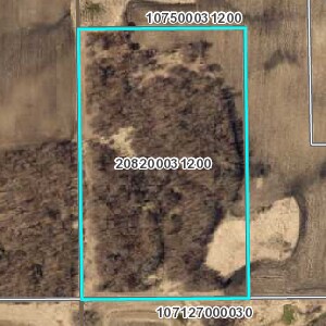
208-200-031200
SECT-03 TWP-118 RANGE-025 UNPLATTED LAND FRANKLIN TWP3 W1/2 OF NE1/4 & E1 1/2RDS OF N14RDS OF NW1/4 EX PARCEL 33 ON MNDOT R/W
Vacantlandnec
Wright
2025
Minnesota
2025
20.39 AC
101002
Wright County
1,102 SF
Minneapolis/St Paul
DEMOGRAPHICS near 3527 Highway 12 Se
1 Mile
3 Mile
5 Mile
2024 Total Population
144
8,016
19,093
2029 Population
162
8,931
21,116
Pop Growth 2024-2029
+ 12.50%
+ 11.41%
+ 10.60%
Average Age
38
39
39
2024 Total Households
48
2,852
6,943
HH Growth 2024-2029
+ 12.50%
+ 11.50%
+ 10.70%
Median Household Inc
$117,499
$100,469
$97,194
Avg Household Size
3.00
2.70
2.70
2024 Avg HH Vehicles
2.00
2.00
2.00
Median Home Value
$399,999
$339,006
$320,369
Median Year Built
1991
1990
1992
Nearby Places
Map Layers
Map Styles
 Street
 Aerial
- Restaurants
- Banks
- Shops
- Fitness
- Groceries
Nearby Properties
Address
Land Use
TOTAL SIZE
Lot Size
Zoning
Address
Land Use
TOTAL SIZE
Lot Size
Zoning
73.93 AC
Address
Land Use
TOTAL SIZE
Lot Size
Zoning
2.42 AC
Address
Land Use
TOTAL SIZE
Lot Size
Zoning
45.40 AC
Address
Land Use
TOTAL SIZE
Lot Size
Zoning
1.43 AC
Address
Land Use
TOTAL SIZE
Lot Size
Zoning
29.60 AC
Address
Land Use
TOTAL SIZE
Lot Size
Zoning
8.75 AC
Address
Land Use
TOTAL SIZE
Lot Size
Zoning
12.85 AC
Address
Land Use
TOTAL SIZE
Lot Size
Zoning
35.30 AC
Address
Land Use
TOTAL SIZE
Lot Size
Zoning
135,530 SF
8.57 AC
Address
Land Use
TOTAL SIZE
Lot Size
Zoning
5.87 AC
Address
Land Use
TOTAL SIZE
Lot Size
Zoning
Address
Land Use
TOTAL SIZE
Lot Size
Zoning
5.71 AC
Address
Land Use
TOTAL SIZE
Lot Size
Zoning
6.72 AC
Address
Land Use
TOTAL SIZE
Lot Size
Zoning
33,518 SF
4.79 AC
Address
Land Use
TOTAL SIZE
Lot Size
Zoning
108,277 SF
5.62 AC
Address
Land Use
TOTAL SIZE
Lot Size
Zoning
58,465 SF
8.50 AC
Address
Land Use
TOTAL SIZE
Lot Size
Zoning
28,385 SF
54.73 AC
Address
Land Use
TOTAL SIZE
Lot Size
Zoning
19,849 SF
2.83 AC
Address
Land Use
TOTAL SIZE
Lot Size
Zoning
10.85 AC
Address
Land Use
TOTAL SIZE
Lot Size
Zoning
3.11 AC
Address
Land Use
TOTAL SIZE
Lot Size
Zoning
57,715 SF
3.84 AC
Address
Land Use
TOTAL SIZE
Lot Size
Zoning
17,597 SF
2.52 AC
Address
Land Use
TOTAL SIZE
Lot Size
Zoning
23,238 SF
14.84 AC
Address
Land Use
TOTAL SIZE
Lot Size
Zoning
Address
Land Use
TOTAL SIZE
Lot Size
Zoning
0.95 AC
Address
Land Use
TOTAL SIZE
Lot Size
Zoning
58,320 SF
2.95 AC
Address
Land Use
TOTAL SIZE
Lot Size
Zoning
Address
Land Use
TOTAL SIZE
Lot Size
Zoning
28,920 SF
3.88 AC
Address
Land Use
TOTAL SIZE
Lot Size
Zoning
14,936 SF
1.58 AC
Address
Land Use
TOTAL SIZE
Lot Size
Zoning
29,997 SF
2 AC
The World's #1 Commercial Real Estate Marketplace
Connect with us
© 2026 CoStar Group
The information above has been obtained from sources believed reliable. While we do not doubt its accuracy we have not verified it and make no guarantee, warranty or representation about it. It is your responsibility to independently confirm its accuracy and completeness. Any projections, opinions, assumptions, or estimates used are for example only and do not represent the current or future performance of the property. The value of this transaction to you depends on tax and other factors which should be evaluated by your tax, financial, and legal advisors. You and your advisors should conduct a careful, independent investigation of the property to determine to your satisfaction the suitability of the property for your needs.