Property Record
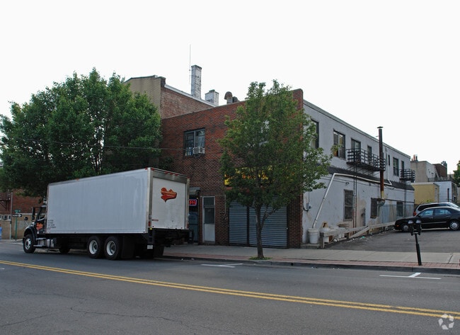
353 Anderson Ave, Fairview, NJ 07022
NEARBY LISTINGS FOR SALE OR LEASE
Property Detail
353 Anderson Ave
18-00414-0000-00027
37X100
Apartment
Bergen
X
New Jersey
34003C0278H
26
2024
0.06 AC
2025
GW Bridge
018102
Northern New Jersey
4,284 SF
New York-Jersey City-White Plains, NY-NJ
DEMOGRAPHICS near 353 Anderson Ave
1 mile
3 mile
5 mile
2024 Total Population
55,297
658,967
1,937,820
2029 Population
54,508
618,669
1,815,851
Pop Growth 2024-2029
(1.43%)
(6.12%)
(6.29%)
Average Age
41
42
41
2024 Total Households
21,666
280,554
830,109
HH Growth 2024-2029
(1.25%)
(6.39%)
(6.67%)
Median Household Inc
$83,281
$73,292
$70,010
Avg Household Size
2.50
2.20
2.20
2024 Avg HH Vehicles
1.00
1.00
.00
Median Home Value
$569,743
$736,646
$762,215
Median Year Built
1967
1950
1957
Nearby Places
Map Layers
Map Styles
 Street
 Aerial
Transit
 Traffic
 Biking
Places
Listings with unknown addresses are not visible on the map
- Restaurants
- Banks
- Shops
- Fitness
- Groceries
PUBLIC TRANSPORTATION
COMMUTER RAIL
Harlem-125Th Street Station (Harlem Line - Metro-North Commuter Railroad Company (Metro-North), Hudson Line - Metro-North Commuter Railroad Company (Metro-North), New Haven Line - Metro-North Commuter Railroad Company (Metro-North))
Drive
Walk
Distance
Harlem-125Th Street Station (Harlem Line - Metro-North Commuter Railroad Company (Metro-North), Hudson Line - Metro-North Commuter Railroad Company (Metro-North), New Haven Line - Metro-North Commuter Railroad Company (Metro-North))
16 min
9.4 mi
Yankees-E 153Rd Street Station (Hudson Line - Metro-North Commuter Railroad Company (Metro-North))
Drive
Walk
Distance
Yankees-E 153Rd Street Station (Hudson Line - Metro-North Commuter Railroad Company (Metro-North))
15 min
9.5 mi
AIRPORT
Newark Liberty International
Drive
Walk
Distance
Newark Liberty International
20 min
14.8 mi
LaGuardia
Drive
Walk
Distance
LaGuardia
27 min
15.1 mi
John F Kennedy International
Drive
Walk
Distance
John F Kennedy International
38 min
26.2 mi
Freight Ports
NY - Red Hook Container Terminal
Drive
Walk
Distance
NY - Red Hook Container Terminal
30 min
14.9 mi
Nearby Properties
Address
Land Use
TOTAL SIZE
Lot Size
Zoning
Address
Land Use
TOTAL SIZE
Lot Size
Zoning
1,233,684 SF
16.94 AC
PARK
Address
Land Use
TOTAL SIZE
Lot Size
Zoning
400,160 SF
10.96 AC
R7-2
Address
Land Use
TOTAL SIZE
Lot Size
Zoning
2,215,000 SF
6.43 AC
R9
Address
Land Use
TOTAL SIZE
Lot Size
Zoning
Address
Land Use
TOTAL SIZE
Lot Size
Zoning
174 AC
P2
Address
Land Use
TOTAL SIZE
Lot Size
Zoning
26.93 AC
R8
Address
Land Use
TOTAL SIZE
Lot Size
Zoning
1,368,870 SF
16.86 AC
R8
Address
Land Use
TOTAL SIZE
Lot Size
Zoning
2,278,432 SF
5.99 AC
R7-2
Address
Land Use
TOTAL SIZE
Lot Size
Zoning
555 SF
4.89 AC
H
Address
Land Use
TOTAL SIZE
Lot Size
Zoning
667,517 SF
1.11 AC
R8B
Address
Land Use
TOTAL SIZE
Lot Size
Zoning
667,517 SF
1.11 AC
R8B
Address
Land Use
TOTAL SIZE
Lot Size
Zoning
667,517 SF
1.11 AC
R8B
Address
Land Use
TOTAL SIZE
Lot Size
Zoning
667,517 SF
1.11 AC
R8B
Address
Land Use
TOTAL SIZE
Lot Size
Zoning
667,517 SF
1.11 AC
R8B
Address
Land Use
TOTAL SIZE
Lot Size
Zoning
667,517 SF
1.11 AC
R8B
Address
Land Use
TOTAL SIZE
Lot Size
Zoning
667,517 SF
1.11 AC
R8B
Address
Land Use
TOTAL SIZE
Lot Size
Zoning
667,517 SF
1.11 AC
R8B
Address
Land Use
TOTAL SIZE
Lot Size
Zoning
667,517 SF
1.11 AC
R8B
Address
Land Use
TOTAL SIZE
Lot Size
Zoning
667,517 SF
1.11 AC
R8B
Address
Land Use
TOTAL SIZE
Lot Size
Zoning
667,517 SF
1.11 AC
R8B
Address
Land Use
TOTAL SIZE
Lot Size
Zoning
667,517 SF
1.11 AC
R8B
Address
Land Use
TOTAL SIZE
Lot Size
Zoning
667,517 SF
1.11 AC
R8B
Address
Land Use
TOTAL SIZE
Lot Size
Zoning
667,517 SF
1.11 AC
R8B
Address
Land Use
TOTAL SIZE
Lot Size
Zoning
667,517 SF
1.11 AC
R8B
Address
Land Use
TOTAL SIZE
Lot Size
Zoning
667,517 SF
1.11 AC
R8B
Address
Land Use
TOTAL SIZE
Lot Size
Zoning
667,517 SF
1.11 AC
R8B
Address
Land Use
TOTAL SIZE
Lot Size
Zoning
667,517 SF
1.11 AC
R8B
Address
Land Use
TOTAL SIZE
Lot Size
Zoning
667,517 SF
1.11 AC
R8B
Address
Land Use
TOTAL SIZE
Lot Size
Zoning
667,517 SF
1.11 AC
R8B
Address
Land Use
TOTAL SIZE
Lot Size
Zoning
667,517 SF
1.11 AC
R8B
The World's #1 Commercial Real Estate Marketplace
Connect with us
© 2026 CoStar Group
The information above has been obtained from sources believed reliable. While we do not doubt its accuracy we have not verified it and make no guarantee, warranty or representation about it. It is your responsibility to independently confirm its accuracy and completeness. Any projections, opinions, assumptions, or estimates used are for example only and do not represent the current or future performance of the property. The value of this transaction to you depends on tax and other factors which should be evaluated by your tax, financial, and legal advisors. You and your advisors should conduct a careful, independent investigation of the property to determine to your satisfaction the suitability of the property for your needs.