Property Record
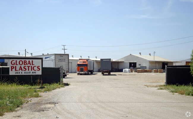
353 E Ellis Ave, Perris, CA 92570


Property Detail
353 E Ellis Ave
330-090-017
5.19 ACRES M/L IN POR NW 1/4 OF SEC 5 T5S R3W FOR TOTAL DESCRIPTION SEE ASSESSORS MAPS
Lightindustrial
Riverside
M4
California
AE The base floodplain where base flood elevations are provided. AE Zones are now used on new format FIRMs instead of A1-A30 Zones.
5.19 AC
2024
Moreno Valley/Perris
2025
Inland Empire (California)
042719
Riverside-San Bernardino-Ontario, CA
45,250 SF
NEARBY LISTINGS FOR SALE OR LEASE
DEMOGRAPHICS near 353 E Ellis Ave
1 mile
3 mile
5 mile
2025 Total Population
6,057
59,898
127,895
2030 Population
6,314
61,686
131,568
Pop Growth 2025-2030
+ 4.24%
+ 2.99%
+ 2.87%
Average Age
32
34
37
2025 Total Households
1,561
14,741
35,496
HH Growth 2025-2030
+ 4.23%
+ 2.92%
+ 2.65%
Median Household Inc
$80,000
$79,568
$75,720
Avg Household Size
3.80
3.90
3.50
2025 Avg HH Vehicles
2.00
2.00
2.00
Median Home Value
$448,305
$454,226
$451,126
Median Year Built
1985
1993
1991
Nearby Places
Map Layers
Map Styles
 Street
 Aerial
Layers
 Traffic
 Biking
Places
Listings with unknown addresses are not visible on the map
- Restaurants
- Banks
- Shops
- Fitness
- Groceries
PUBLIC TRANSPORTATION
COMMUTER RAIL
South Perris (Metrolink 91-Perris Valley Line - Metrolink Trains)
Drive
Walk
Distance
South Perris (Metrolink 91-Perris Valley Line - Metrolink Trains)
1 min
15 min
0.8 mi
Perris Downtown (Metrolink 91-Perris Valley Line - Metrolink Trains)
Drive
Walk
Distance
Perris Downtown (Metrolink 91-Perris Valley Line - Metrolink Trains)
3 min
1.6 mi
AIRPORT
Ontario International
Drive
Walk
Distance
Ontario International
44 min
35.4 mi
Freight Ports
Port of Long Beach
Drive
Walk
Distance
Port of Long Beach
94 min
70.2 mi
Nearby Properties
Address
Land Use
TOTAL SIZE
Lot Size
Zoning
Address
Land Use
TOTAL SIZE
Lot Size
Zoning
28.13 AC
RR
Address
Land Use
TOTAL SIZE
Lot Size
Zoning
34.84 AC
Address
Land Use
TOTAL SIZE
Lot Size
Zoning
57,600 SF
51.69 AC
Address
Land Use
TOTAL SIZE
Lot Size
Zoning
187,889 SF
20.64 AC
Address
Land Use
TOTAL SIZE
Lot Size
Zoning
32,709 SF
4.61 AC
C2
Address
Land Use
TOTAL SIZE
Lot Size
Zoning
104,208 SF
10.96 AC
Address
Land Use
TOTAL SIZE
Lot Size
Zoning
89,409 SF
6.18 AC
Address
Land Use
TOTAL SIZE
Lot Size
Zoning
207,130 SF
16.15 AC
Address
Land Use
TOTAL SIZE
Lot Size
Zoning
22,119 SF
4.59 AC
R3
Address
Land Use
TOTAL SIZE
Lot Size
Zoning
75,109 SF
9.39 AC
Address
Land Use
TOTAL SIZE
Lot Size
Zoning
1,080 SF
9.53 AC
A02
Address
Land Use
TOTAL SIZE
Lot Size
Zoning
122,824 SF
5.18 AC
CC
Address
Land Use
TOTAL SIZE
Lot Size
Zoning
13.95 AC
Address
Land Use
TOTAL SIZE
Lot Size
Zoning
50,000 SF
5.36 AC
CC
Address
Land Use
TOTAL SIZE
Lot Size
Zoning
47,440 SF
5.32 AC
C2
Address
Land Use
TOTAL SIZE
Lot Size
Zoning
1,018,178 SF
57.91 AC
Address
Land Use
TOTAL SIZE
Lot Size
Zoning
3,750 SF
37.79 AC
GI
Address
Land Use
TOTAL SIZE
Lot Size
Zoning
97,942 SF
11 AC
Address
Land Use
TOTAL SIZE
Lot Size
Zoning
7,250 SF
2.35 AC
Address
Land Use
TOTAL SIZE
Lot Size
Zoning
35,600 SF
3.19 AC
Address
Land Use
TOTAL SIZE
Lot Size
Zoning
41,840 SF
8.92 AC
Address
Land Use
TOTAL SIZE
Lot Size
Zoning
13,489 SF
6.18 AC
R3
The World's #1 Commercial Real Estate Marketplace
Connect with us
© 2026 CoStar Group
The information above has been obtained from sources believed reliable. While we do not doubt its accuracy we have not verified it and make no guarantee, warranty or representation about it. It is your responsibility to independently confirm its accuracy and completeness. Any projections, opinions, assumptions, or estimates used are for example only and do not represent the current or future performance of the property. The value of this transaction to you depends on tax and other factors which should be evaluated by your tax, financial, and legal advisors. You and your advisors should conduct a careful, independent investigation of the property to determine to your satisfaction the suitability of the property for your needs.