Property Record
353 Route 70, Medford, NJ 08055
NEARBY LISTINGS FOR SALE OR LEASE
Property Detail
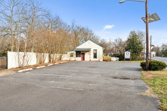
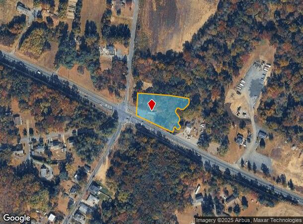
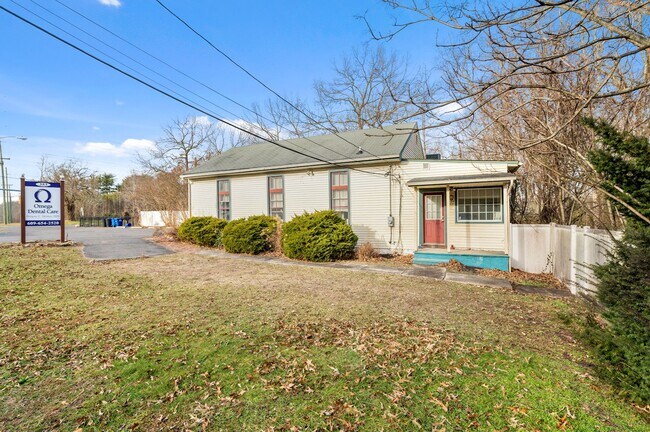
353 Route 70
20-00809-0000-00007
INCL BLK 809 LOTS 5 & 7
Medicalbuilding
Burlington
AE
New Jersey
34005C0268F
7
2024
0.69 AC
2025
South Burlington County
703801
Philadelphia
1,356 SF
Philadelphia-Camden-Wilmington, PA-NJ-DE-MD
DEMOGRAPHICS near 353 Route 70
1 Mile
3 Mile
5 Mile
2024 Total Population
548
13,709
54,301
2029 Population
549
13,892
55,193
Pop Growth 2024-2029
+ 0.18%
+ 1.33%
+ 1.64%
Average Age
42
43
44
2024 Total Households
198
5,284
21,121
HH Growth 2024-2029
0.00%
+ 1.42%
+ 1.74%
Median Household Inc
$135,597
$127,696
$121,584
Avg Household Size
2.70
2.50
2.50
2024 Avg HH Vehicles
2.00
2.00
2.00
Median Home Value
$417,213
$388,940
$375,088
Median Year Built
1982
1977
1982
Nearby Places
Map Layers
Map Styles
 Street
 Aerial
- Restaurants
- Banks
- Shops
- Fitness
- Groceries
PUBLIC TRANSPORTATION
AIRPORT
Philadelphia International
DRIVE
WALK
Distance
Philadelphia International
43 min
30.6 mi
Trenton Mercer
DRIVE
WALK
Distance
Trenton Mercer
47 min
34.5 mi
Freight Ports
Port of Philadelphia
DRIVE
WALK
Distance
Port of Philadelphia
28 min
20.7 mi
SALE & LEASE HISTORY
LISTING DATE
SALE/LEASE

Jan 28, 2022
For Sale
Aug 03, 2022
For Lease
Aug 03, 2022
For Sale
Nearby Properties
Address
Land Use
TOTAL SIZE
Lot Size
Zoning
Address
Land Use
TOTAL SIZE
Lot Size
Zoning
3 AC
GMN
Address
Land Use
TOTAL SIZE
Lot Size
Zoning
16.60 AC
Address
Land Use
TOTAL SIZE
Lot Size
Zoning
62.20 AC
GMN
Address
Land Use
TOTAL SIZE
Lot Size
Zoning
13,636 SF
23 AC
HC-1
Address
Land Use
TOTAL SIZE
Lot Size
Zoning
49.38 AC
PPE
Address
Land Use
TOTAL SIZE
Lot Size
Zoning
34.74 AC
PPE/
Address
Land Use
TOTAL SIZE
Lot Size
Zoning
22.74 AC
HC-1
Address
Land Use
TOTAL SIZE
Lot Size
Zoning
57.38 AC
PPE
Address
Land Use
TOTAL SIZE
Lot Size
Zoning
9.88 AC
PPE
Address
Land Use
TOTAL SIZE
Lot Size
Zoning
23.70 AC
HM
Address
Land Use
TOTAL SIZE
Lot Size
Zoning
1,754 SF
10.69 AC
HC-2
Address
Land Use
TOTAL SIZE
Lot Size
Zoning
17.54 AC
PPE
Address
Land Use
TOTAL SIZE
Lot Size
Zoning
23,402 SF
2.42 AC
RHO
Address
Land Use
TOTAL SIZE
Lot Size
Zoning
13.50 AC
HC-1
Address
Land Use
TOTAL SIZE
Lot Size
Zoning
1,716 SF
42.56 AC
GMN
Address
Land Use
TOTAL SIZE
Lot Size
Zoning
18.55 AC
LI
Address
Land Use
TOTAL SIZE
Lot Size
Zoning
6.08 AC
HM
Address
Land Use
TOTAL SIZE
Lot Size
Zoning
10.36 AC
PI
Address
Land Use
TOTAL SIZE
Lot Size
Zoning
157.02 AC
VRD
Address
Land Use
TOTAL SIZE
Lot Size
Zoning
3,684 SF
8.80 AC
HC-1
Address
Land Use
TOTAL SIZE
Lot Size
Zoning
20,460 SF
23.95 AC
AR
Address
Land Use
TOTAL SIZE
Lot Size
Zoning
1.64 AC
SGRA
Address
Land Use
TOTAL SIZE
Lot Size
Zoning
4.90 AC
PPE
Address
Land Use
TOTAL SIZE
Lot Size
Zoning
17,194 SF
150.35 AC
GD
Address
Land Use
TOTAL SIZE
Lot Size
Zoning
10.65 AC
GMS
Address
Land Use
TOTAL SIZE
Lot Size
Zoning
18,362 SF
5.59 AC
RHC
Address
Land Use
TOTAL SIZE
Lot Size
Zoning
3.87 AC
PPE
Address
Land Use
TOTAL SIZE
Lot Size
Zoning
42,060 SF
15.49 AC
CC
Address
Land Use
TOTAL SIZE
Lot Size
Zoning
1,868 SF
88.95 AC
RA
Address
Land Use
TOTAL SIZE
Lot Size
Zoning
11.30 AC
GD
The World's #1 Commercial Real Estate Marketplace
Connect with us
© 2025 CoStar Group
The information above has been obtained from sources believed reliable. While we do not doubt its accuracy we have not verified it and make no guarantee, warranty or representation about it. It is your responsibility to independently confirm its accuracy and completeness. Any projections, opinions, assumptions, or estimates used are for example only and do not represent the current or future performance of the property. The value of this transaction to you depends on tax and other factors which should be evaluated by your tax, financial, and legal advisors. You and your advisors should conduct a careful, independent investigation of the property to determine to your satisfaction the suitability of the property for your needs.