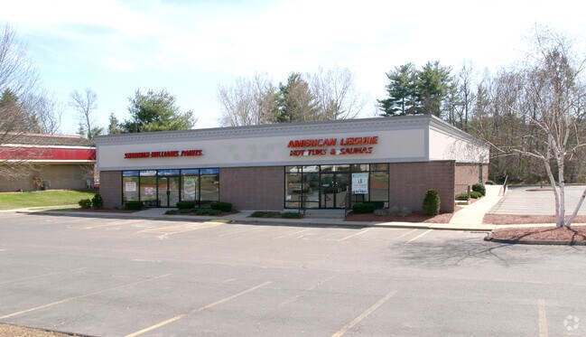
Property Record
353 W Main St, Avon, CT 06001


Property Detail
353 W Main St
Hartford-West Hartford-East Hartford, CT
HARTFORD
AVON-000006-000000-000454-000353
Connecticut
Storebuilding
4540353
B and X Area of moderate flood hazard, usually the area between the limits of the 100-year and 500-year floods.
2.07 AC
2025
Avon
2025
Hartford
462201
NEARBY LISTINGS FOR SALE OR LEASE
DEMOGRAPHICS near 353 W Main St
1 mile
3 mile
5 mile
2025 Total Population
3,514
26,714
54,827
2030 Population
3,600
27,386
56,134
Pop Growth 2025-2030
+ 2.45%
+ 2.52%
+ 2.38%
Average Age
44
43
43
2025 Total Households
1,415
10,282
21,772
HH Growth 2025-2030
+ 2.54%
+ 2.57%
+ 2.46%
Median Household Inc
$132,812
$143,895
$143,725
Avg Household Size
2.40
2.50
2.50
2025 Avg HH Vehicles
2.00
2.00
2.00
Median Home Value
$428,931
$461,534
$448,054
Median Year Built
1975
1976
1976
Nearby Places
Map Layers
Map Styles
 Street
 Aerial
Layers
 Traffic
 Biking
Places
Listings with unknown addresses are not visible on the map
- Restaurants
- Banks
- Shops
- Fitness
- Groceries
PUBLIC TRANSPORTATION
AIRPORT
Bradley International
Drive
Walk
Distance
Bradley International
44 min
23.1 mi
Freight Ports
Port of New Haven
Drive
Walk
Distance
Port of New Haven
62 min
40.0 mi
The World's #1 Commercial Real Estate Marketplace
Connect with us
© 2026 CoStar Group
The information above has been obtained from sources believed reliable. While we do not doubt its accuracy we have not verified it and make no guarantee, warranty or representation about it. It is your responsibility to independently confirm its accuracy and completeness. Any projections, opinions, assumptions, or estimates used are for example only and do not represent the current or future performance of the property. The value of this transaction to you depends on tax and other factors which should be evaluated by your tax, financial, and legal advisors. You and your advisors should conduct a careful, independent investigation of the property to determine to your satisfaction the suitability of the property for your needs.