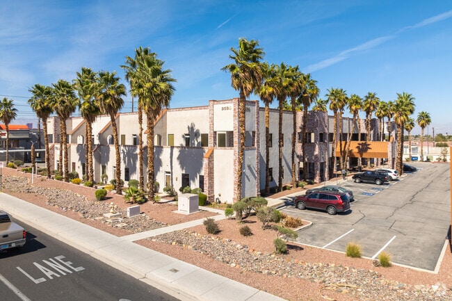
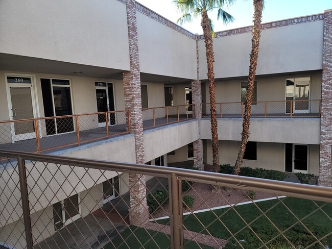
Property Record
3530 E Flamingo Rd, Las Vegas, NV 89121

This Property Is For Sale
Current Lease Availabilities
Property Detail
3530 E Flamingo Rd
161-18-401-068
PARCEL MAP FILE 93 PAGE 37 LOT 2 & PT SW4 SW4 SEC 18 21 62
Commercialnec
Clark
C2
Nevada
B and X Area of moderate flood hazard, usually the area between the limits of the 100-year and 500-year floods.
2
2026
2.56 AC
2026
Central East Las Vegas
001706
Las Vegas
37,213 SF
Las Vegas-Henderson-North Las Vegas, NV
NEARBY LISTINGS FOR SALE OR LEASE
DEMOGRAPHICS near 3530 E Flamingo Rd
1 mile
3 mile
5 mile
2025 Total Population
17,921
211,998
480,700
2030 Population
18,731
221,134
503,362
Pop Growth 2025-2030
+ 4.52%
+ 4.31%
+ 4.71%
Average Age
45
40
39
2025 Total Households
7,417
84,860
187,119
HH Growth 2025-2030
+ 4.54%
+ 4.40%
+ 4.92%
Median Household Inc
$74,101
$53,182
$57,477
Avg Household Size
2.40
2.40
2.50
2025 Avg HH Vehicles
2.00
1.00
1.00
Median Home Value
$379,453
$328,266
$354,407
Median Year Built
1977
1980
1986
Nearby Places
Map Layers
Map Styles
 Street
 Aerial
Layers
 Traffic
 Biking
Places
Listings with unknown addresses are not visible on the map
- Restaurants
- Banks
- Shops
- Fitness
- Groceries
PUBLIC TRANSPORTATION
AIRPORT
Harry Reid International
Drive
Walk
Distance
Harry Reid International
10 min
5.4 mi
Boulder City Municipal
Drive
Walk
Distance
Boulder City Municipal
29 min
20.9 mi
Freight Ports
Port of Long Beach
Drive
Walk
Distance
Port of Long Beach
319 min
281.5 mi
Nearby Properties
Address
Land Use
TOTAL SIZE
Lot Size
Zoning
Address
Land Use
TOTAL SIZE
Lot Size
Zoning
265,609 SF
47.36 AC
H1
Address
Land Use
TOTAL SIZE
Lot Size
Zoning
138.07 AC
PF
Address
Land Use
TOTAL SIZE
Lot Size
Zoning
281,120 SF
21.38 AC
Address
Land Use
TOTAL SIZE
Lot Size
Zoning
345,133 SF
27.01 AC
H1
Address
Land Use
TOTAL SIZE
Lot Size
Zoning
21,257 SF
12.72 AC
Address
Land Use
TOTAL SIZE
Lot Size
Zoning
44.69 AC
PF
Address
Land Use
TOTAL SIZE
Lot Size
Zoning
72.03 AC
PF
Address
Land Use
TOTAL SIZE
Lot Size
Zoning
709,943 SF
43.10 AC
C2
Address
Land Use
TOTAL SIZE
Lot Size
Zoning
6,396 SF
15.06 AC
Address
Land Use
TOTAL SIZE
Lot Size
Zoning
95,928 SF
3.71 AC
C:U-V
Address
Land Use
TOTAL SIZE
Lot Size
Zoning
239,785 SF
2.20 AC
C:R-5
Address
Land Use
TOTAL SIZE
Lot Size
Zoning
198.15 AC
PF
Address
Land Use
TOTAL SIZE
Lot Size
Zoning
38,764 SF
12.66 AC
H1
Address
Land Use
TOTAL SIZE
Lot Size
Zoning
4,460 SF
27.52 AC
Address
Land Use
TOTAL SIZE
Lot Size
Zoning
15.95 AC
PF
Address
Land Use
TOTAL SIZE
Lot Size
Zoning
11.18 AC
PF
Address
Land Use
TOTAL SIZE
Lot Size
Zoning
56,526 SF
12.44 AC
C2
Address
Land Use
TOTAL SIZE
Lot Size
Zoning
5,649 SF
15.32 AC
R4
Address
Land Use
TOTAL SIZE
Lot Size
Zoning
6,659 SF
6.05 AC
H1
Address
Land Use
TOTAL SIZE
Lot Size
Zoning
13,589 SF
56.80 AC
PF
Address
Land Use
TOTAL SIZE
Lot Size
Zoning
554,741 SF
9.79 AC
C:MLZ
Address
Land Use
TOTAL SIZE
Lot Size
Zoning
4.18 AC
PF
Address
Land Use
TOTAL SIZE
Lot Size
Zoning
7,908 SF
24.13 AC
R4
Address
Land Use
TOTAL SIZE
Lot Size
Zoning
150,772 SF
2.46 AC
Address
Land Use
TOTAL SIZE
Lot Size
Zoning
2,926 SF
19.73 AC
R3
Address
Land Use
TOTAL SIZE
Lot Size
Zoning
36.86 AC
PF
Address
Land Use
TOTAL SIZE
Lot Size
Zoning
40.07 AC
PF
Address
Land Use
TOTAL SIZE
Lot Size
Zoning
7,304 SF
12.58 AC
R4
Address
Land Use
TOTAL SIZE
Lot Size
Zoning
6,834 SF
5.14 AC
C2
Address
Land Use
TOTAL SIZE
Lot Size
Zoning
163,408 SF
3.66 AC
C2
The World's #1 Commercial Real Estate Marketplace
Connect with us
© 2026 CoStar Group
The information above has been obtained from sources believed reliable. While we do not doubt its accuracy we have not verified it and make no guarantee, warranty or representation about it. It is your responsibility to independently confirm its accuracy and completeness. Any projections, opinions, assumptions, or estimates used are for example only and do not represent the current or future performance of the property. The value of this transaction to you depends on tax and other factors which should be evaluated by your tax, financial, and legal advisors. You and your advisors should conduct a careful, independent investigation of the property to determine to your satisfaction the suitability of the property for your needs.